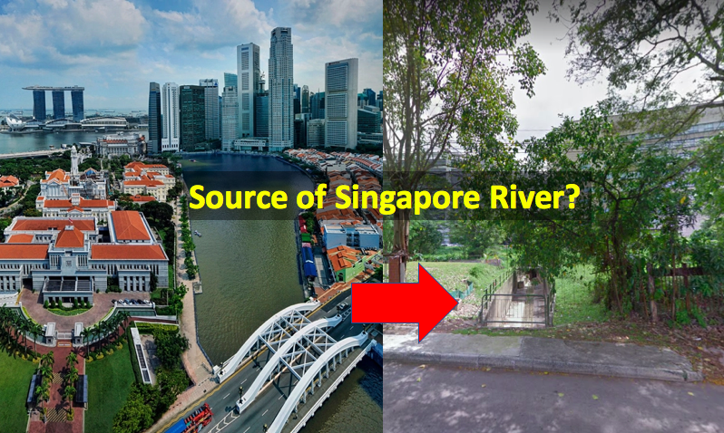
The bustling Singapore River is featured heavily in our Singapore story, and even features in the lyrics of the highly popular National Day song, Home, whose chorus goes:
"This is home truly
Where I know I must be
Where my dreams wait for me
Where that river always flows"
So, everyone knows the Singapore River, but do you know its source?
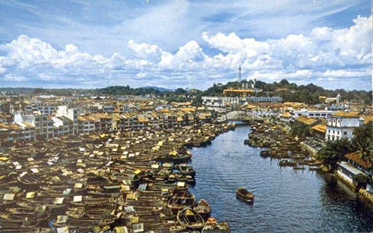 Singapore River in 1955. Source: NAS
The present-day source
According to Infopedia, much of the areas upstream of the Singapore River were swampy land, flooded occasionally by the tides before the turn of the 19th century.
Officially, the "present demarcated start of the Singapore River" is actually the Kim Seng Bridge.
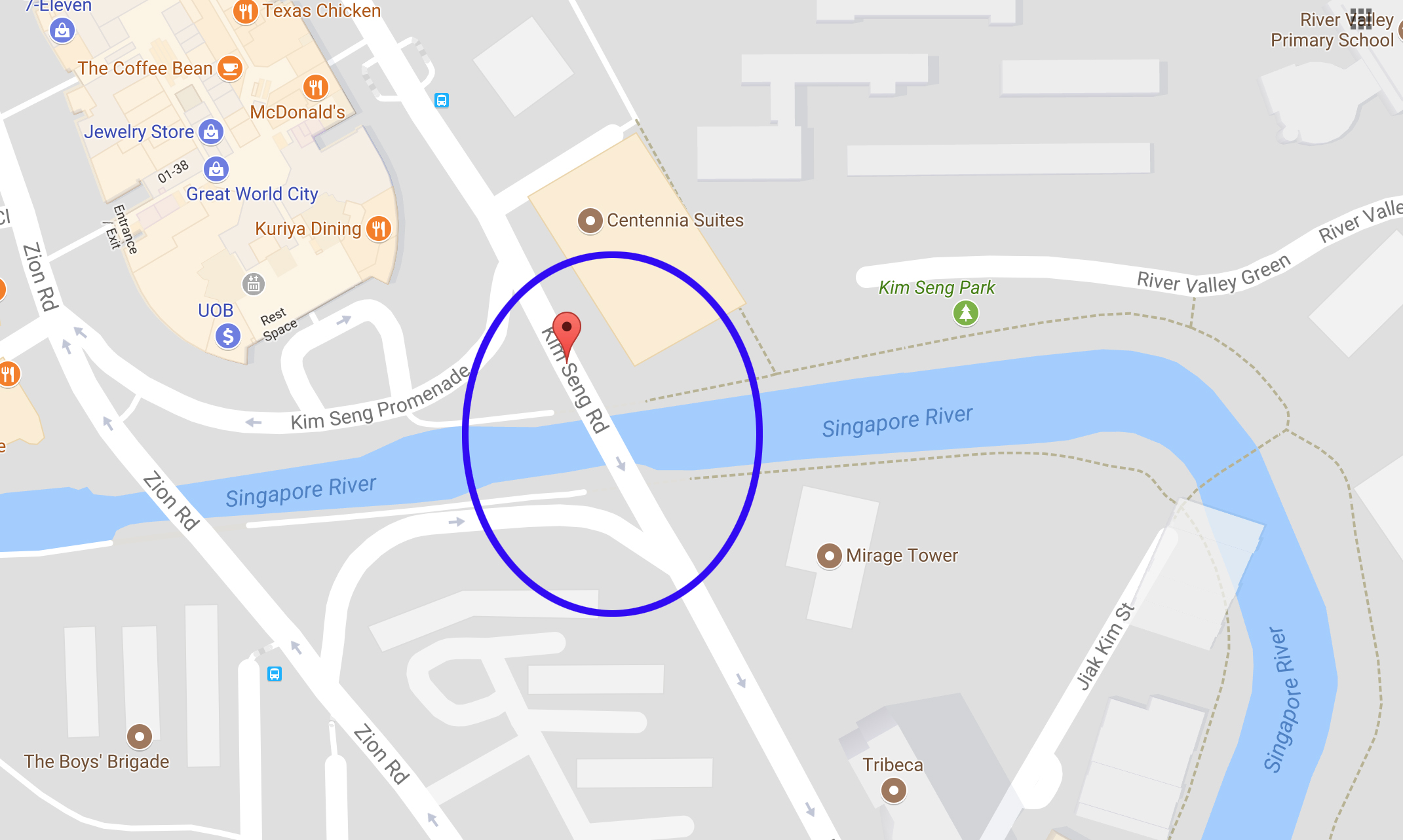 Via Google Maps.
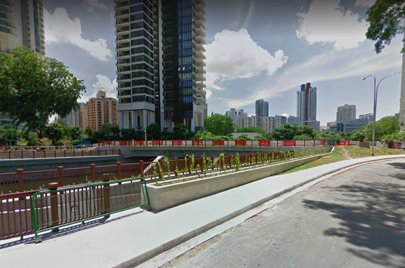 Present day view of Kim Seng Bridge in the direction of the Singapore River. Screenshot from Google Street View.
However, the river itself actually extends beyond the bridge.
So, where does it actually start from?
[related_story]
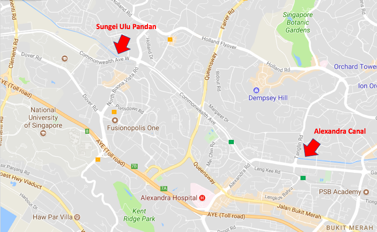
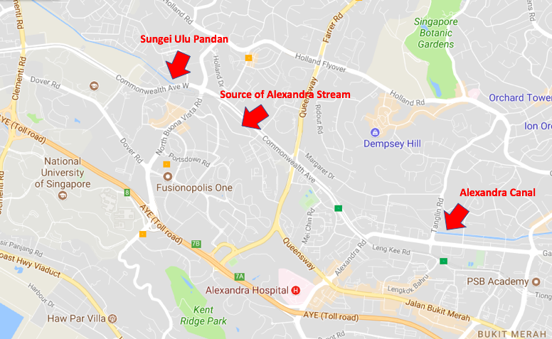
Alexandra Canal
Beyond Kim Seng Bridge (towards Zion Road), the River is fed by Alexandra Canal.
Presently, there are multiple water sources (from various streams, drains, underground canals, etc) that feed into the Alexandra Canal, and subsequently flows into the Singapore River.
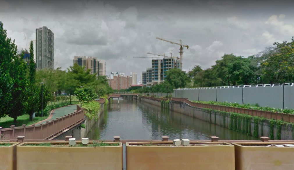 View of Alexandra Canal in the direction away from the Singapore River. Screenshot from Google Street View.
What's interesting to note is that Alexandra Canal was previously a stream before it was converted into a canal.
It was a curious stream which fed water into both the Singapore River and Sungei Pandan. The locals even had a name for this special river with no apparent source -- boh beh kang 无尾江 (No Tail River in Hokkien).
Original source of the Singapore River
This missing source of Alexandra stream seems to be the original source of the Singapore River, and Infopedia pins it at the "area between the present Sungei Ulu Pandan Canal system and the Alexandra Canal system".
Using the One Historical Map, we are able to trace the source of Alexandra Canal using a past map, and locate it in the present day.
We found that the Alexandra stream actually begins from the Tanglin Halt and Commonwealth Avenue area.
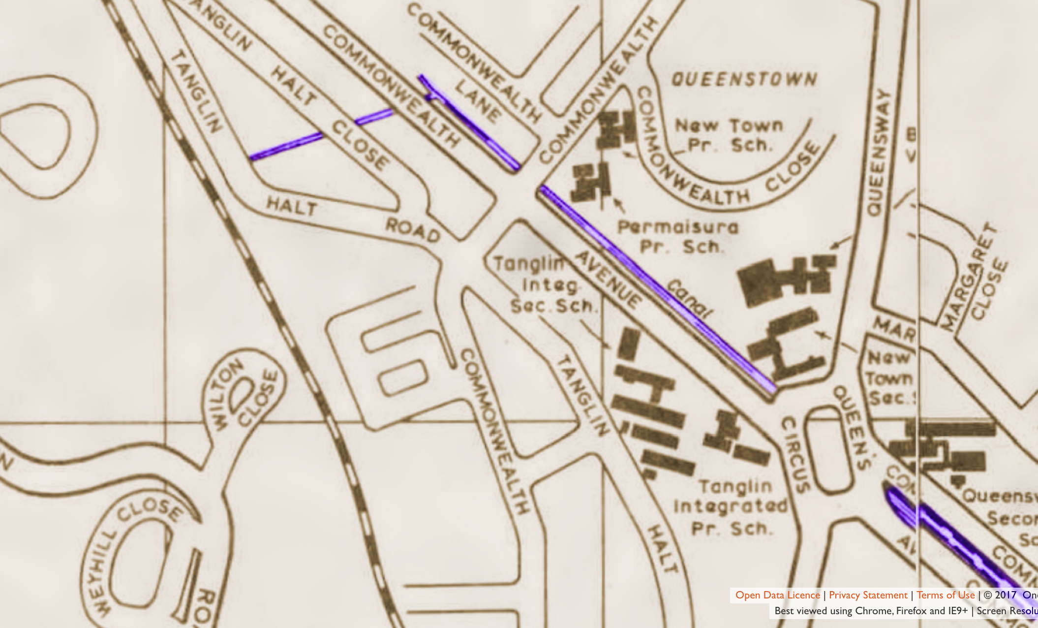 We coloured the canal blue for easier viewing. Via One Historical Map.
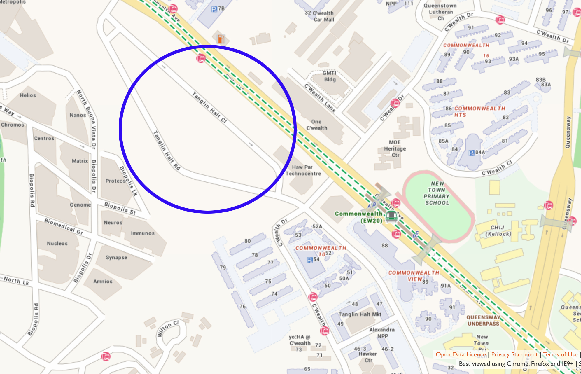 Estimated source of the Singapore River on a 2017 map. Via One Historical Map.
The Sungei Ulu Pandan Canal system is only one cross junction away from this location, which ties in with the fact Alexandra stream feeds water to both the Singapore River and Sungei Pandan.
 Via One Historical Map. Text and Circle added for clarity.
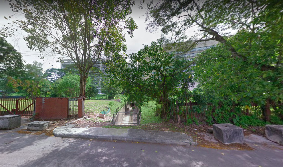
So, in all likelihood, this humble drain along Tanglin Halt Road was the original source of Alexandra stream and the Singapore River.
 Screenshot from Google Street View.
Here's another view of the drain and its surrounding area, with Tanglin Halt estate in the background.

The Singapore River technically has lost its mouth today, since it was dammed up by Marina Barrage in 2008. This means that the river's water no longer merges with the sea.
Remember, if you drink water think of its source. In this case, it's in the Tanglin Halt area.
Here are some totally unrelated but equally interesting stories:
Apparently, there’s a headless ghost that will deliver booze to you this Halloween
5 times Singaporeans ownself scared ownself with hoaxes
I let a 20-year-old Tarot card reader inside my mind and it was nothing like I expected

Top image adapted from Wikipedia and Google Street View.
If you like what you read, follow us on Facebook, Instagram, Twitter and Telegram to get the latest updates.