Near the base of Mount Faber lies an abandoned reservoir, just about a third of the size of an Olympic swimming pool.
Initially used as a water source, it later became a pool where soldiers swam — first the British, and then Japanese.
The reservoir appeared on maps since 1905, and was known to supply water to ships, according to a 1909 forum letter which complained that its water was undrinkable, and a "fever nest" responsible for high incidence of malaria in the area.
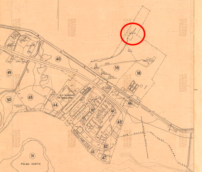 1905 map showing Keppel Hill Reservoir at the top right. Image via National Archives Singapore website.
The reservoir went on to make headlines a few times over the next few decades, though it was often due to misfortune, such as the drowning of young British soldiers who underestimated its 20-foot (6.1 metres) depth.
By the 1950s, only an outline of the water body was left on official survey maps, no longer designated as a reservoir, having possibly fallen into disuse due to its limited capacity.
Rediscovery
After the reservoir was “re-discovered“ in 2014 by a researcher from the National Heritage Board (NHB), a video documentary was created "using the technology of Google Glass".
According to NHB's 2014 annual report the video "garnered more than 50,000 views in one week".
NHB's enthusiasm about Google Glass may seem somewhat misplaced in hindsight, given that the device has been shelved by Google.
But its pithy observation that the reservoir remains "protected from progress and the passing of time" certainly rings true.
How to go there
If you're looking to make a trip down to find the Keppel Hill Reservoir, here's a guide for you.
The guide is broken up into different segments (with the estimated time, and difficulty ratings from 1 to 5) which you can choose according to your appetite for risk and/ or adventure.
We also provide directions to an underground bunker which can be visited en route to the reservoir, as well as a lone Japanese tomb that requires a bit of a detour.
Route segments:
- Segment 1: "The bunker" (5 minutes, 1/5 difficulty)
- Segment 2: Choose either:
- (a): "Uphill battle" (10 minutes, 5/5 difficulty)
- (b): "Retrograde" (12 minutes, 1/5 difficulty)
- Segment 3: "Walk in the park" (10 minutes, 2/5 difficulty)
- Segment 4: "Keppel Hill Reservoir" (10 minutes, 0/5 difficulty)
- Segment 5: "The lone tomb" (20 minutes, 4/5 difficulty)
- Segment 6: "Summit push" (15 minutes, 3/5 difficulty)
The entire sequence should take around an hour and a half, including breaks.
Finding the starting point
Start your visit at Seah Im Open Carpark, located just across the road from Seah Im Food Centre and a 10-minute walk from Harbourfront MRT station.
If you're driving, parking there is relatively affordable — S$0.60 for 30 minutes.
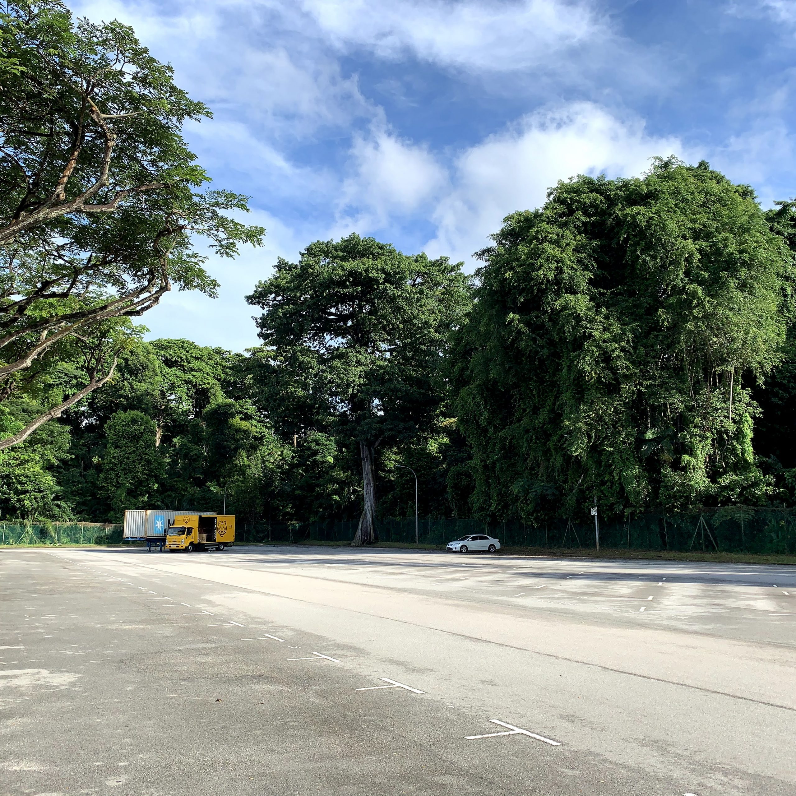 Seah Im Open Carpark was mostly vacant when we visited on weekday morning. Photo by Nigel Chua.
The carpark is also where you'll find the start of the route through the forest to the reservoir — a curious gap in the carpark fence next to the tall tree in its northwest corner.
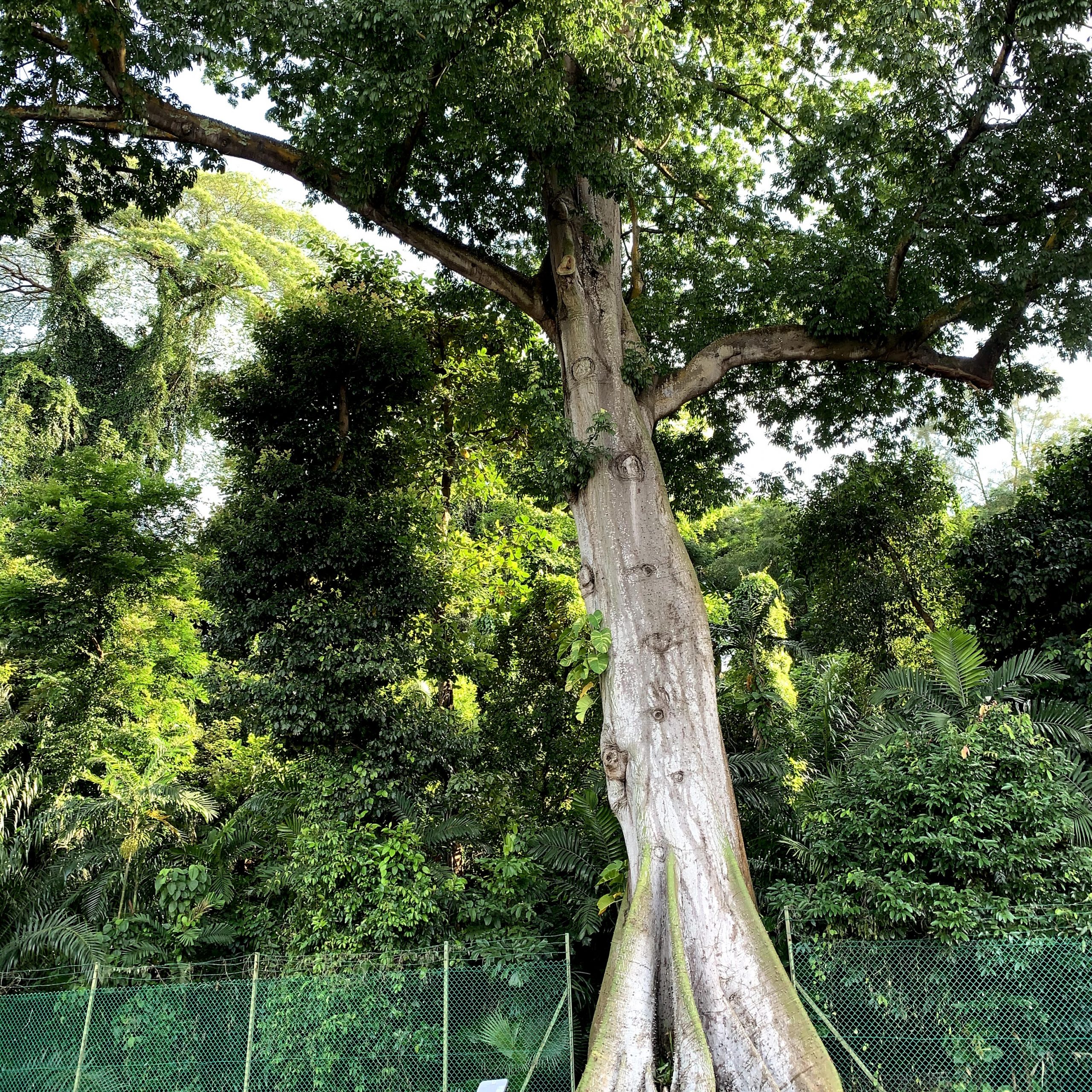 But why is there a gap in the fence? Photo by Nigel Chua.
Once you step across a small drain just beyond the fence, the trail begins.
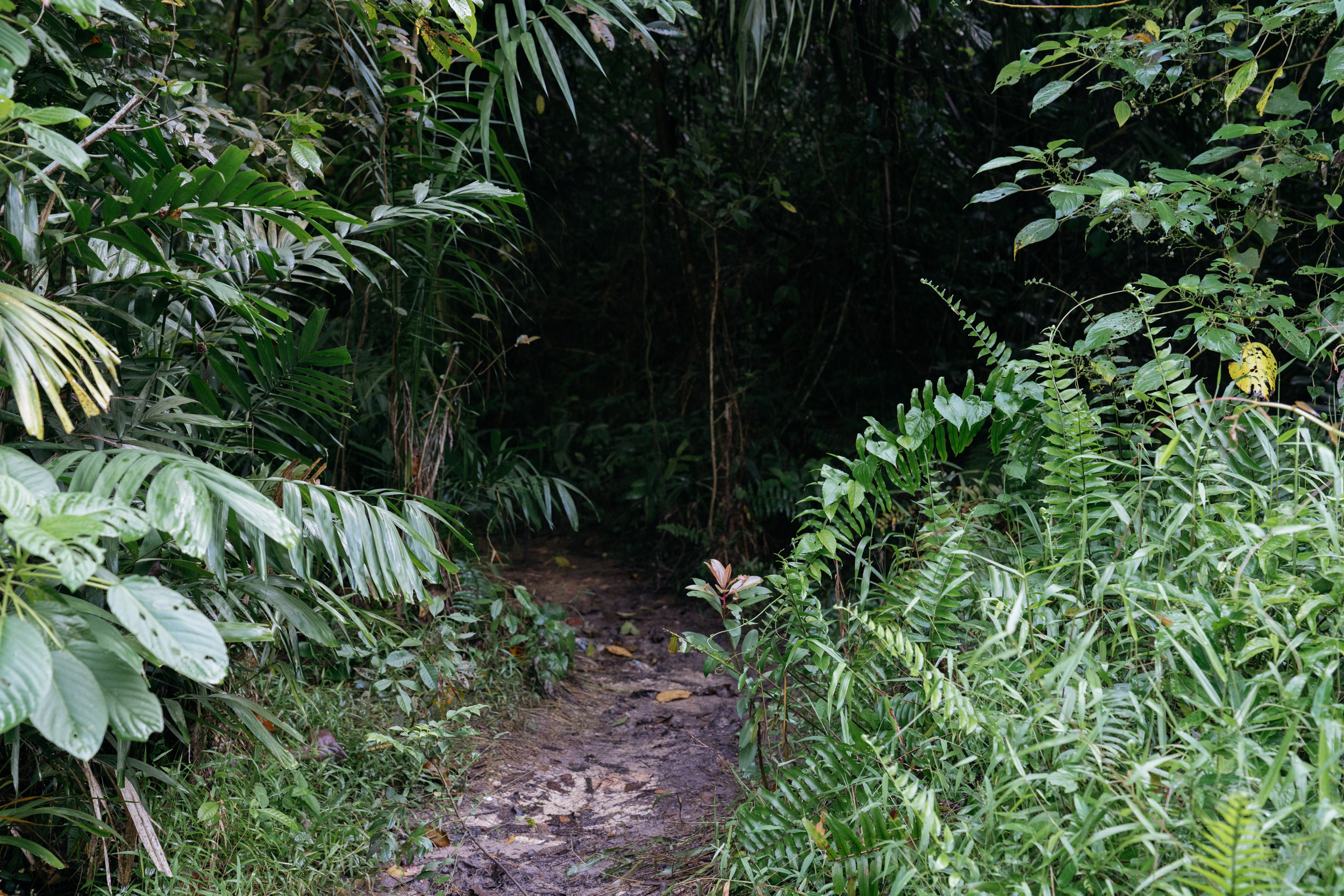
Slippery, semi-established trails
There's no official trail, but most of the route is easy enough to follow as previous visitors have mostly followed the same path through the otherwise thick undergrowth.
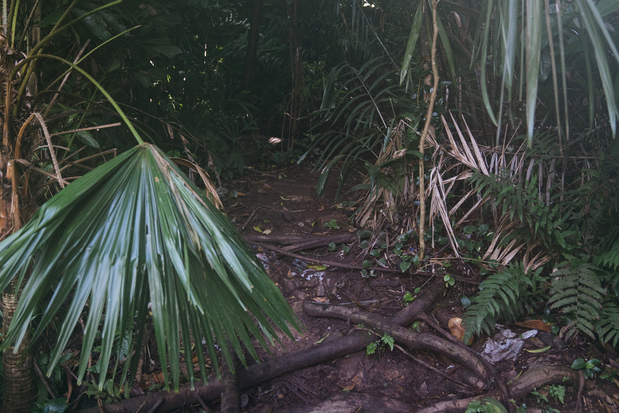 Photo by Andrew Koay.
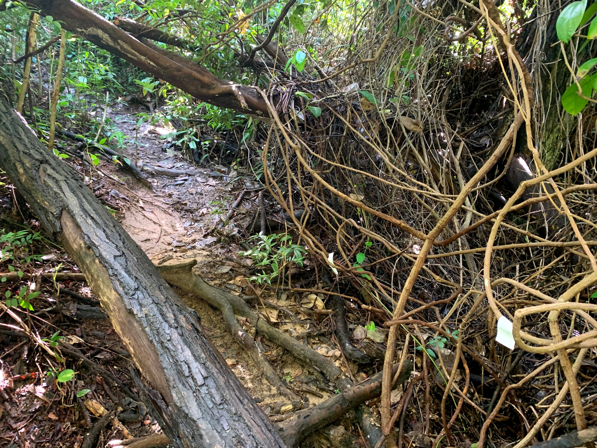
As it had been raining on the days just prior to our visit, parts of the trail were rather slippery and squelchy, though the exposed tree roots provided a bit more confidence.
Segment 1: "The bunker" (5 minutes, 1/5 difficulty)
Within less than 10 metres from the start of the trail comes the first reward: the entrance to a bunker dug into the side of the hill.
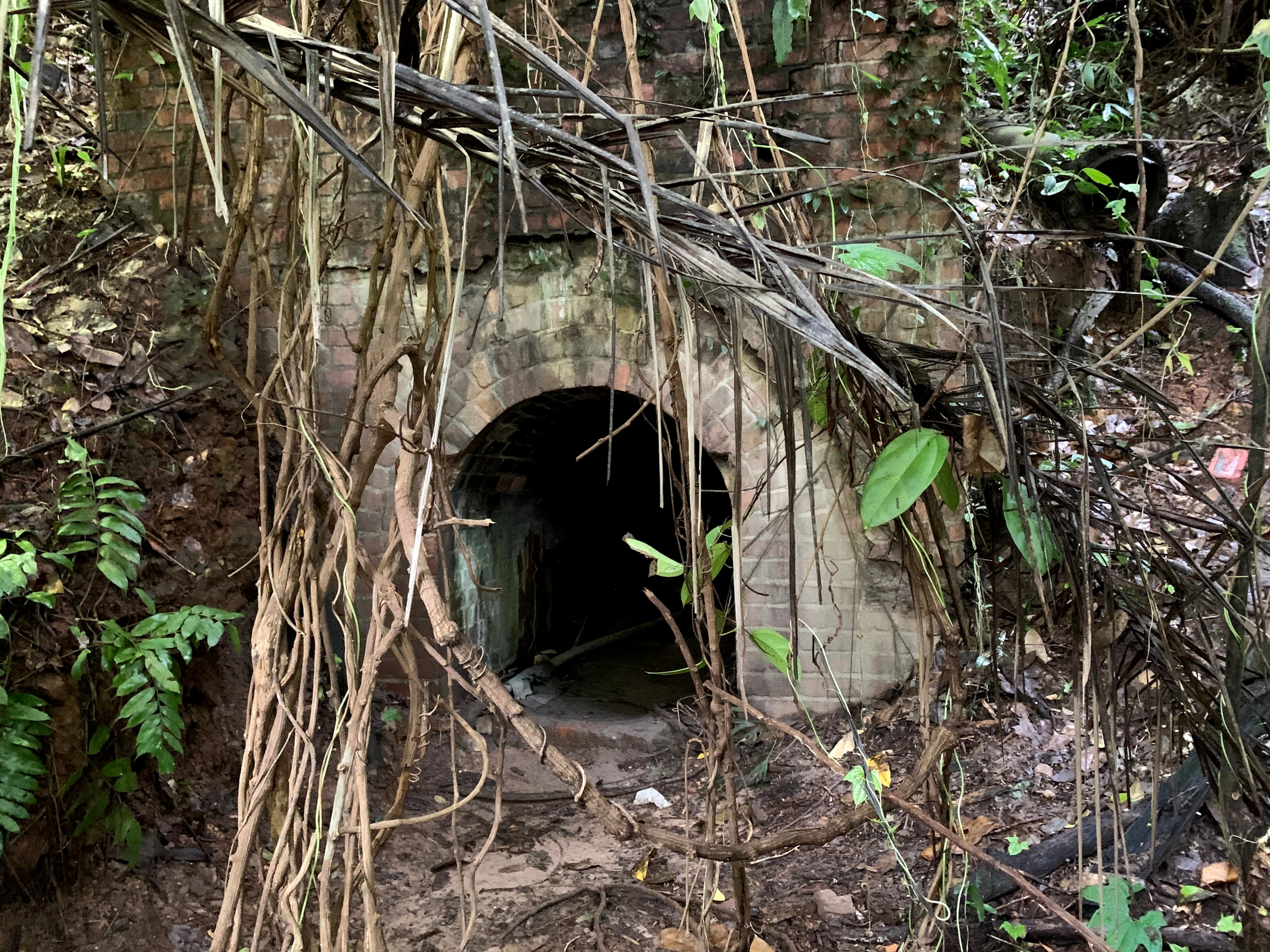 A possible air-raid shelter or storage area for explosive/flammable substances. Photo by Nigel Chua.
You may have to stoop a little to enter the bunker, which opens up into a second chamber with a higher ceiling, over 2 metres high.
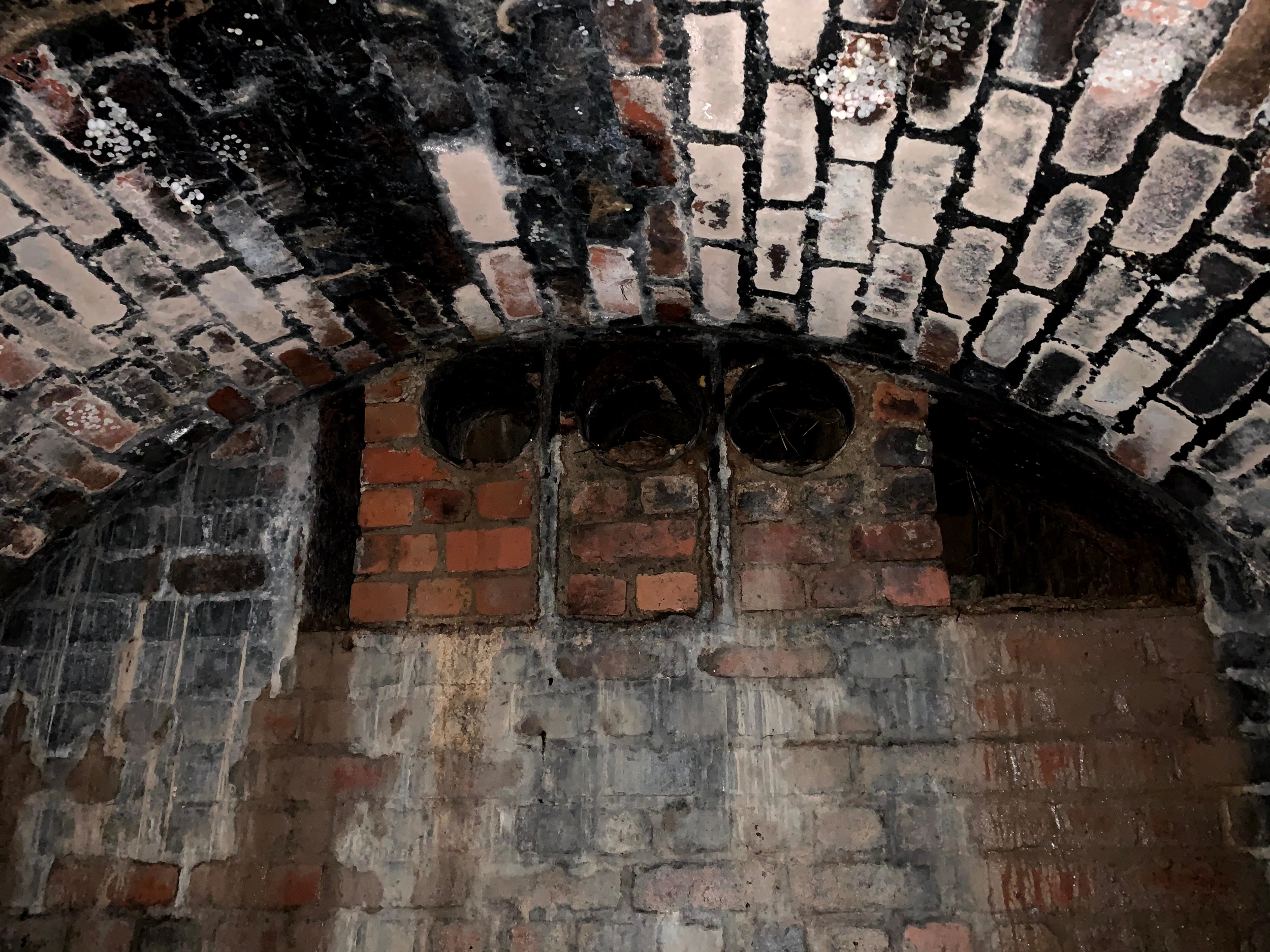 Ventilation holes can be seen on the side of the second chamber nearer to the entrance. Photo by Nigel Chua.
As the bunker isn't very large, a quick detour to look around shouldn't take too long.
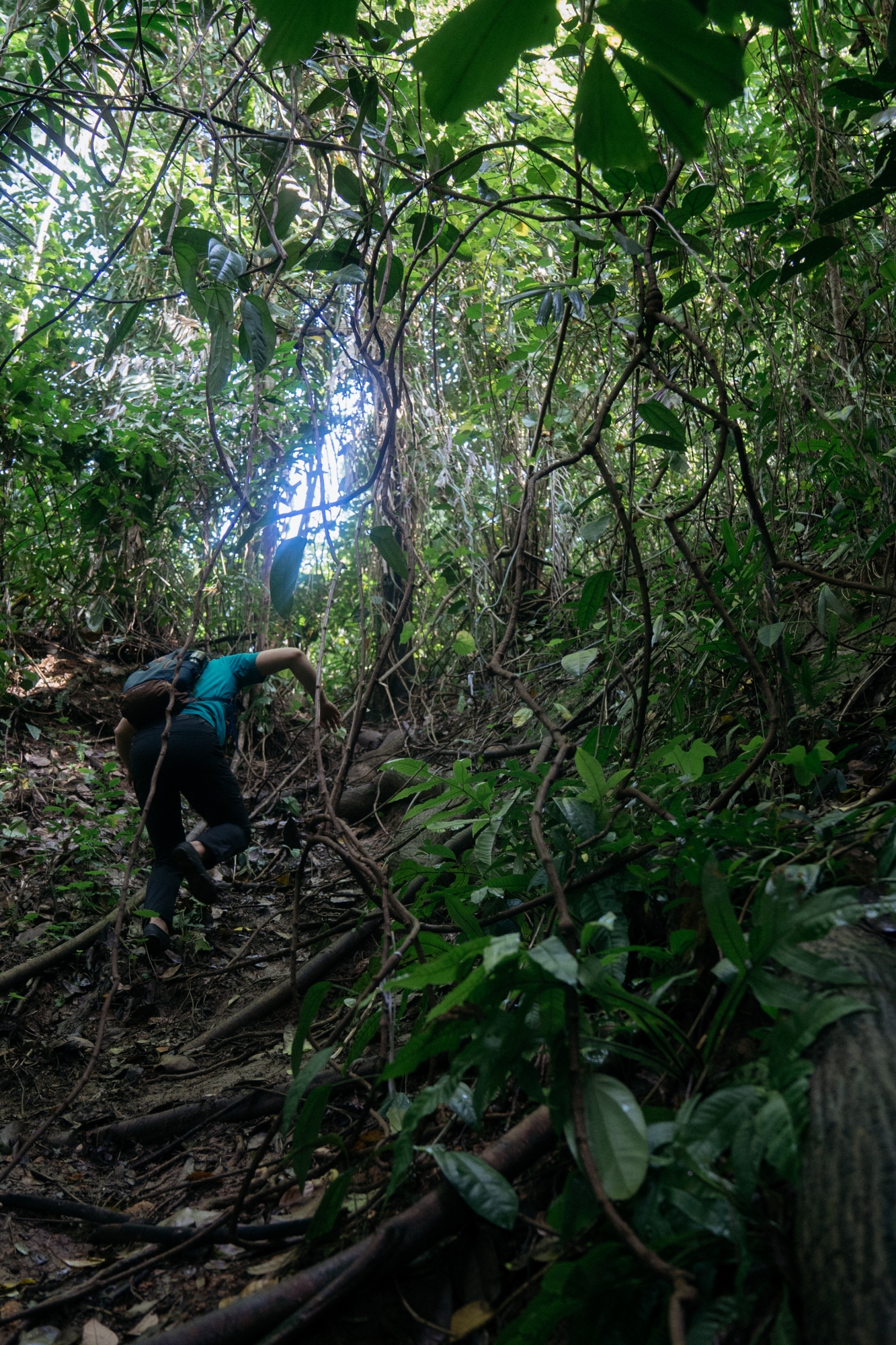
Segment 2a: "Uphill battle" (10 minutes, 5/5 difficulty)
Emerging from the bunker, take a right turn to continue on the trail.
The next part is quite steep and narrow, and some climbing on all fours might be necessary, especially if it rained the day before. This was the hardest part of our entire trip.
 It's the climb. Photo by Andrew Koay.
After the climb, you should arrive at a stretch of paved road with a "Y" junction.
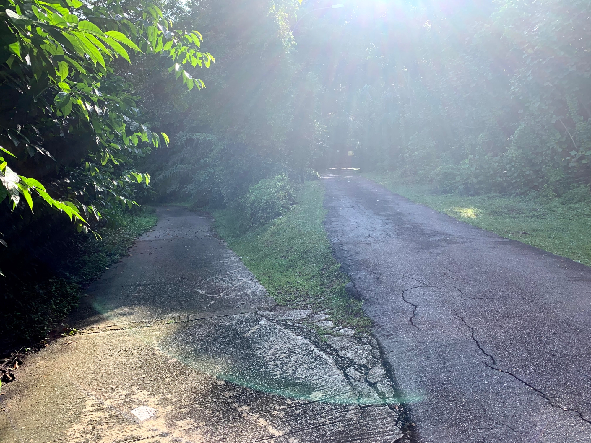 Follow the lower path, to the left. Photo by Nigel Chua.
This is a short segment that should take less than 10 minutes.
Segment 2b: "Retrograde" (12 minutes, 1/5 difficulty)
If scrambling up a slippery slope on all fours is a little too daunting, or if you intend to bring young children along, there's a much easier way to get to the "Y" junction.
It basically involves retracing your steps back out through the carpark and along the road, down to Wishart Road and Keppel Hill.
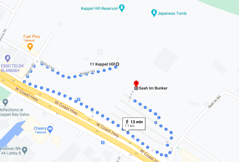 Take a long-cut through the carpark. Screenshot via Google maps.
Segment 3: "Walk in the park" (10 minutes, 2/5 difficulty)
Following the path on the left fork of the "Y" junction, you'll descend down a concrete ramp that ends abruptly in a large, brackish puddle.
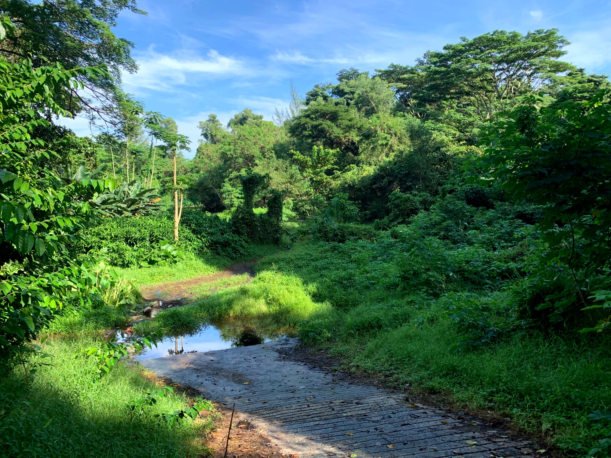 The road somewhat-less travelled. Photo by Nigel Chua.
Getting across without wetting your feet is arguably the hardest part of the segment, as evidenced by debris laid out across the pond by previous visitors.
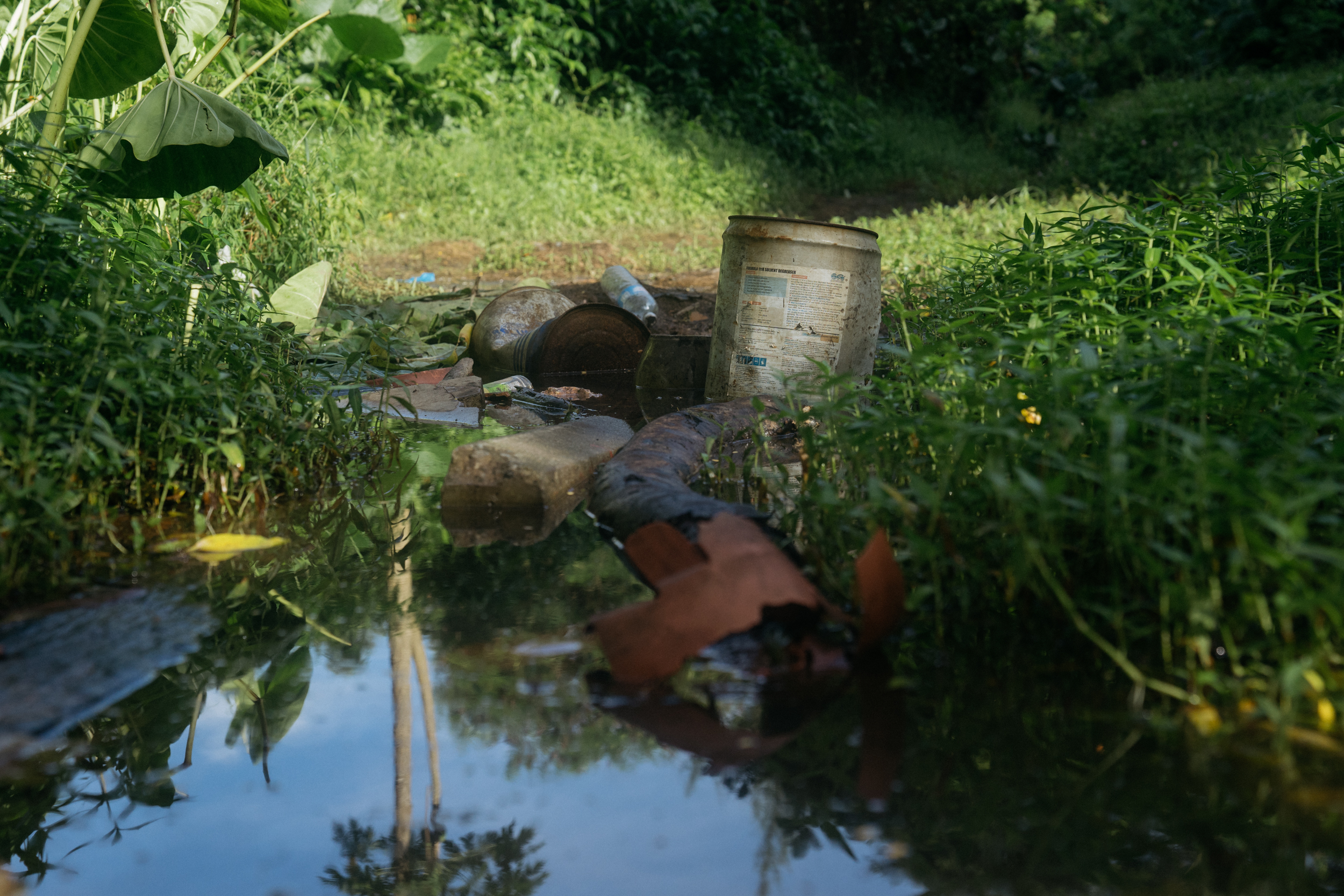 A makeshift bridge. Photo by Andrew Koay.
Or, it could be the easiest part, if you don't mind getting your feet wet.
Once you've traversed this obstacle, the trail through the forest — and to the reservoir — is pretty clear.
 Re-entering the foliage. Photo by Andrew Koay.
Along the way, you can look out for bits of white string, tape, and plastic bags tied to trees and vines, for assurance that you are indeed on the right track.
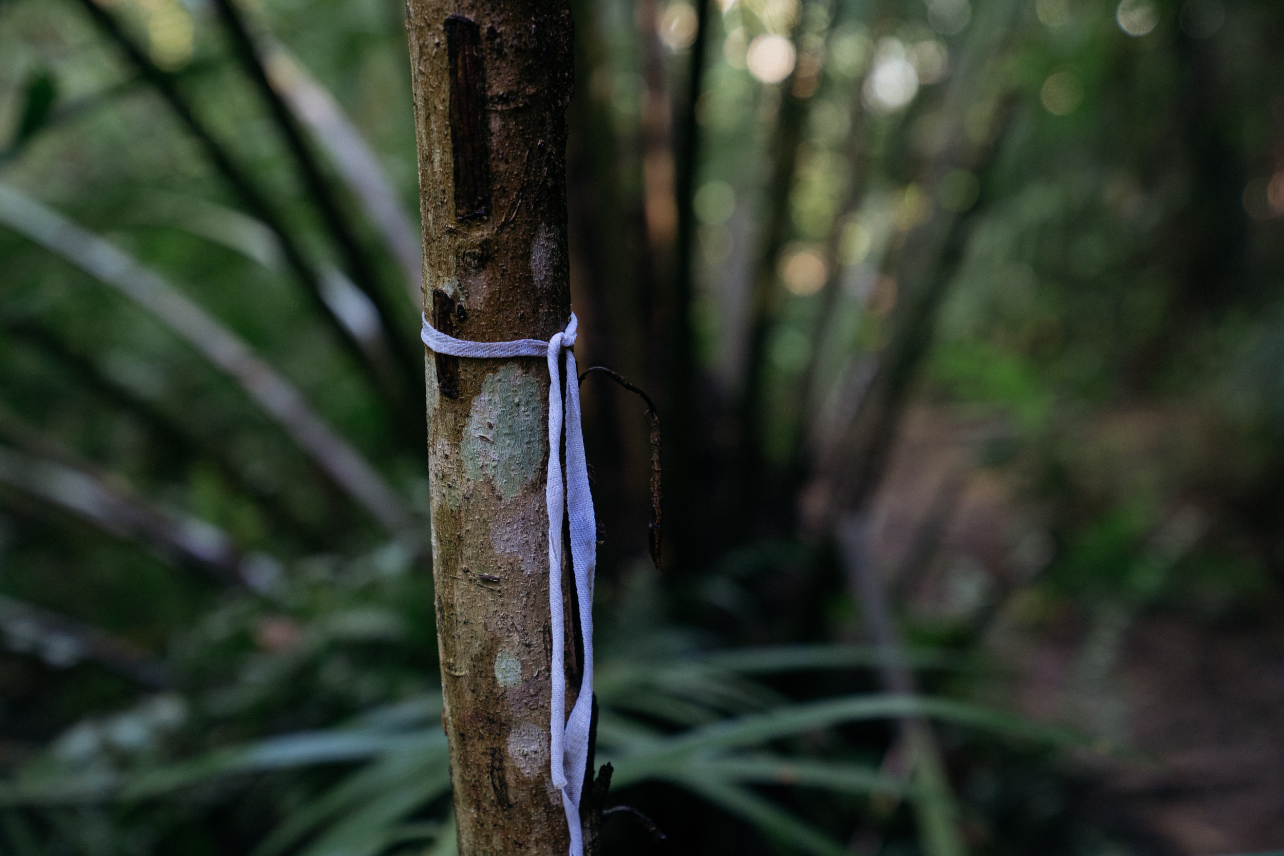 Small but effective. Photo by Andrew Koay.
Soon, you will hear the sound of running water — from a stream running under a small culvert — signalling that you are about to arrive at the reservoir.
Segment 4: "Keppel Hill Reservoir" (10 minutes, 0/5 difficulty)
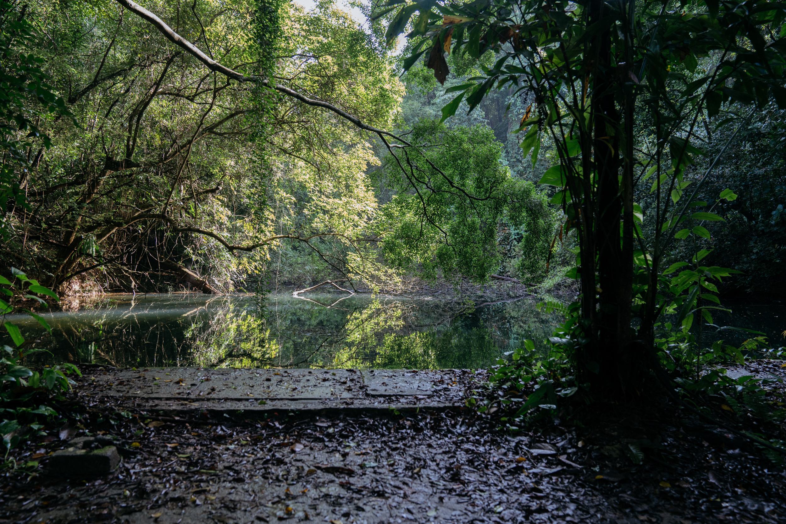 Take a dive (into history). Photo by Andrew Koay.
You'll once again be standing on concrete, as you approach the reservoir itself.
A few things to look out for in and around the reservoir include a small flight of stairs, which presumably led to a diving board, and another small flight of stairs down into the reservoir itself.
You can also try to guess at the age of a battered red and white signboard which warns:
"DANGER
NO SWIMMING
NO FISHING"
Facing the reservoir, you can choose to take a detour to the right side (to the east), to find a lone Japanese tomb, in what we call Segment 5.
You can also skip Segment 5, and go right to Segment 6, which is the path to the left (to the west), which will lead up to Mount Faber Park.
Segment 5: "The tomb" (20 minutes, 4/5 difficulty)
The path on the east side of the reservoir starts with a small flight of concrete stairs, and ends with the remains of a longer brick stairway.
We've rated its difficulty 4/5 as it involves some dodging between branches, vines, and fallen trees, as well as some sequences of steep uphill climbing.
 Jump over the trunk, dodge under the branch. Photo by Nigel Chua.
The vegetation here is generally less dense than in the previous segments, however, as it's likely that the area was once cleared of trees and plants to make way for the tomb.
The tomb
Not much is known about the tomb, or the person whose body is buried beneath it.
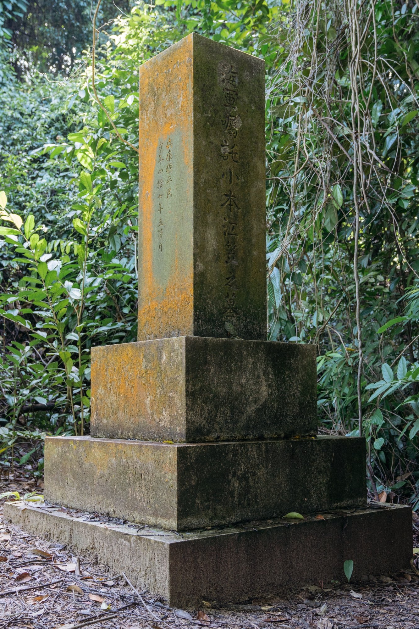 The inscription provides the person's name as "小本江笠" — likely a Japanese name read as “Komoto Ekasa”, rendered in Chinese characters. Photo by Andrew Koay.
If you want to know more about this Japanese tomb, remembersingapore.org has some information gleaned from translations of the inscriptions.
It posits that the tomb belongs to a civilian ship engineer who came to Singapore in 1942 in the early days of the Japanese occupation, and apparently died of overwork within months.
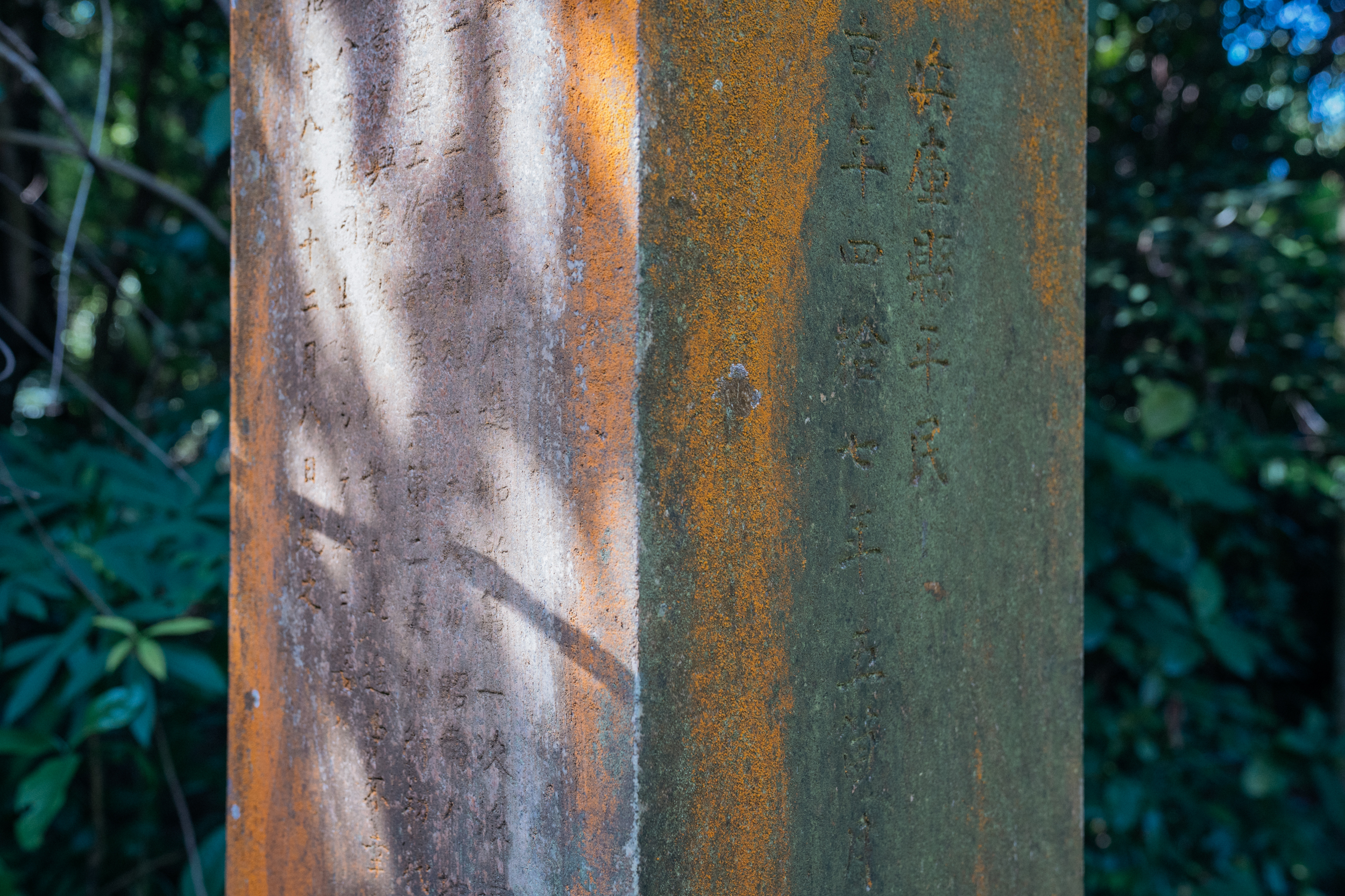 The inscriptions are hard to read as moss has accumulated on the surface. Photo by Andrew Koay.
The history website also poses the question of why he was singled out for special treatment, when other civilians were buried in a cemetery in Yio Chu Kang.
On the way down, check out the staircase for red bricks which bear the word "Alexandra", indicating that they came from the Alexandra Brickworks Company.
The Alexandra Brickworks Company produced bricks in Singapore since 1899.
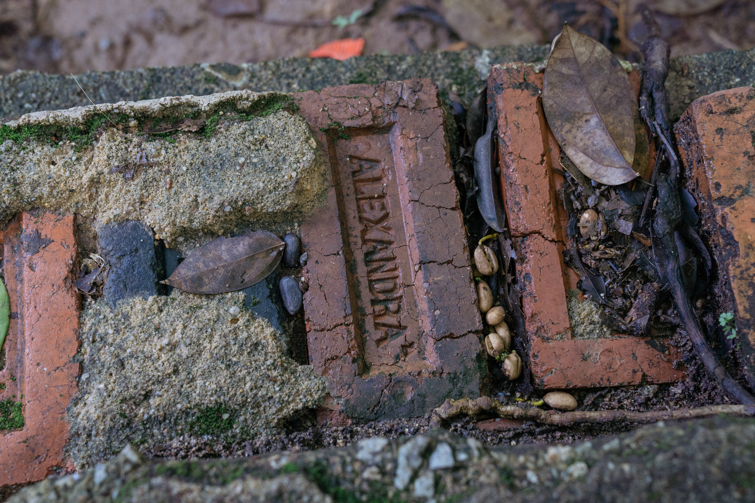 Good place to take a
 brick break. Photo by Andrew Koay.
You can allocate around 20 minutes for this segment, including the walk there from the reservoir, some time to look around the tomb, and the walk back to the reservoir.
Segment 6: "Summit push" (15 minutes, 3/5 difficulty)
The path on the west side of the reservoir doesn't lead to any other (known) historical landmark, although you are free to explore the undergrowth for yourself.
The "established" trails, however, connect quite neatly to Mount Faber Park, so this segment is well-suited for those seeking to earn their lunch calories.
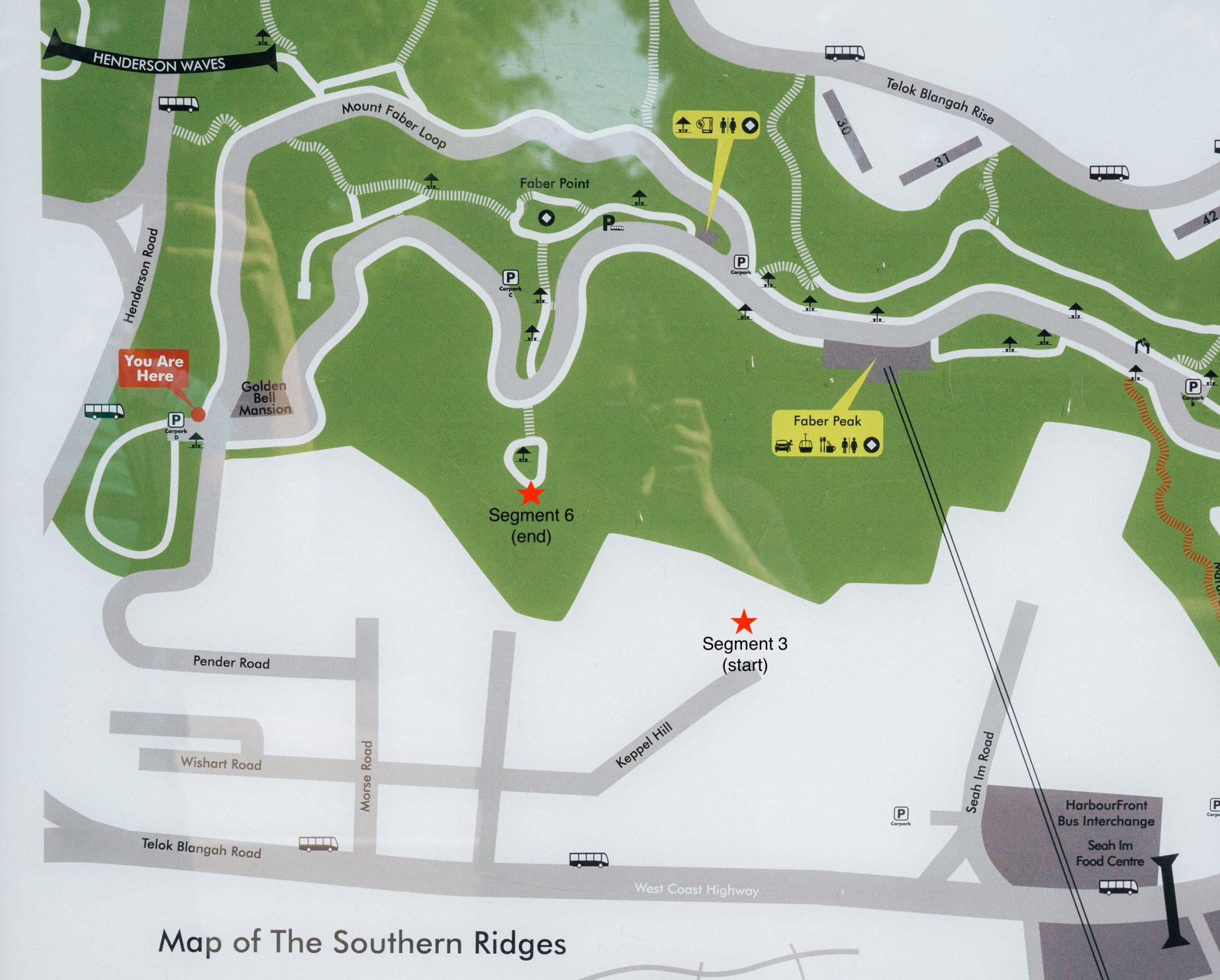 NParks map. Photo by Andrew Koay.
If you want to use this map to orientate yourself, Segment 3 starts from the "Y" junction at the end of Keppel Hill, while Segment 6 ends at the small looping path, which leads to a staircase leading directly north, up to Faber Point, the top of Mount Faber.
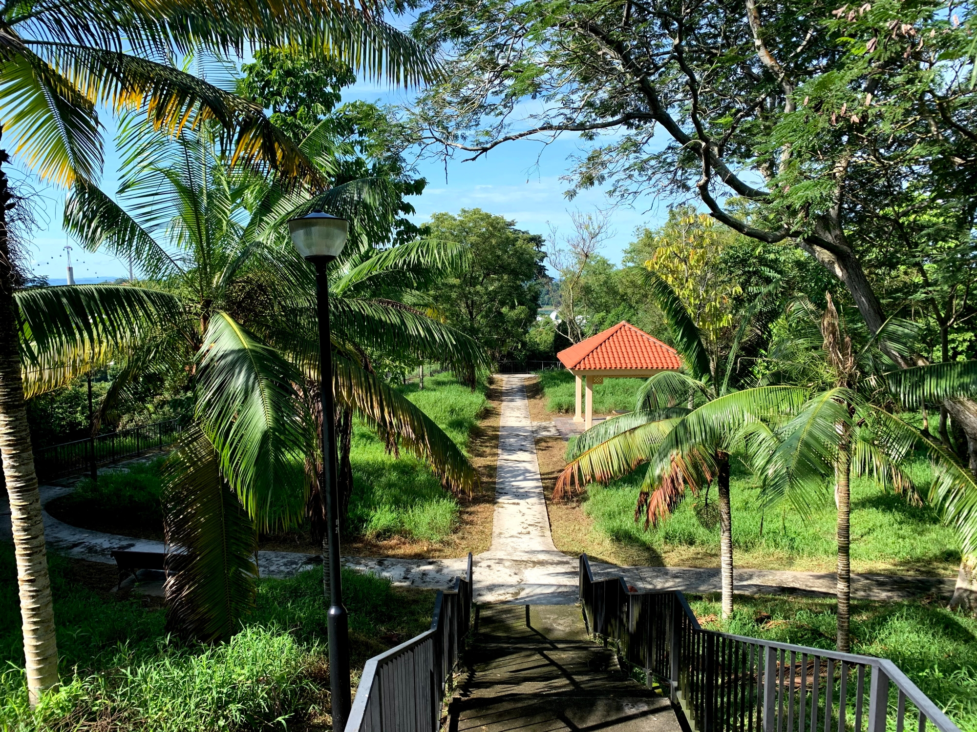 The view from the top of the staircase. Photo by Nigel Chua.
From here, you may wish to proceed down the paved road to the base of Mount Faber as retracing your steps back down the hill is more risky and challenging, especially if it is muddy and wet.
What does the future hold for this historical site?
For sure, the little reservoir holds some history within its placid waters. But it is hard to imagine that it would one day be "revamped" in the same way as other "minor" historical sites like the Yishun Hot Springs, which turned into a park early this year.
At the same time, Keppel Hill Reservoir's location, on the verdant south side of Mount Faber, and its small size, means that it is equally unlikely to be turned into yet another waterfront condo anytime soon.
For now, it's something different for those seeking an experience somewhat off the beaten track, that isn't (or hasn't been) fenced off or earmarked for future development just yet.
Places like this can cater to those who need something extra to motivate them to head outdoors, and for seasoned adventurers who are no longer surprised at the fact that one often has to queue up to enter the MacRitchie treetop walk.
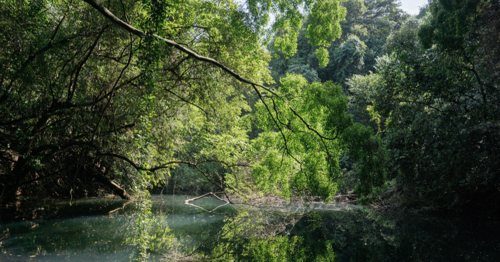
 Keppel Hill Reservoir is one part of Singapore that's not (yet) been made into a garden. Photo by Andrew Koay.
Will it be forgotten again?
It has been said that history tends to repeat itself.
On that note, you might be wondering if, or when, the Keppel Hill Reservoir will eventually be forgotten yet again.
Till then, it remains available to the adventurous ones among us, literally a stone's throw away from the more familiar side of Singapore that we all know.
We deliver more stories to you on LinkedIn
Top image by Andrew Koay
If you like what you read, follow us on Facebook, Instagram, Twitter and Telegram to get the latest updates.