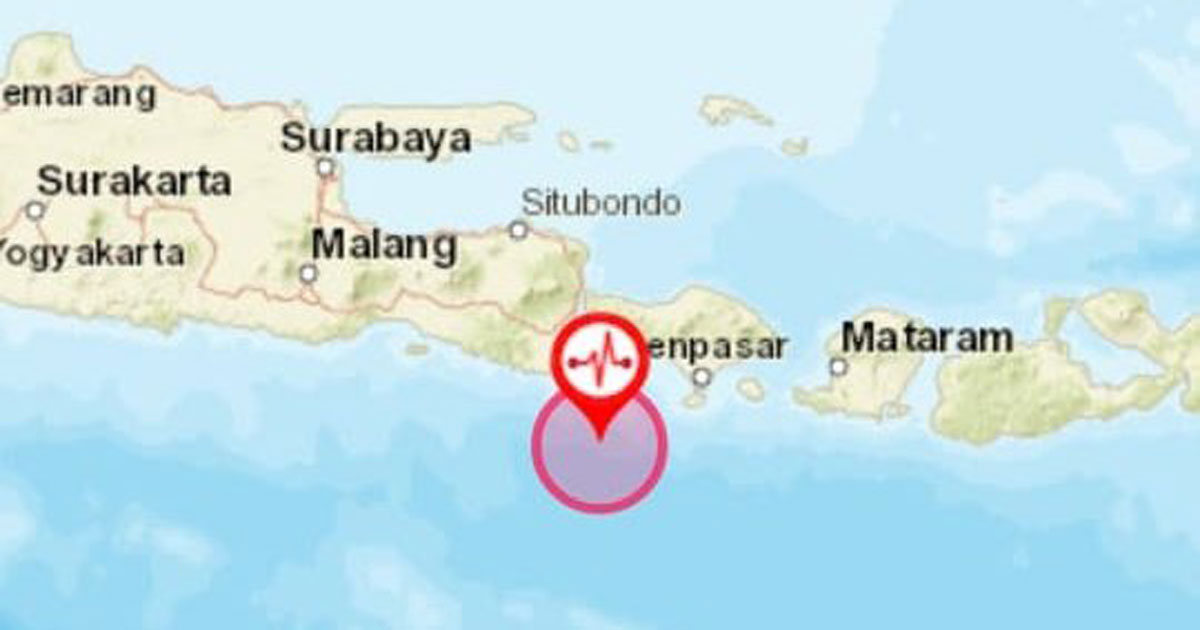
A magnitude 6.1 undersea earthquake struck the south of Indonesian island Bali on Tuesday, July 16.
Indonesia's disaster management agency tweeted that a magnitude-6.0 quake struck at about 7.20am at a depth of 68km.
Kekuatan : 6.0 SR
— BNPB Indonesia (@BNPB_Indonesia) July 16, 2019
Tanggal : 16-Jul-2019
Waktu Gempa : 07:18:36 WIB
Lintang : 9.11 LS
Bujur : 114.54 BT
Kedalaman : 68 Km
Lokasi:
South of Bali, Indonesi
Keterangan:
Gempa ini tidak berpotensi TSUNAMI
:::: BMKG :::: BMKG :::: BMKG :::: pic.twitter.com/a9OqN8ThUa
There was no potential for a tsunami.
The European earthquake monitoring agency EMSC said the quake's epicentre was 102km southwest of Denpasar in Bali and was 100km deep.
No tsunami warning was triggered, the Hawaii-based Pacific Tsunami Warning Center said.
The quake's preliminary magnitude of 5.7 was recorded by the US Geological Survey.
Previously
A major 7.3-magnitude earthquake struck the remote Maluku islands in eastern Indonesia on Sunday, July 14.
At least two people were killed and thousands had to be evacuated after the shallow quake struck in the evening.
If you like what you read, follow us on Facebook, Instagram, Twitter and Telegram to get the latest updates.