What do the housing estates of Bedok, Marine Parade and Tanjong Rhu, East Coast Park, the Benjamin Sheares Bridge and the Esplanade have in common?
They were all built on land that was reclaimed under the same project: The East Coast Reclamation project overseen by the Housing Development Board (HDB).
Dubbed the "Great Reclamation", the East Coast Reclamation project is also Singapore's largest land reclamation project thus far.
20-year project
In all, it added a total of 1,525 hectares of land at a cost of S$613 million over seven phases from 1966 to 1986.
 Source: Rumah: Contemporary Architecture of Singapore, Singapore Institute of Architects, 1981
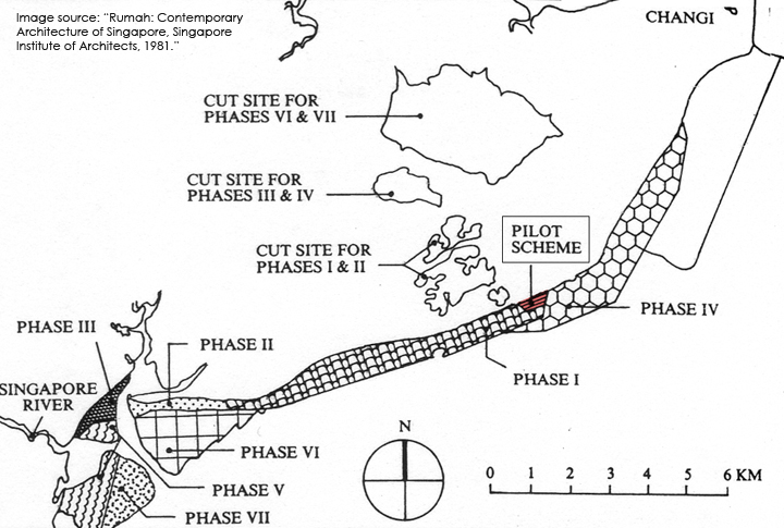
Prior to this massive reclamation, here's a map of where the original coastline was located in Bedok:
[caption id="" align="alignnone" width="640"] Source: Heartbeat@Bedok[/caption]
None of the landfill material was imported
One would think that such a project would have necessitated the mass import of sand for use as landfill material -- a topic that has seen its fair share of issues and controversy in recent years.
However, as the initial map above shows with its cut sites, all of the landfill material used for the reclamation was locally sourced.
In 1963, a pilot project was carried out at Bedok Point as a trial run of sorts to reclaim up to 48 acres of land.
The success of the pilot saw the hills of Bedok and Tampines earmarked to provide the landfill material for the main project itself.
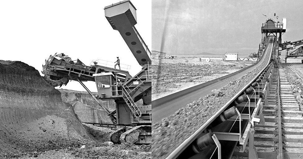
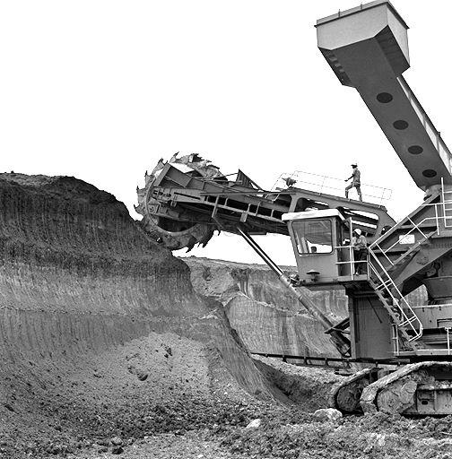
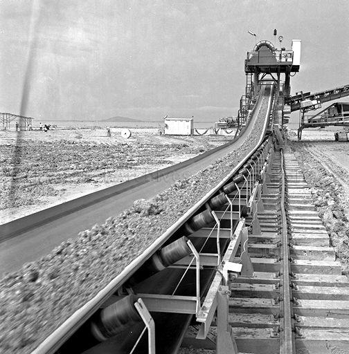
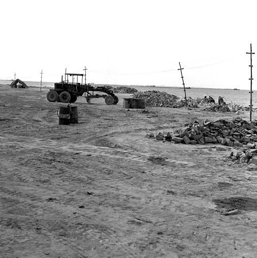
Accordingly, these hills were cut into earth by bucket wheel excavators, before being transported by a conveyor belt to a jetty off Bedok, where the earth was loaded onto barges that would proceed to dump the material into the areas marked for reclamation.
 Source: National Archives of Singapore
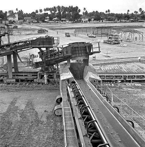 Source: National Archives of Singapore
 Source: National Archives of Singapore
Afterwards, the earth would then be graded and compacted by bulldozers and trucks in order to ensure that the land was level.
 Source: National Archives of Singapore
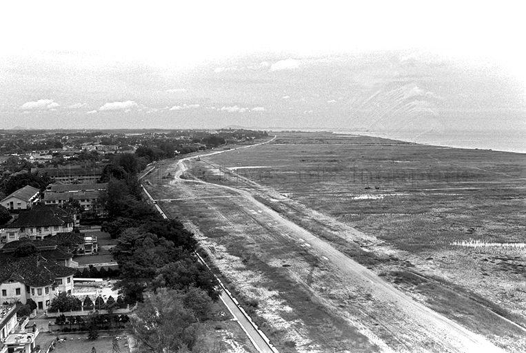
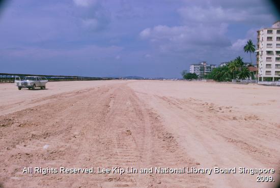
This resulted in the eventual addition of new land to Singapore that would encompass the entire stretch of Singapore's southeastern length, from Bedok to Marina Bay.
 Source: National Archives of Singapore
 Source: NLB eresources
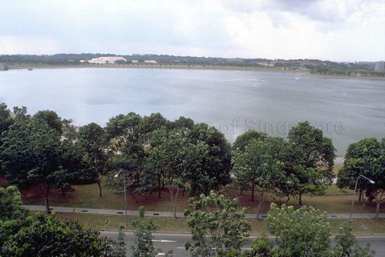
Reclamation led to the formation of Bedok Reservoir
In a unique twist, if the reclamation of East Coast added land to Singapore, it also added a new body of water within Singapore.
Such was the volume of material used for the project that in 1983, the cut site for Phases III and IV was converted by the Public Utilities Board over a period of three years into Bedok Reservoir by 1986.
 Source: National Archives of Singapore
This probably also explains why Bedok and Tampines are so flat now.
After all, before the reclamation, Simpang Bedok village actually stood on ground high enough to offer a view of the Singapore Strait.
[related_story]
Suffice to say, apart from Changi Airport, no other land development project has had such a significant impact in shaping the landscape of eastern Singapore.
Things that were eventually built along East Coast:
Top image collage from National Archives of Singapore
If you like what you read, follow us on Facebook, Instagram, Twitter and Telegram to get the latest updates.