In the 1960s, Singapore's land was unable to accommodate more roads. The government formulated Singapore's first concept plan for infrastructural development then.
The concept plan laid out a blueprint for a network of expressways, as well as the concept for the Mass Rapid Transit (MRT).
In the very beginning, public transport was envisioned to be the main mode of transport for Singaporeans. In a 1996 Transport White Paper, the government proposed that the goal was to make 75 percent of total daily travel by public transport.
It took 10 years for the MRT system to be studied and designed, and even then, it was met with criticism.
The first two phases
Ultimately, it came to fruition and the first train began operating on Nov. 7, 1987.
Back then, there were only five stations in operation -- Yio Chu Kang, Ang Mo Kio, Bishan, Braddell, and Toa Payoh.
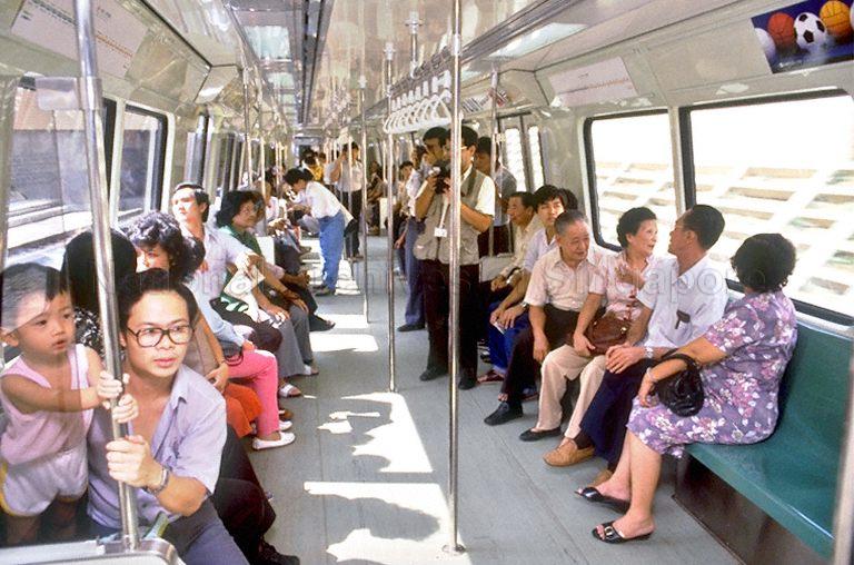 Train commuters on opening day. Via NAS.
By December 1987, the stretch from Novena to Raffles Place, and Tanjong Pagar to Outram Park opened for public commuting.
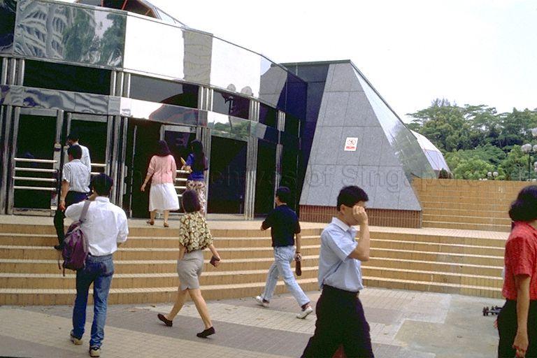 Orchard MRT when it was just opened. Via NAS.
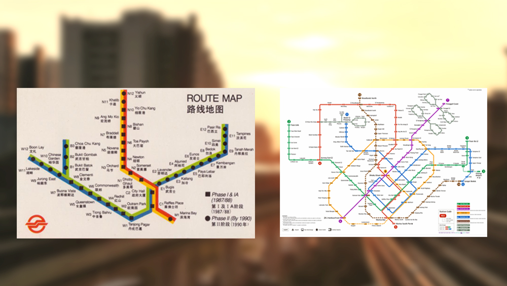
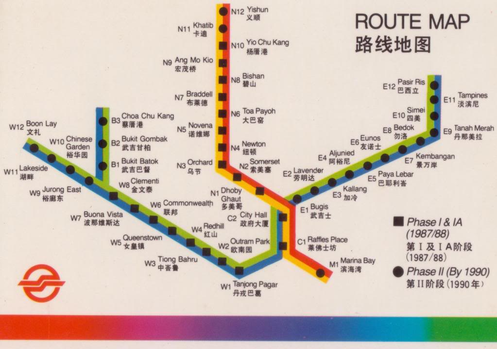
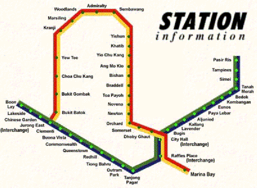
By March 1988, the stretch from Tiong Bahru to Clementi was opened to the public, thus completing the first phase of the MRT (indicated by square icons in the route map below).
 Via Pinterest.
The second phase of the MRT (indicated by round icons in the MRT route map above) was completed in July 1990.
Station codes
One interesting thing to note is the initial alphanumeric code given to the stations.
Station codes were generally labelled according to their line direction (E for eastward line, W for westward line etc).
Exceptions were made for the central interchange stations which started with "C", Marina Bay (M1), and the stations on the Branch Line (Bukit Batok to Choa Chu Kang)
[related_story]
Woodlands extension
The next phase of the MRT system was the Woodlands Extension, meant to serve commuters who lived in the North/ Northwest region. The extension connected Choa Chu Kang to Yishun and opened in February 1996.
 Via.
Via.
Fun fact: The electronic displays at the station entrances which inform commuters about train arrival times were first implemented in 1996 at stations along the Woodlands Extension.
The start of automated lines
Seven years later, Singapore's first automated line, the North East Line, opened in June 2003. It also saw a change in MRT line colours and station codes.
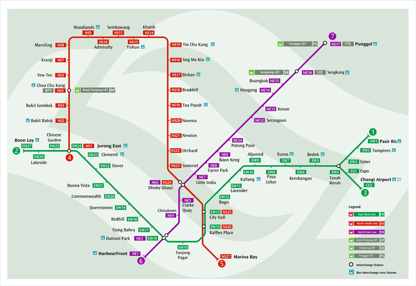 Via Pinterest.
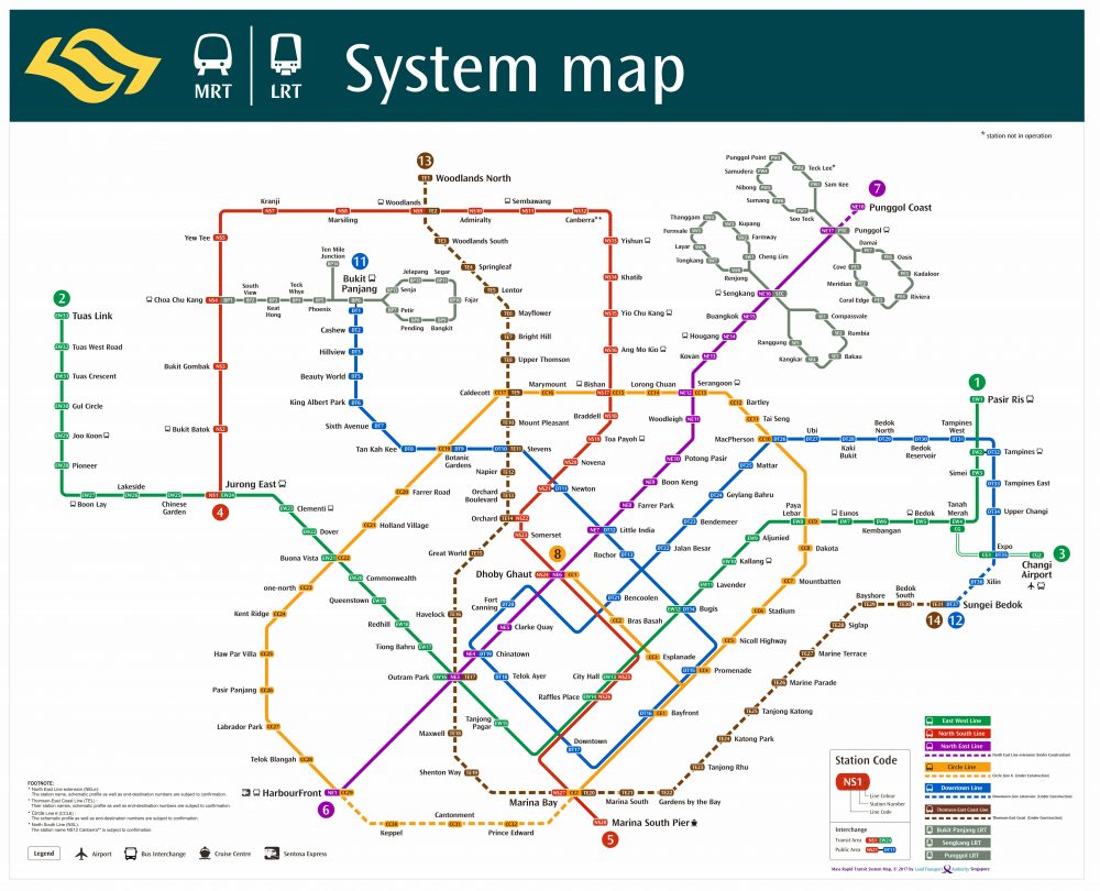
Over the years, more automated lines (Circle Line and Downtown Line) were opened. The Downtown Line was recently completed and is currently the longest MRT line in Singapore.
The Circle Line's loop is expected to be completed in 2025.
In the future, we can also expect to see Thomson East Coast Line which is going to be Singapore's first fully cashless line which will be opening in stage from 2019.
The Thomson-East Coast Line begins at Woodlands, travels all the way down to Marina Bay, before turning east to serve commuters living along the East Coast.
 Via LTA.
In the 2013 Transport Masterplan, the goal by 2030 is to have eight in 10 homes be a 10-minute walk away from a train station, and have 85 percent of all public transport trips be completed within one hour.
Seems like with each new MRT line, we're one step closer to that dream -- a dream that perhaps looks like this?
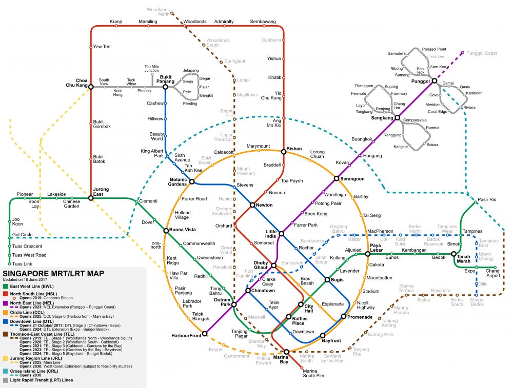 Via MRT.sg
For now...
Transport Minister Khaw Boon Wan visited SMRT's Tuas West Depot on Monday (Nov. 13), where he noted that more engineering hours were needed to quickly upgrade the ageing rail assets.
With the oldest parts of Singapore's rail network hitting 30 years old this year, an upgrade in the MRT system is due to solve the immediate problem of the regular occurrences of train disruptions.
Top images via Pinterest, LTA, and SMRT
If you like what you read, follow us on Facebook, Instagram, Twitter and Telegram to get the latest updates.