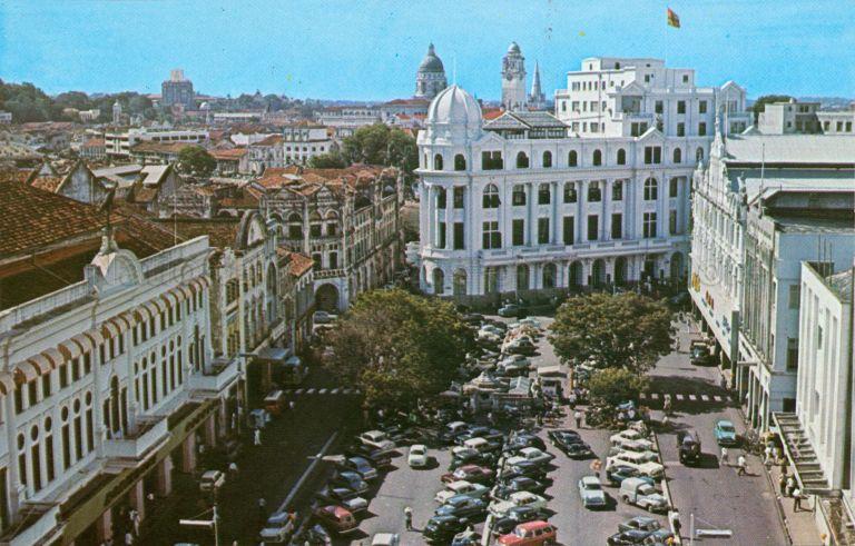
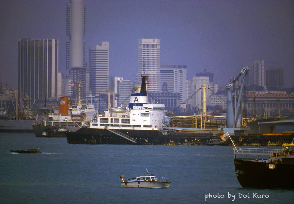
When Singapore became independent in 1965, the island that began as a fishing village at the time of Raffles' founding in 1819 had already grown into an important port city.
However, 1965 Singapore was still much less developed than the likes of Hong Kong, Japan, and Australia, which the Singapore of today is comparable with.
Since Singapore became a fully self-governing country in 1959 under founding prime minister (PM) Lee Kuan Yew (LKY), Singapore's meteoric development from third world to first is well-known.
In the area of public housing, for example, the first generation of independent Singapore's leaders created the present day Housing Development Board (HDB) in 1960.
Within the first three years of HDB's existence, it had already managed to build almost as many flats as it took its colonial-era predecessor, the Singapore Improvement Trust, 32 years to achieve.
Similarly, Singapore's industries developed rapidly and moved from manufacturing to services within a single generation -- a feat that requires the phenomenally quick and complementary development of areas, such as education and infrastructure.
Unfortunately, Singaporeans are as myopic about the past as they are very forward-looking.
The extremely fast pace of Singapore's development, which was kickstarted by LKY's leadership in 1959, has led many to adopt a short-sighted vision of Singapore's history that only has two major milestones -- LKY becoming PM of Singapore in 1959 and our independence in 1965.
This vision of history is further compounded by a quote lifted out of a speech LKY made in 1967 at a dinner organised by the UK Manufacturers' Association.
In his speech, he said:
We have create(d) this out of nothingness, from 150 souls in a minor fishing village into the biggest metropolis 2 degrees north of the Equator.
Over the years, this quote has become part of the myth about LKY and his contributions to Singapore.
Many Singaporeans have grown to believe that before 1965 and before LKY became PM, the island was nothing more than a little fishing village.
This belief is wrong for two reasons.
Reason 1: This quote was lifted out of context
Firstly, the quote has been taken entirely out of context. If you read the entire 1967 speech, you will realise that LKY had acknowledged Stamford Raffles' contribution to the development of Singapore very early on in his speech:
When Stamford Raffles landed here on the 29th of January, 1819 there were then 120 Malays and 30 Chinese. Remember this: there were already 30 `Chinamen` here. He decided that the future trade of the East India company would flourish and expand if he used this as a base and attracted the entrepreneurial skills, subsidiary skills, of all the people in the region. So he opened this up. Within three months, the population had expanded to 5,000 Chinese, still 120 odd Malays, but 5,000 Chinese and a few hundred Indians.
Note: Some academic sources have placed Singapore's population at the time of Raffles' founding at 1,000 inhabitants of various ethnic origins, instead of the 150 Malays and Chinese that LKY had mentioned in his speech.
LKY went on in his speech, crediting Raffles for kickstarting Singapore's development from a mudflat into a city:
But for him (Raffles), this would still be a mudflat. Let us not pretend it was anything else. But he brought in the skills and gave the reason for what is now here.
Reason 2: Singapore was not a mudflat before LKY. He said so in his speech.
Known as his "mudflat to metropolis" speech, LKY, while visiting Sembawang, told Singaporeans in 1965:
"Over 100 years ago, this was a mud-flat, swamp. Today, this is a modern city. Ten years from now, this will be a metropolis. Never fear." Speech at the Sree Nayarana Mission in Sembawang, Sep 12, 1965.
So Singapore was not a mudflat fishing village before LKY became PM, and we also have the pictures to prove it.
1824
The story goes that after Sir Stamford Raffles' founding of modern Singapore in 1819, the tiny fishing village that it was developed and grew rapidly.
In 1824, the print below was made of the view of the Singapore River and Chinatown from Government Hill (present day Fort Canning). Photography, as an invention, was only in its infancy in the early 1800s, so people still relied heavily on paintings and prints to capture what they saw.
[caption id="" align="aligncenter" width="623"]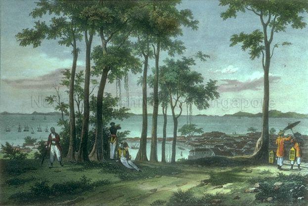 Source: National Archives[/caption]
Look closely at the picture. It's only been five years after Raffles' founding, but the fishing village had grown into a town.
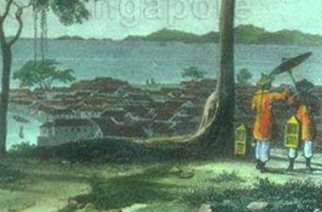 Adapted from source: National Archives
1830
This picture gives a closer look at the Singapore River six years after the print above was made. Notice the crowd it depicts on the river banks. It does not look like a fishing village at all.
[caption id="" align="aligncenter" width="685"]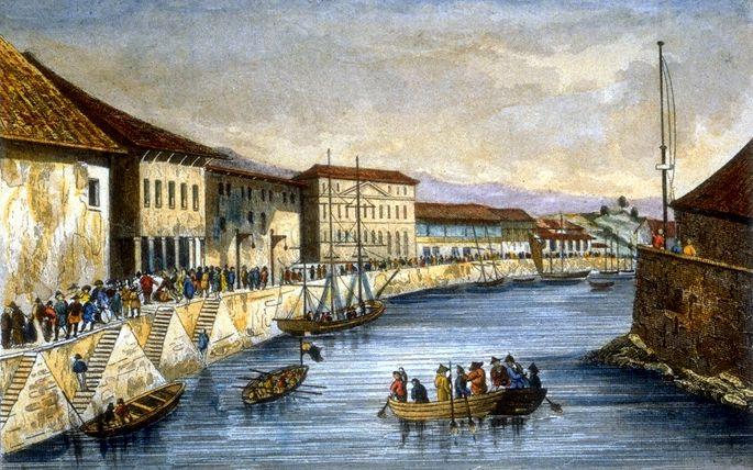 Source: National Archives[/caption]
1837
Seven years later, this picture of inland Singapore in 1837 has Fort Canning in the background. It looks more like a town/city.
[caption id="" align="aligncenter" width="768"]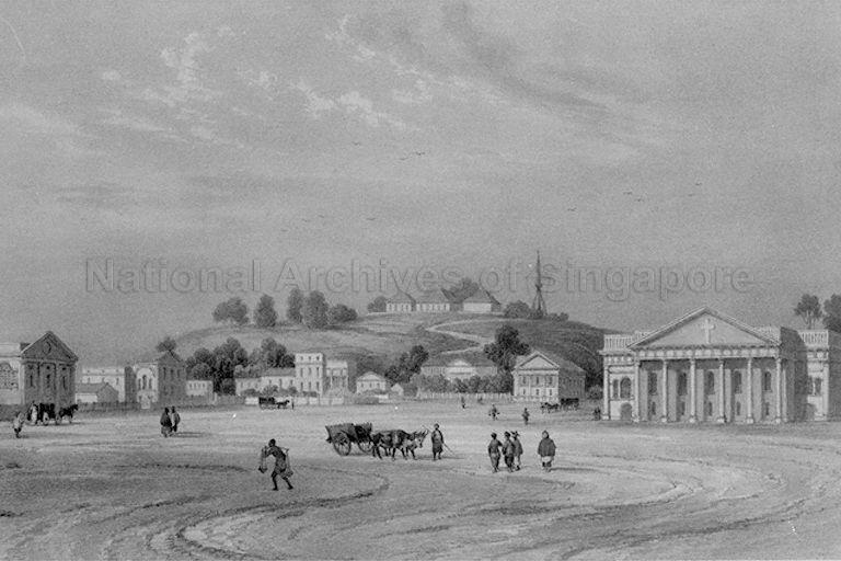 Source: National Archives[/caption]
1840s
This picture of the Singapore River with a view of Fort Canning Hill in the background was drawn by Francois-Edmond Paris. It does show some people fishing in the Singapore River, but the setting clearly is not that of a fishing village.
[caption id="" align="aligncenter" width="768"]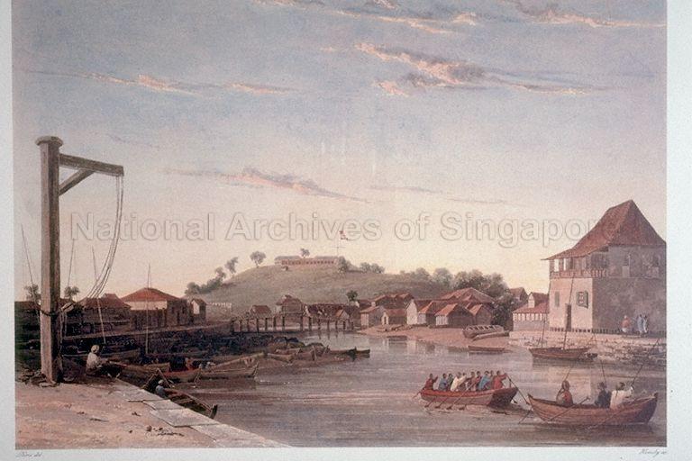 Source: National Archives[/caption]
1847
The painting below was done by British civil engineer and artist John Turnbull Thomson. Thomson was instrumental in designing and building by many buildings and public infrastructure in colonial Singapore, including Horsburgh Lighthouse on Pedra Branca.
The painting features St Andrew's Church (first building from the right), the predecessor of St. Andrews Cathedral. At the time Thomson painted this picture, the church would have been struck by lightning once in 1845. It would be struck again by lightning in 1849, before the building was considered structurally unsafe in 1852 and eventually demolished.
Not a fishing village, LKY wasn't even born yet.
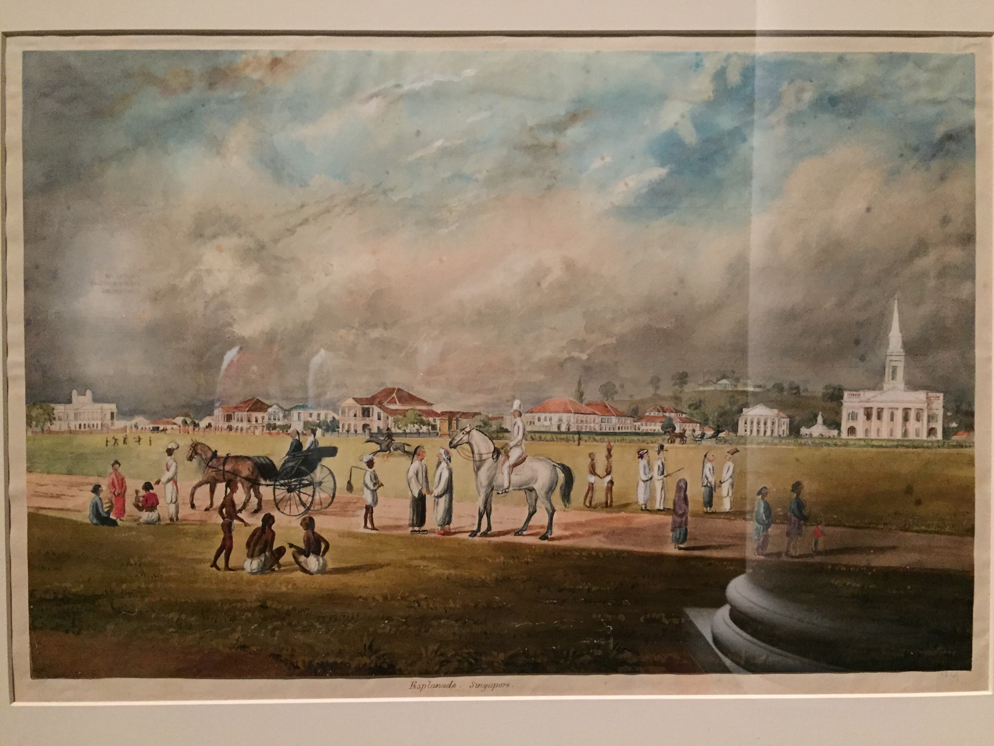
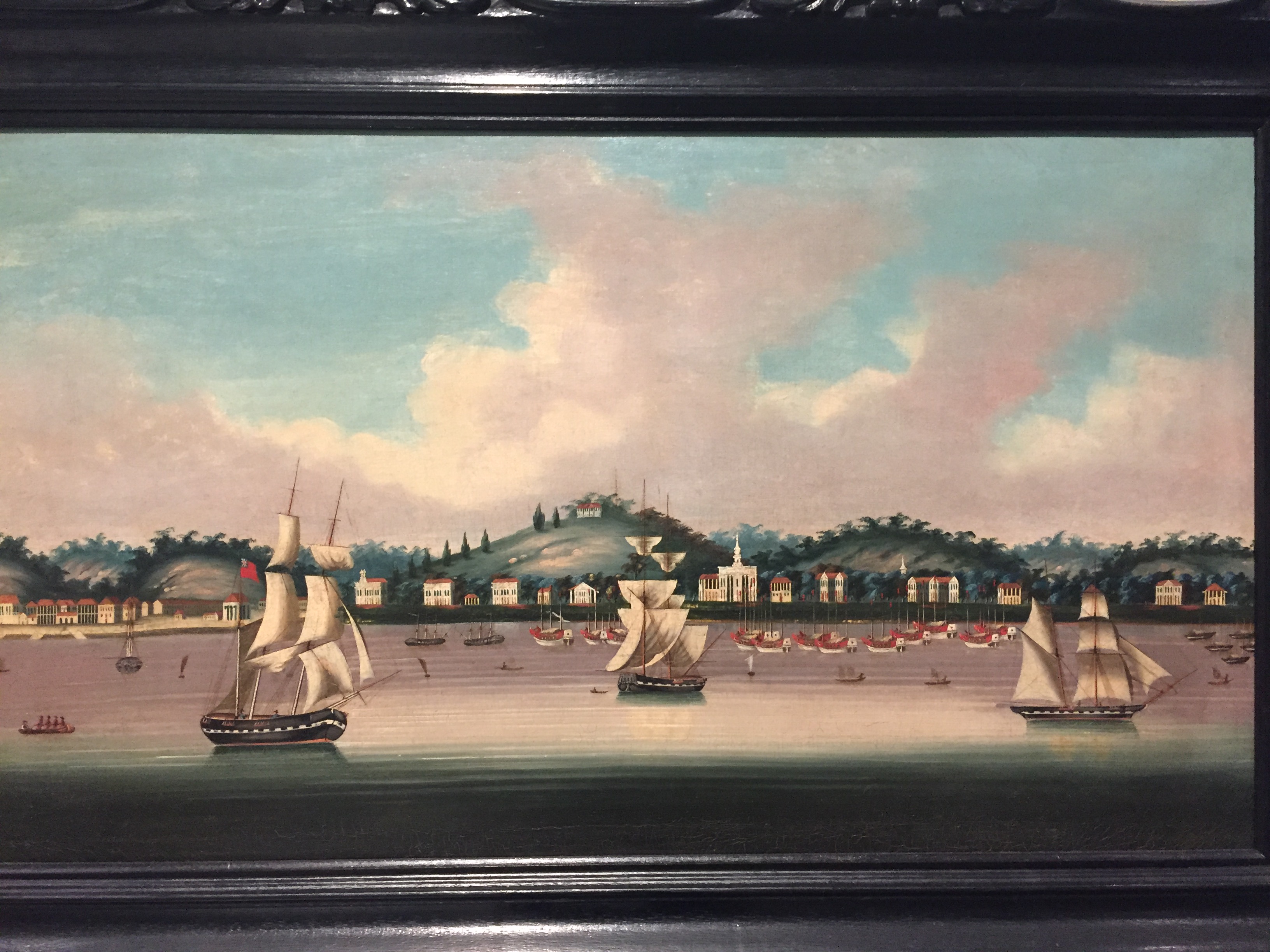
1850
Here's a painting of the view of the Singapore harbour from the sea in 1850 by an unknown Chinese artist. The harbour looks busy with many ships anchored there. Fort Canning Hill and St Andrew's Church can be seen.
No more fishing village!
1890s
Fast-forward to the 1890s and the emergence of commercial photography. This a photo of a bustling South Bridge Road in the Chinatown area with Masjid Jamae Mosque and Sri Mariamman Temple clearly visible. No fishing village here.
[caption id="" align="aligncenter" width="683"]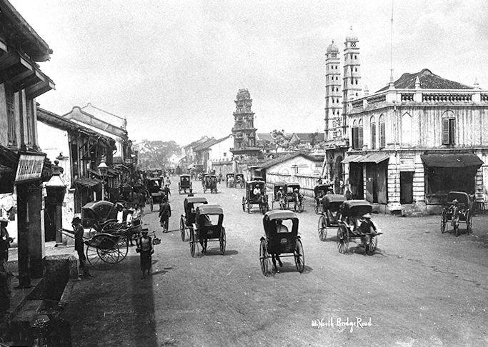 Source: National Archives[/caption]
1900
Look at the post city that Singapore had grown to be. LKY still wasn't born yet.
[caption id="" align="aligncenter" width="693"]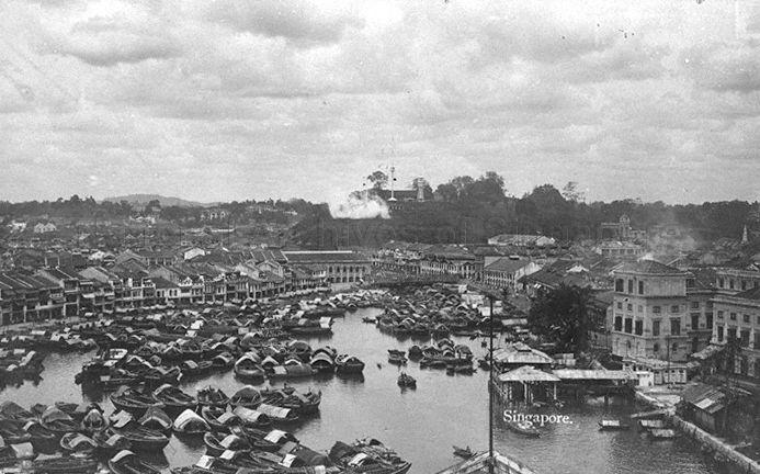 Source: National Archives[/caption]
1925
This image shows what Raffles Place looked like in 1925. LKY would have only been 2 years old in 1925.
[caption id="" align="aligncenter" width="646"]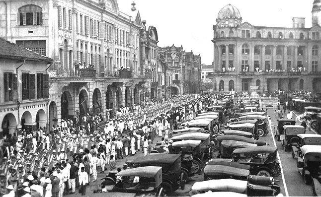 Source: National Archives[/caption]
1930s
Here's a view of Robinson Road with Lau Pa Sat to the left.
[caption id="" align="aligncenter" width="630"]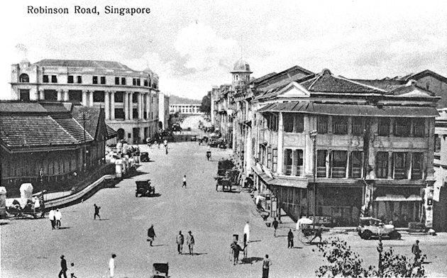 Source: National Archives[/caption]
1940
Shortly before the Japanese Occupation from 1942 to 1945, Collyer Quay looked like this.
[caption id="" align="aligncenter" width="690"]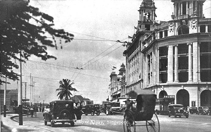 Source: National Archives [/caption]
1950s
This was what the area at the curve between Orchard Road and Penang Road looked like in the 1950s.
[caption id="" align="aligncenter" width="718"]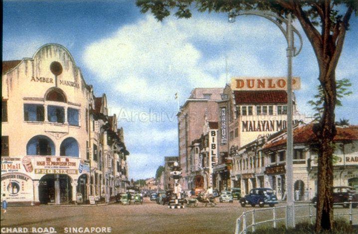 Source: National Archives[/caption]
1960s
Finally, here is a view of Singapore in the 1960s, the decade in which LKY had become PM and Singapore became independent.
[caption id="" align="aligncenter" width="768"]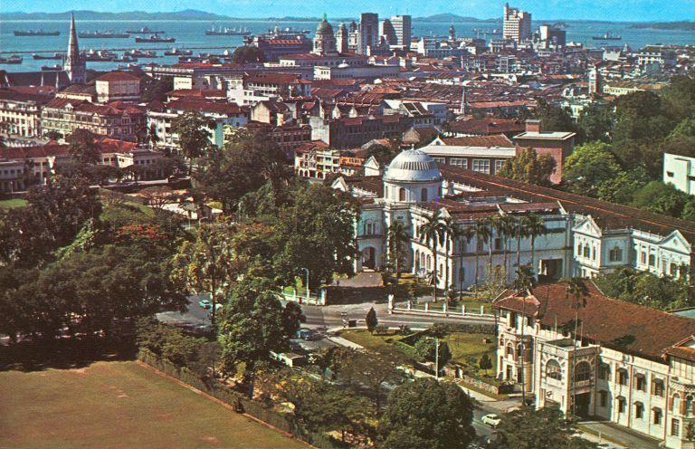 Source: National Archives[/caption]
1975
The development of post-independence Singapore is well-known. Here is a view of Clifford Pier and Change Alley in 1975. Notice how the metropolis was beginning to take shape.
[caption id="" align="aligncenter" width="757"]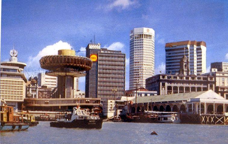 Source: National Archives[/caption]
1979
Four years on in 1979, here's a view of the Central Business District from the waterfront.
1980s
Singapore's rapid development continued in the 1980s.
[caption id="" align="aligncenter" width="500"]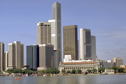 Source[/caption]
1994
The metropolis grew throughout the 1990s.
[caption id="" align="aligncenter" width="1024"]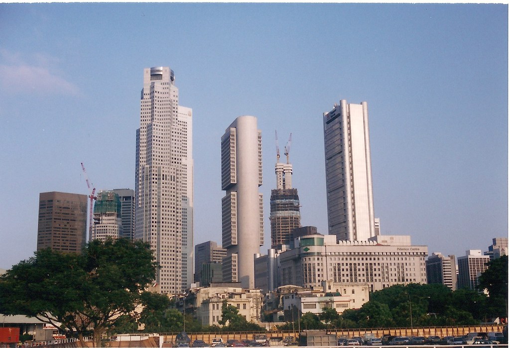 Source[/caption]
2016
The metropolis today.
[caption id="" align="aligncenter" width="900"] Source[/caption]
Top photo from National Archives
If you like what you read, follow us on Facebook and Twitter to get the latest updates.
If you like what you read, follow us on Facebook, Instagram, Twitter and Telegram to get the latest updates.
