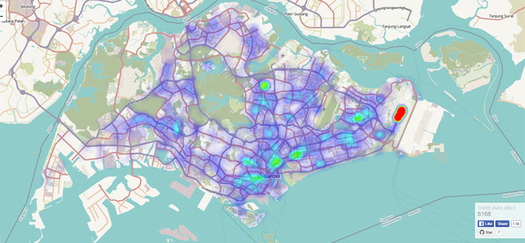
A first-year undergraduate student from the National University of Singapore has created a heatmap to give anyone a bird's-eye view of where Singapore’s taxis are in real-time.
According to Tech In Asia, Joseph Tang, who studies computer science at the National University of Singapore, created the map by retrieving data from the government’s open data initiative.
Not only does the map show where Singapore's taxis are currently aggregated, for example, Changi Airport is perpetually red hot with taxis, it also indicates exactly how many taxis are plying the road at any given moment.
Earlier in the afternoon, there were about 7,000 to 8,000 taxis on the roads.
During the 4pm to 5pm timing, there were approximately 6,900 taxis on the road.
However, by 6pm, the number of taxis altogether plying the roads was as low as 4,079.
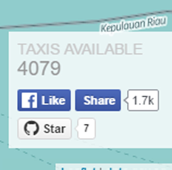
This fall in the number of taxis can be considered precipitous, as it is equivalent to more than a 40 percent drop over the course of the afternoon.
One reason could be because taxis are changing shift or drivers are responding to the decline in demand for taxis as a result of surcharges kicking in and simply not driving during this period.
But this figure should be seen in the larger context: As of March 2016, the total taxi fleet in Singapore is 28,286 taxis, operated by six taxi companies.
Moreover, there are some 57,000 active cab drivers in Singapore.
Therefore, the solution of granting more taxi licenses and increasing the pool of drivers does not directly address the issue of shortage of taxis, as it does not translate to more taxis plying the road.
Uber and Grab, anyone?
If you like what you read, follow us on Facebook and Twitter to get the latest updates.
If you like what you read, follow us on Facebook, Instagram, Twitter and Telegram to get the latest updates.