Indonesia's burning forests have resulted in a haze situation affecting the region. Again.
And while the haze is clearly visible to those in the affected areas, it can also be seen all by satellites in outer space.
Images of smoke blankets in Borneo
In September 2019, NASA's Earth Observatory released several satellite images of the smoke blankets in Indonesia.
According to NASA, their satellites have detected evidence of fires in this region throughout August.
However, the number and intensity of fires significantly increased in the first week of September.
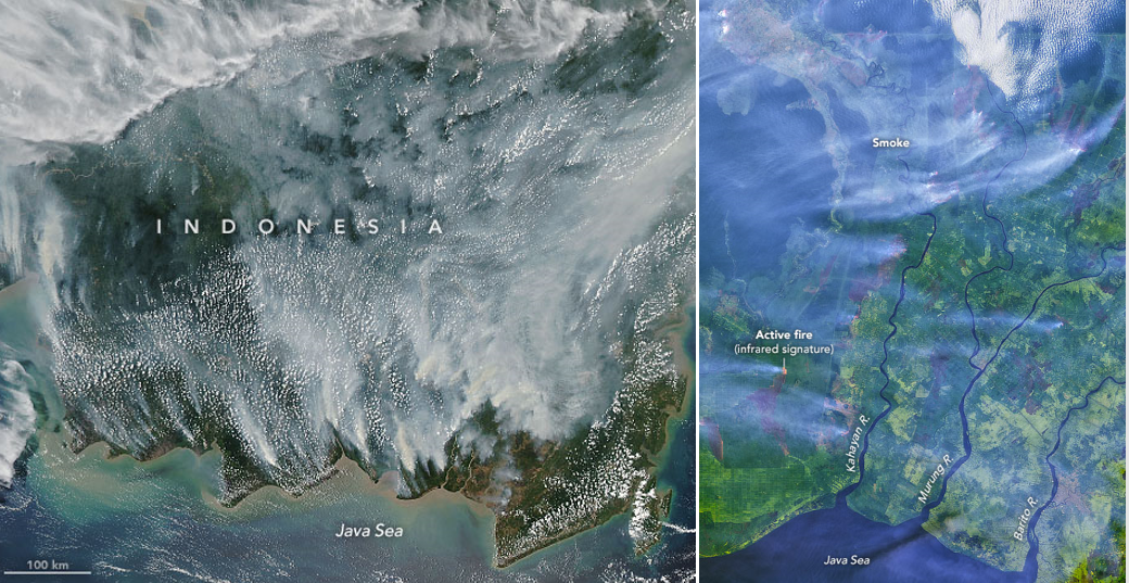
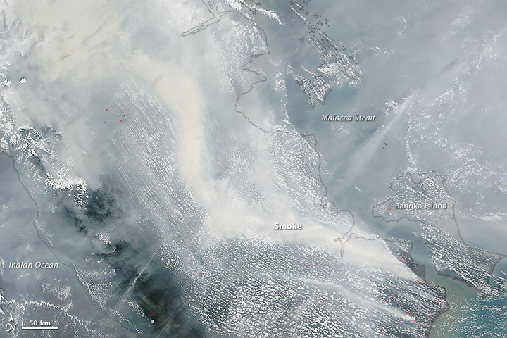
Here's an image showing the smoke cover on Sep. 14, 2019:
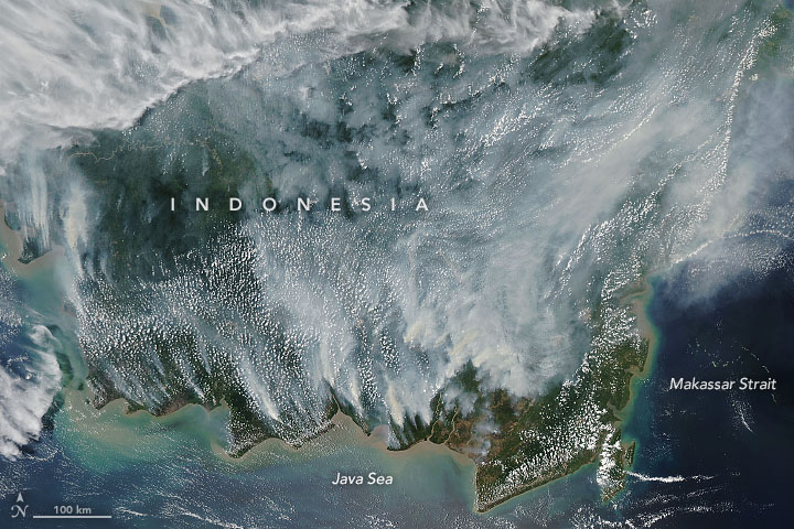 Photo from NASA Earth Observatory.
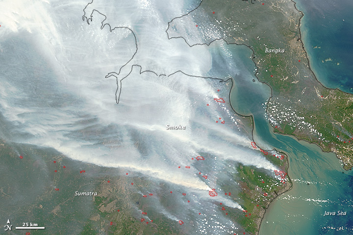
Here's another image from Sep. 15, 2019, showing smoke and fires in southern Borneo, captured by Aqua satellite.
This image, which was put together using photos captured by the satellite Landsat 8, showed active fires.
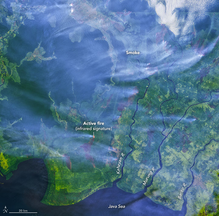 Photo from NASA Earth Observatory.
NASA also released a map showing the peat fires as of Sep. 17:
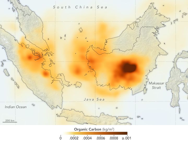 Photo from NASA Earth Observatory.
Peat fires release large amounts of gases and particles, and tend to be difficult to extinguish.
Images of the haze in 2015
According to NASA scientist Robert Field, the number of hotspots picked up by satellites have not been as high as in 2015.
This is due to the bouts of rain in mid-August, which delayed the progress of the fires.
Here are some satellite images of the haze from 2015:
 October 2015. Photo from NASA Earth Observatory.
 September 2015. Photo from NASA Earth Observatory.
Satellite imaging as a tool
Satellite images have not only been used as a means to detect hotspots and smoke plumes, but are also used for weather forecasts.
According to the Meteorological Service Singapore, remotely sensed data from satellites complement other data from radars and lightning detection systems to form a more complete picture of atmospheric conditions.
CRISP, a remote sensing satellite ground station, can be found in The National University of Singapore.
They acquire and process images of the earth's surface covering different countries, including Indonesia, Brunei, Malaysia, Singapore and the Philippines.
Top photo composite image, via NASA Earth Observatory.
If you like what you read, follow us on Facebook, Instagram, Twitter and Telegram to get the latest updates.