

Have you ever noticed these structural "quirks" in CityLink Mall and Raffles City?
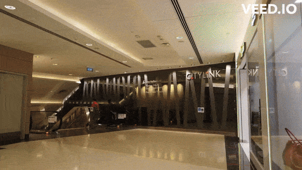
First, this stretch in CityLink Mall that requires mallgoers to go down an escalator only to go up an escalator about 10 metres away -- essentially creating an underpass.
 Adapted from SG Virtual Walking/YouTube.
Then there is the curious lack of a direct connection between Basement 1 of Raffles City and City Hall MRT station.
To get to the station from Basement 1 of the mall, you'll need to take a long escalator up to Level 1 (where there used to be a McDonald's) before descending via yet another long escalator.
Functioning just like an overhead pass.
Clearly, something cuts across CityLink Mall and Raffles City, which the underpass and overpass were designed to avoid.
And that is the Stamford Canal, which still exists to this day, except that many of us walk over (or under) it without a clue every day.
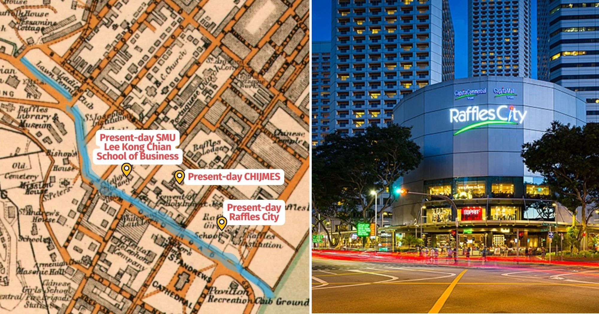
This post by Urban Explorers of Singapore shows the alignment of the Stamford Canal (in blue) and where it cuts across CityLink Mall (in red).
Before it was known as Stamford Canal, it was a small freshwater stream that was prominent enough to be marked on historical town plans from the 1800s.
This stream, known as Sungei Beras Bassa, started from somewhere in Tanglin and ran through present-day Orchard -- where it irrigated the nutmeg orchards that gave Singapore's most well-known shopping belt its name -- before cutting across the civic district and emptying into the sea near where present-day Raffles City stands.
Today, the mouth has been moved to where the floating platform sits, courtesy of land reclamation.
It is said that this freshwater stream was where many Indian dhobies (laundrymen) washed customers' clothes; from that, we get the name "Dhoby Ghaut".
Turned into a canal
The stream was subsequently turned into a canal, which overflowed its banks each time the tide came in.
Because of this, Stamford Road, which ran along the canal, was known as “lau chui khe”, meaning “flowing water road” in Hokkien.
Here's a 1913 map of Singapore town where you can see the canal (highlighted in blue).
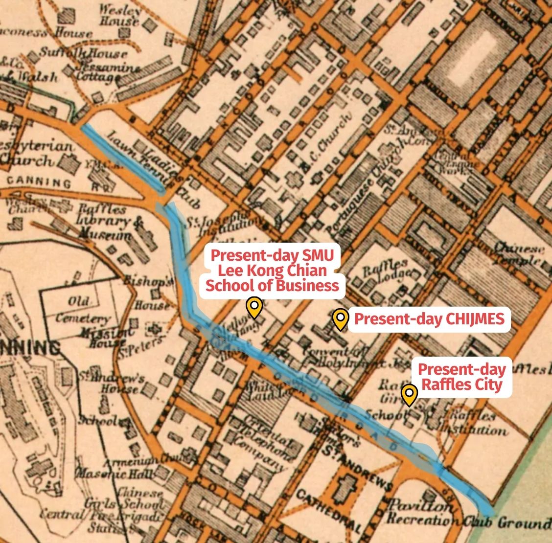 Adapted from 1913 map via NUS Libraries Historical Maps of Singapore.
This canal used to be known by other names too: Brass Bassa Canal/Raffles River in the 19th century.
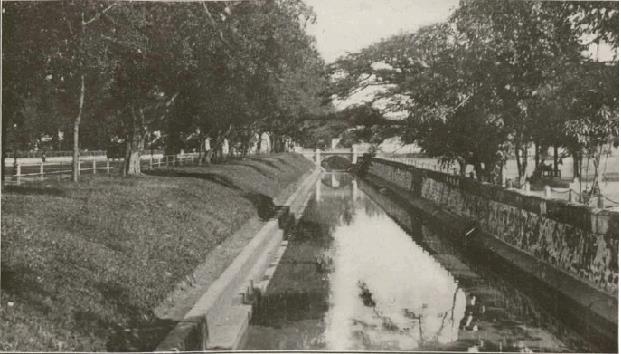
In the past, it looked like this:
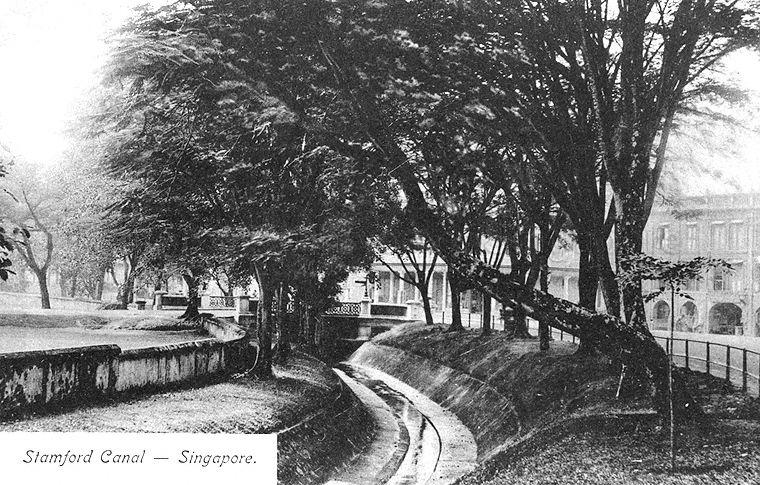 Via NAS
Here's another photo of the canal, taken between 1927 and 1934:
 Via NLB
According to the National Heritage Board, crossing the canal whenever it flooded was a challenging endeavour.
"Crossing the canal proved to be a challenge—one that was solved in ingenious ways by the Scouts at Raffles Institution; Raffles Institute was located across Stamford Canal then (where Raffles City stands currently).
Fashioning a rudimentary bridge out of ropes and sticks, the students at the time scampered across Stamford Canal with ease."
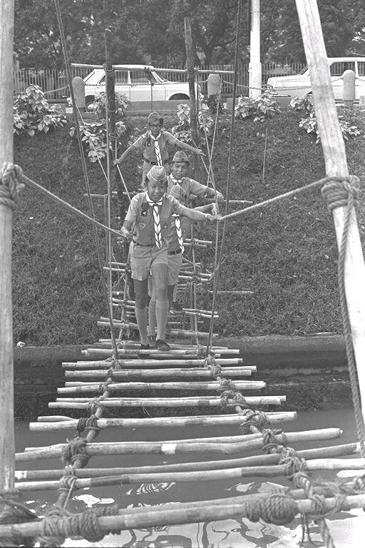 Photo via NAS
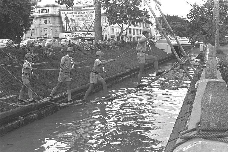 Photo via NAS
Covered up
The Stamford Canal tended to flood, especially in the sections that run through Orchard, because the catchment area sits in a valley.
This problem was exacerbated by the urbanisation of the area; more concrete surfaces led to more surface run-off flowing into the canal.
And so in 1978, the government started to widen and deepen the Stamford Canal, at the cost of S$56 million.
By 1984, the Stamford Canal had become a "large muddy eyesore" in the words of a Straits Times reporter.
You can imagine the smell.
Perhaps that's part of the reason why the government opted to cover up the Stamford Canal and construct buildings and pedestrian malls on it: to beautify the urban environment.
Clues pointing to the existence of the canal
Since then, the canal has "disappeared" from view. Even so, there are clues that point to its existence.
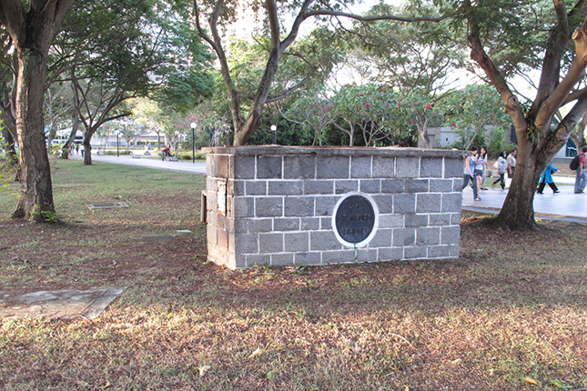
Several bridges used to sit across the Stamford Canal.
All of them were demolished when the canal was covered but there are remnants of one bridge -- small chiselled stone walls that marked the piers of Stamford Bridge -- that you can find at the War Memorial Park.
They are embellished with a metal plate marking the year the bridge was opened, and rich symbolic imagery.
 Via Roots.gov.sg
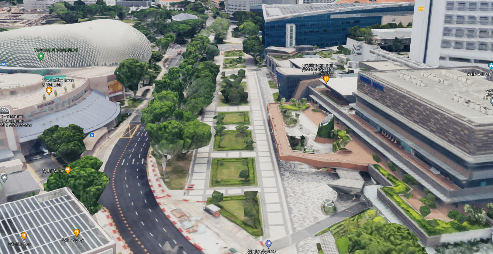
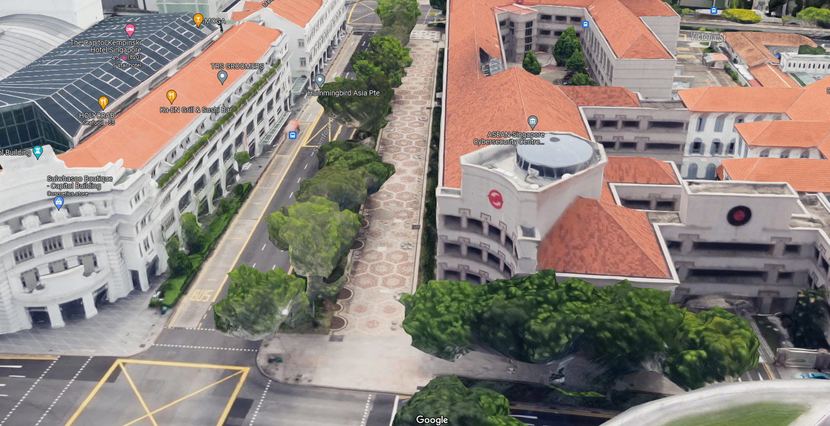
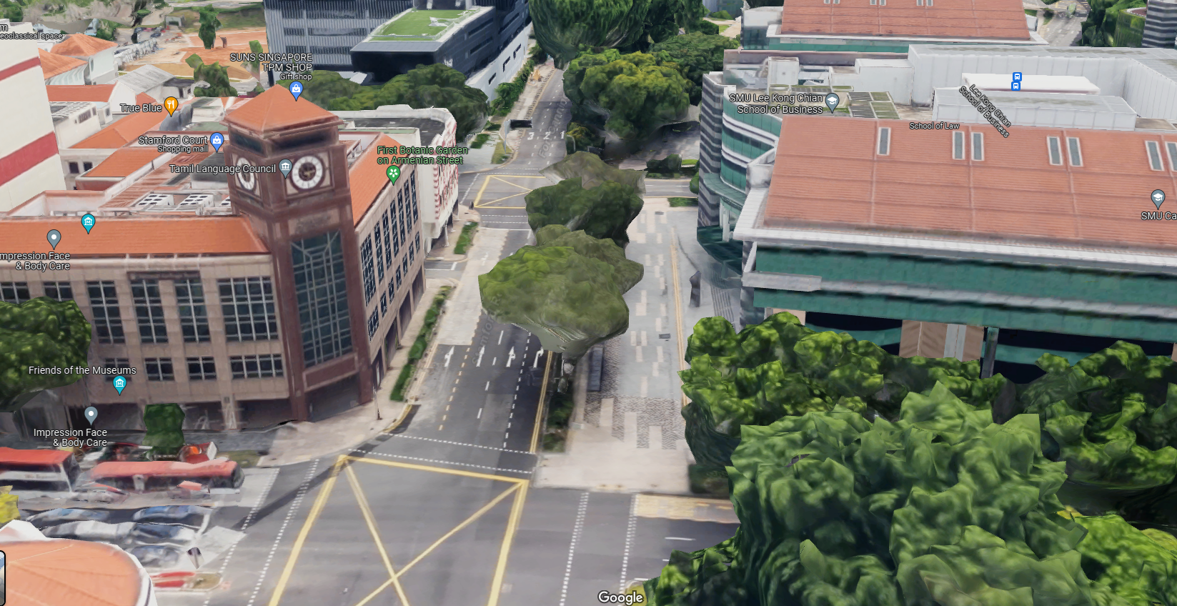
The other clue is the pedestrianised paths that start from outside Marina Square.
Walking down towards the Singapore Management University (SMU), you'll find that the paths are very wide and curiously uniform in width.
 Via Google Maps
It's particularly obvious outside the SMRT headquarters and SMU's Lee Kong Chian School of Business.
The canal lies underneath these paths.
 Via Google Maps
 Via Google Maps
Now you know!
Top images: Historical Maps of Singapore, STB
If you like what you read, follow us on Facebook, Instagram, Twitter and Telegram to get the latest updates.