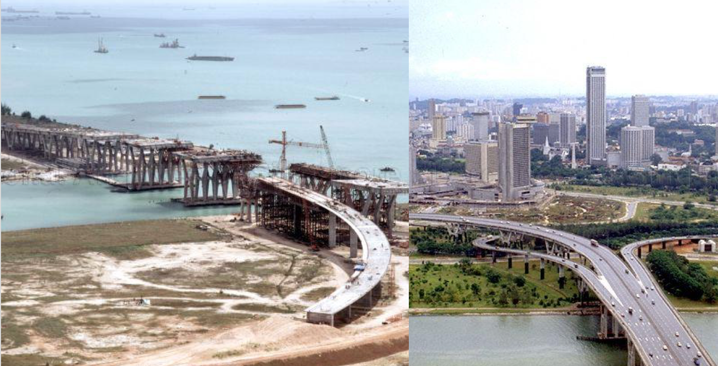
On Sept. 26, 1981, the Benjamin Sheares Bridge opened.
Construction began in 1977 as part of the East Coast Parkway (ECP).
And boy, was it high.
Built over a water body, the bridge served a crucial role in Singapore's developing transport network then as it formed part of Singapore's second highway.
Built on reclaimed land
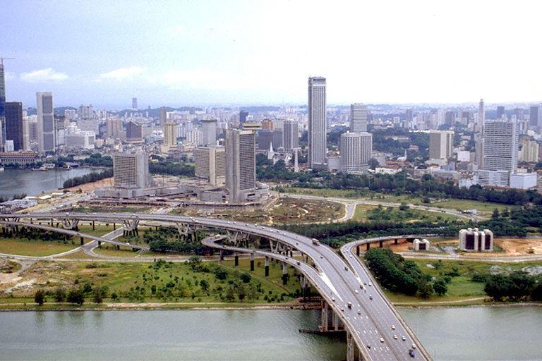
While much of the newer transport networks are built underground, this bridge was built on reclaimed land. It shortened travelling time between East Coast and Marina Bay.
Land reclamation was a very popular strategy to deal with land scarcity in Singapore at that time. From this photo, you can also see the reclaimed land that would later become Gardens By The Bay East:
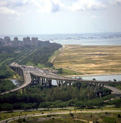 Photo from NAS.
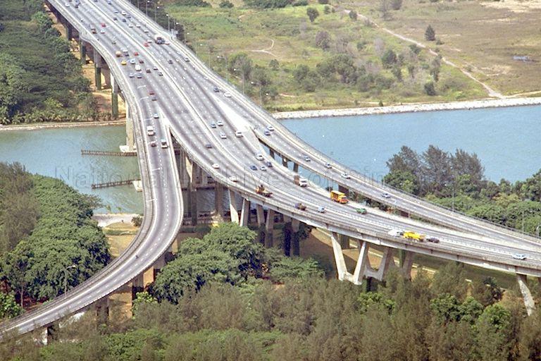 Photo from NAS.
An ambitious project
Costing a whopping S$109.8 million then, Benjamin Sheares Bridge is the longest and highest elevated bridge built by the Public Works Department, now known as the CPG Corporation.
It was also quite an engineering feat.
The bridge is 1.8km long, and 29m at its highest point over the Kallang basin. This is approximately the same height as a 10-storey HDB flat.
The bridge has eight lanes and a pair of two-metre-wide footpath for pedestrians.
Named after the second President of Singapore, Benjamin Sheares did not manage to see the completion of the project though.
He passed away four months before the bridge was opened to the public.
The reason for this height was to enable larger ships to pass under the bridge to and from the ship repair yards in Tanjong Rhu.
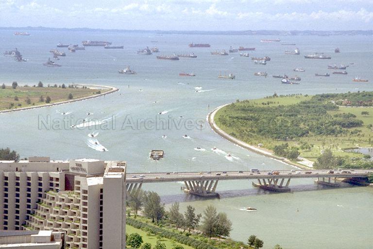 Photo from NAS.
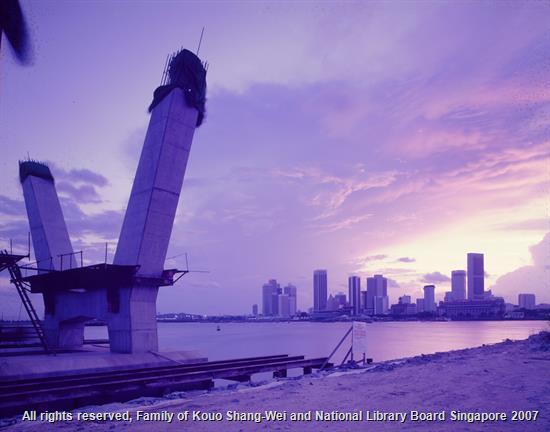 Photo from the Kouo Shang-Wei Collection, National Library Board.
The tapered H-shaped trestles that supported the bridge were also specially designed to facilitate the passage of ships without obstruction by the columns.
However, the shipyards relocated when the actual construction began.
A scenic ride
Apart from solid form and function, the bridge was also designed to contrast with the skyline of City Hall, and offer a panoramic view of the city.
In other words, cruising down the Benjamin Sheares Bridge was supposed to be an awe-inspiring scenic ride.
 Photo from NAS.
When the bridge first opened, motorists would stop their vehicles on the highway to take photographs or admire the sights, despite warnings issued by the traffic police.
Couples would even take wedding photos on the bridge.
Today, the Benjamin Sheares Bridge has been downgraded from an expressway to an arterial road due to the opening of the Marina Coastal Expressway.
With the MCE, many motorists no longer get to see the view from the bridge.
Expressways were crucial
Bearing in mind that the MRT system only began construction in the 1980s, the need for road networks and highways to connect towns then was pressing.
According to the 1971 Concept Plan, new high-density satellite towns were supposed to be built around the central catchment area, each linked by a system of islandwide expressways.
The ECP was one of the five expressways built for this purpose, and the bridge was Phase Four of its construction.
The bridge would not only connect to existing roads and highways, but would also serve as an efficient bypass that would take traffic around, not into, the city.
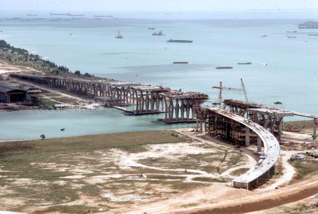 Photo from NAS.
Top photo composite image from NAS
If you like what you read, follow us on Facebook, Instagram, Twitter and Telegram to get the latest updates.