


News
Lim Chu Kang Road closes, marks end of S'pore's only makeshift runway for military planes
Also marks the end of illegal racing there.


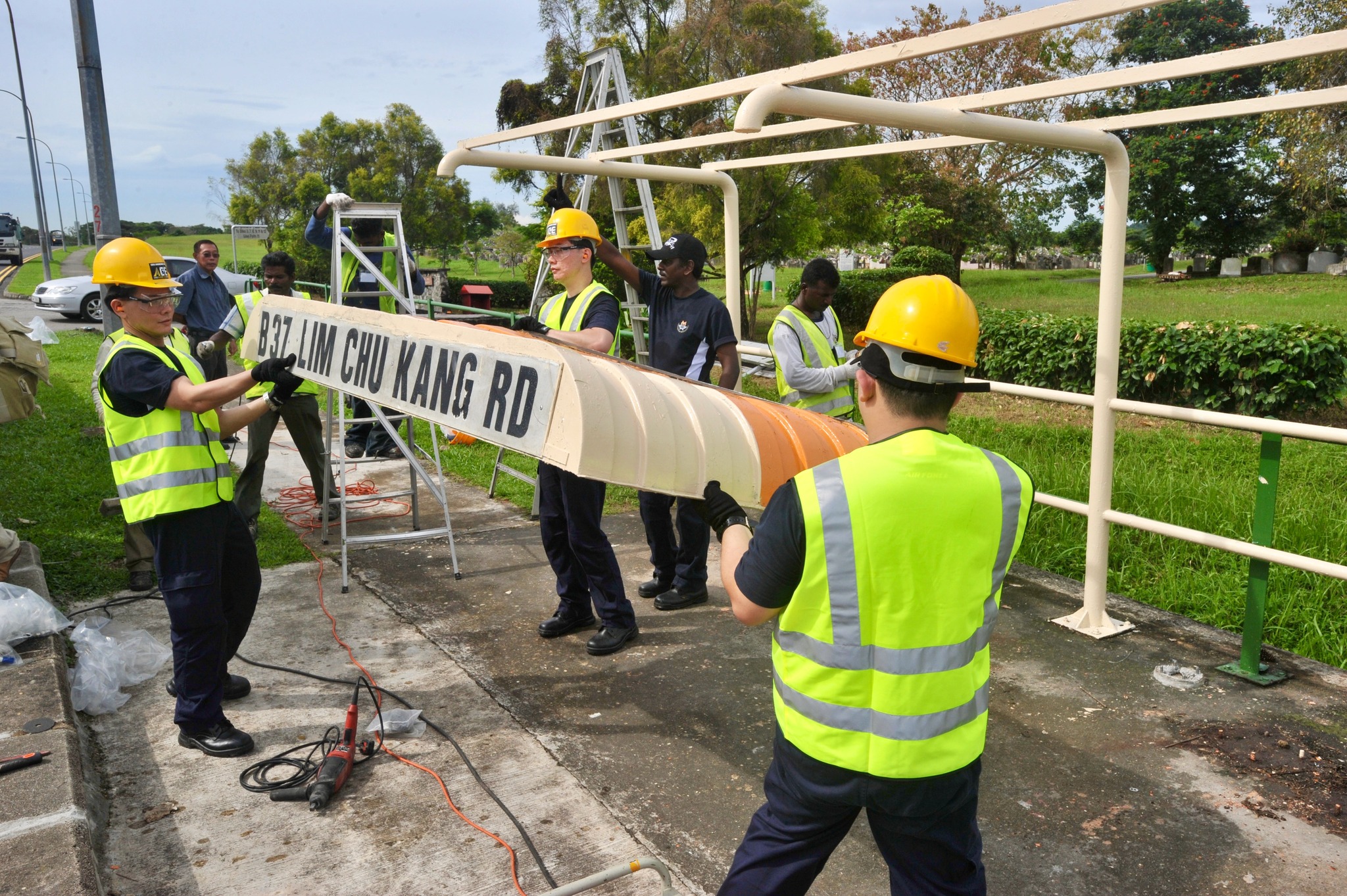
Lim Chu Kang Road was decommissioned and closed from 12:30am on Saturday, Jun. 8, 2025.
Expansion of Tengah Air Base
This was to facilitate the expansion of the 86-year-old Tengah Air Base to accommodate the relocation of Paya Lebar Air Base.
The move will be completed from 2030 onwards.
Tengah Air Base's expansion was first announced in 2017 and will involve the exhumation of 80,500 graves and affect six farms in the area.
End of an era
The closure of Lim Chu Kang Road marks the end of an era.
The road, flanked by graveyards on one side and Tengah Air Base on the other, had been in existence since the mid-1986.
This was after the old Lim Chu Kang Road, which was long and curvy, was straightened.
The former curved segment of the road was renamed Old Lim Chu Kang Road.
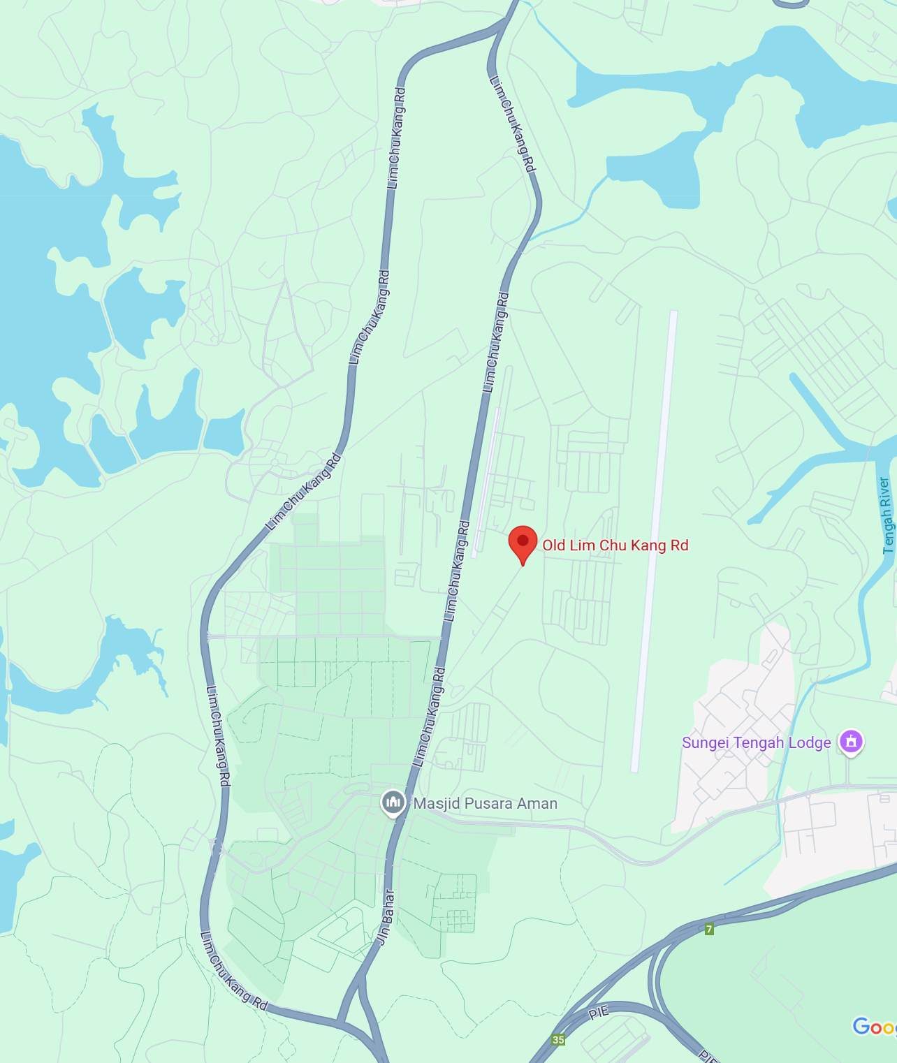
And to replace Lim Chu Kang Road, a curvy realigned Lim Chu Kang Road has been constructed on the other side.
Straightened stretch
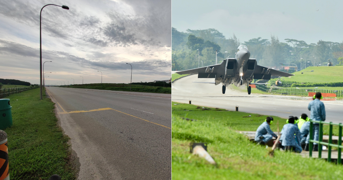
A 2.5km straightened stretch of the decommissioned Lim Chu Kang Road was previously used by the Singapore Armed Forces (SAF) as a makeshift runway.
When the straightened six-lane road was at first completed, it was not immediately opened to the public.
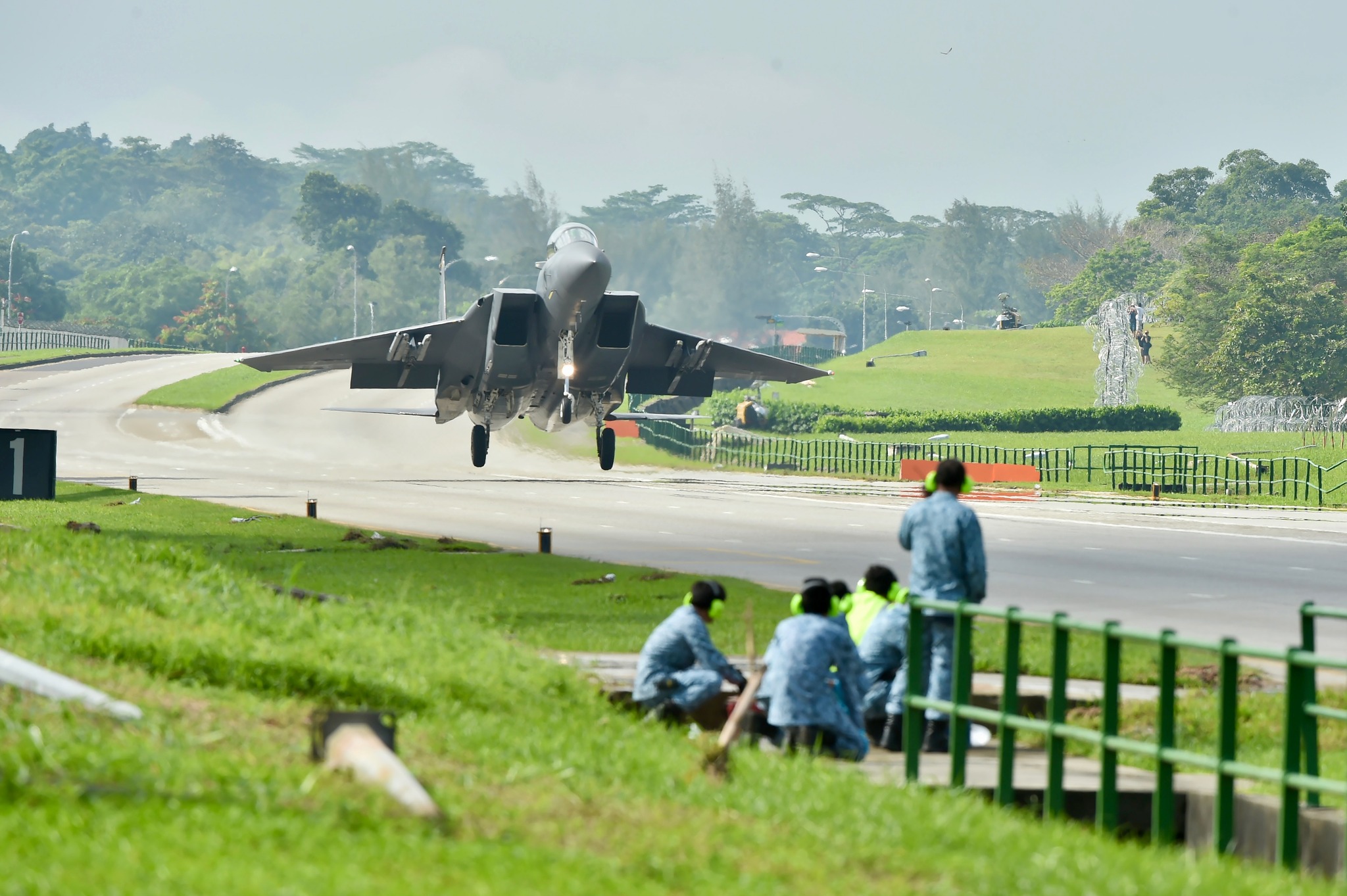
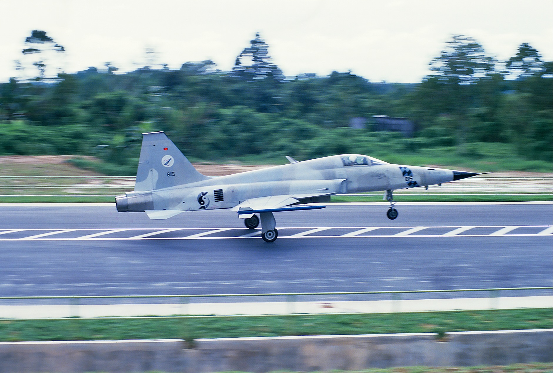
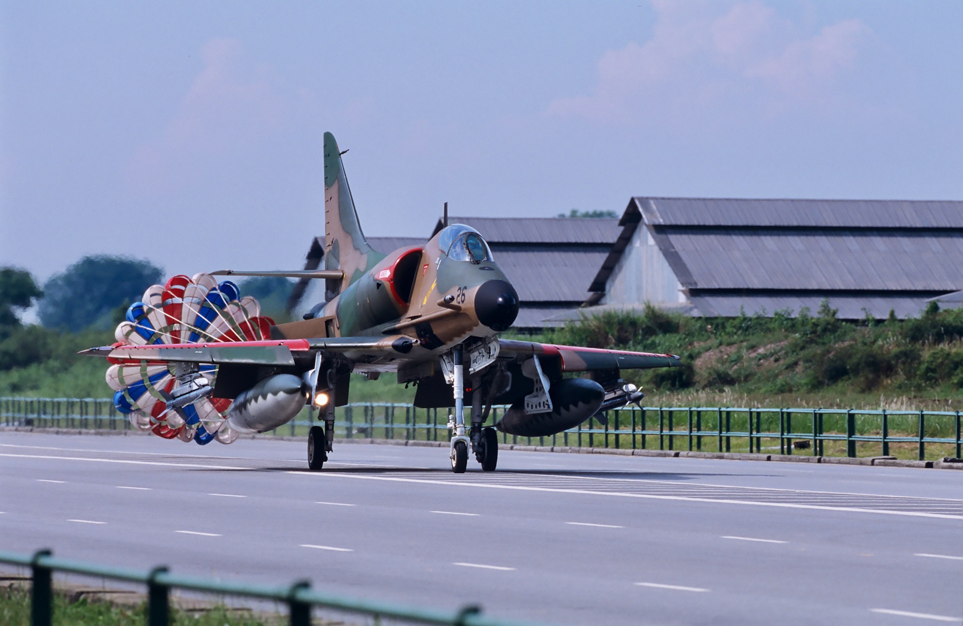
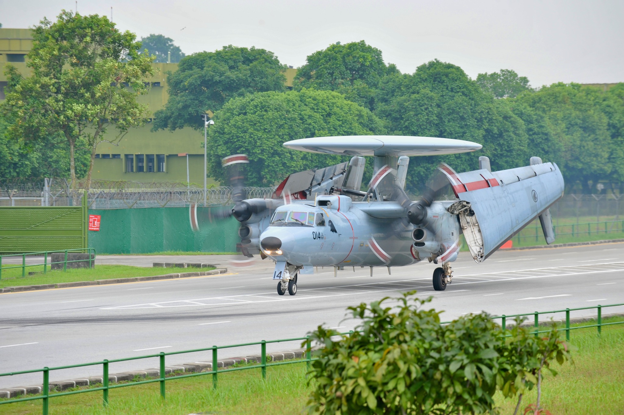
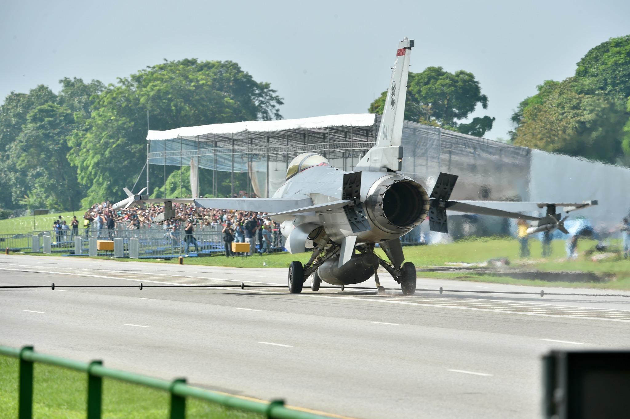
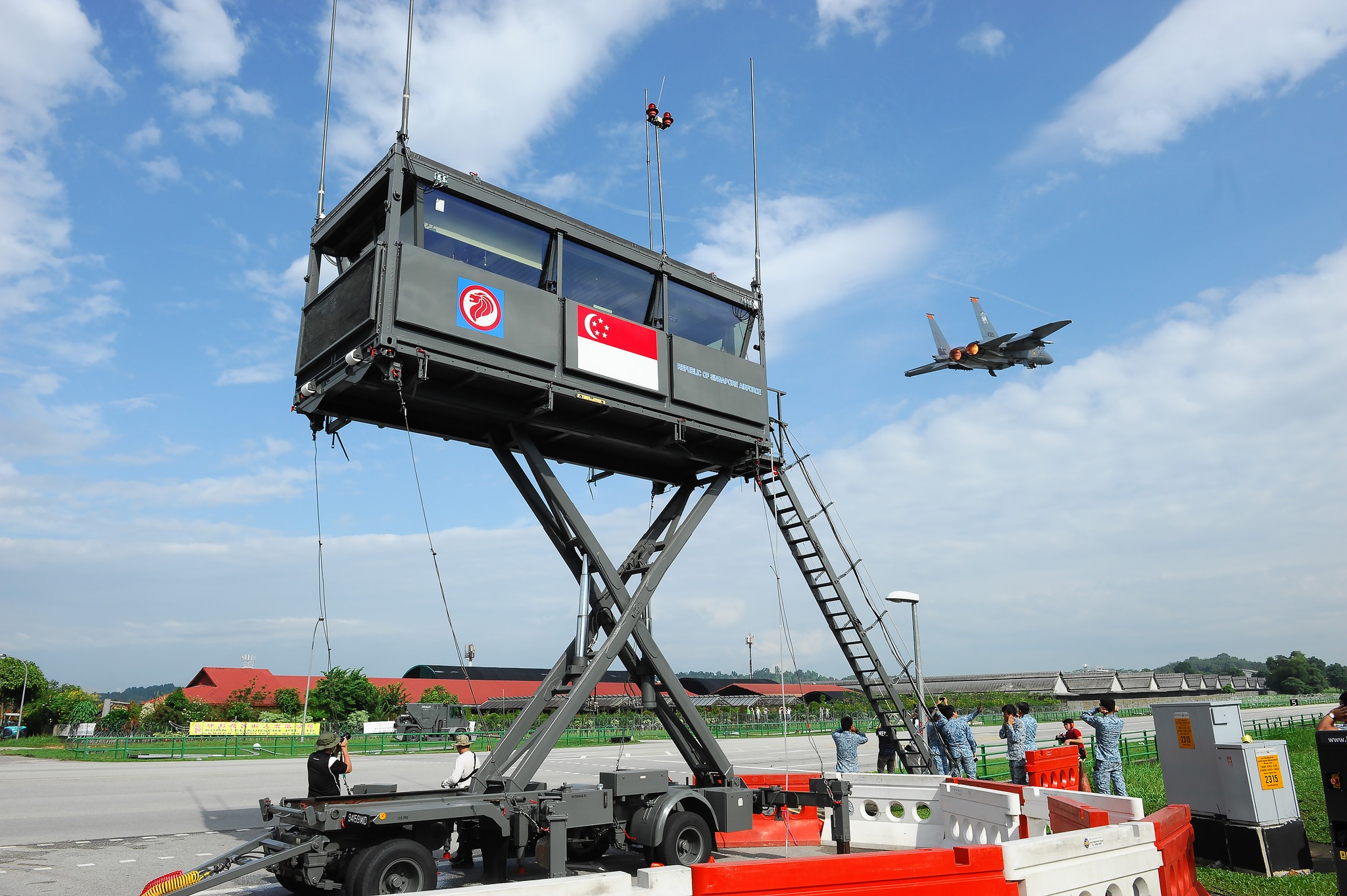
On Apr. 16, 1986, it was used as an emergency runway for Republic of Singapore Air Force (RSAF) aircraft.
This was the first emergency runway exercise for RSAF, involving two A4 Skyhawks and two F5E Tigers.
Pioneer, the media arm of the SAF, shared photos of the occasions when military planes utilised a public road converted into a makeshift runaway as a farewell to Lim Chu Kang Road.
 via Pioneer
 via Pioneer
 via Pioneer
 via Pioneer
 via Pioneer
 via Pioneer
Makeshift runway for emergency situations
The Lim Chu Kang runway was narrower than a typical runway at 24m wide and slightly shorter, at 2.5km long, as compared to an actual runway, which is about 2.75km long.
The use of Lim Chu Kang Road for taking off and landing planes was one of the ways to maximise the use of training areas in Singapore.
It could take between six and 48 hours to convert the road into an emergency runway.
Preparation works included the dismantling of lamp posts, bus stops, drain railings and traffic lights.
 via Pioneer
Road debris had to be swept and removed to minimise potential damages to the aircraft.
"Lim Chu Kang Runway" eventually hosted seven emergency runway exercises in the span of 39 years.
Such exercises will take place in the expanded Tengah Air Base in the future.
Spot for car enthusiasts
For car enthusiasts, a 1.8km stretch of the road was affectionately known as "40 Tiang", which means "lamp post" in Malay.
In the 1990s, Lim Chu Kang Road was used to host illegal races.
On the eve of Lim Chu Kang Road's closure, the usually dark and empty road was lined with a long stretch of cars, whose drivers showed up in force to pay tribute to the iconic strip one last time.
Many took photos to commemorate the occasion.
Road works to be carried out
The decommissioning of Lim Chu Kang Road is to facilitate the remaining road works that are slated for completion in the third quarter of 2025.
These works include reconfiguring the junction between Jalan Bahar and Old Choa Chu Kang Road into a signalised T-junction, following the closure of Lim Chu Kang Road, the Land Transport Authority (LTA) said on May 26.
They also involve removing parts of the closed sections of Jalan Bahar and Lim Chu Kang Road, LTA said.
The realigned road has new footpaths along both sides to enhance pedestrian connectivity.
Construction for the realigned Lim Chu Kang Road started in February 2019.
Eight new bus stops will be added along the realigned Lim Chu Kang Road.
Six bus stops along Jalan Bahar and Old Choa Chu Kang Road will be relocated to better serve commuters.
Gazetted as heritage road
As Lim Chu Kang Road is a gazetted heritage road, a green buffer of 10m on both sides of the road is enforced and the removal of trees or plants is prohibited.
A total of 1.8km of the green verges along this road falls within this green buffer, LTA noted.
With the partial road closure and the corresponding removal of green verges, LTA said the remaining 0.6km stretch of green verges will continue to be designated under the same order.
The National Parks Board (NParks) will further enhance the greenery along this 0.6km stretch.
Native tree species, such as asam gelugor and island lychee, will be added to create a multi-tiered native forest landscape that will provide shade for road users and ecological connectivity for biodiversity.
New directional traffic signs will be put up to guide motorists travelling along the realigned road.
Top photos via Google Maps & Pioneer