


News

S'pore reclaims 800-hectares of land at Pulau Tekong, to be used for military training
The polder will be used for military training purposes.
September 08, 2025, 12:00 PM


Singapore has reclaimed about 800 hectares of land (about the size of two Toa Payoh towns) at the north-western tip of Pulau Tekong.
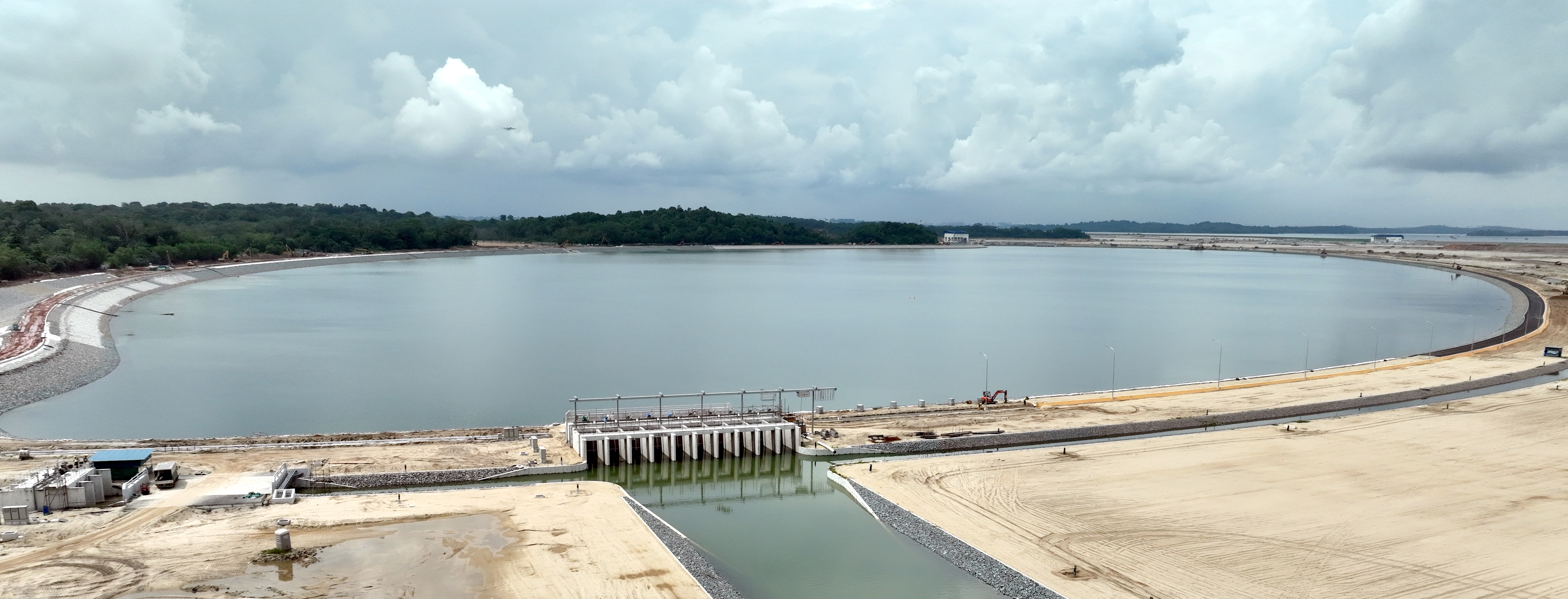
Singapore's very first polder
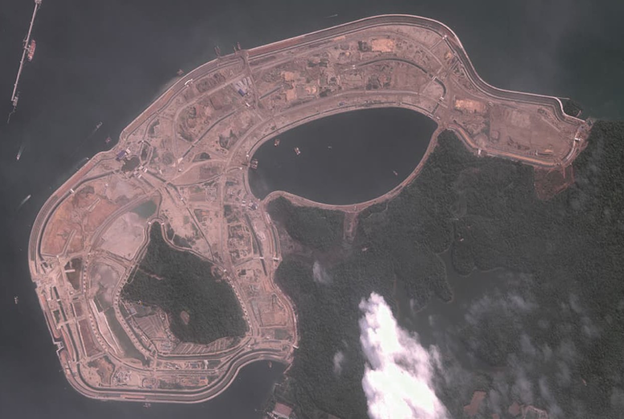 Aerial shot of the polder area at Pulau Tekong in 2024 (Photo via ST Engineering Geo-Insights)
The completion of main construction works for the polder via the empoldering method marks the first time Singapore has reclaimed land below the mean sea level.
A polder is a low-lying land reclaimed from a water body.
The polder will be used for military training purposes, freeing up space on the mainland for other uses, such as the development of new homes and amenities.
According to the Housing & Development Board (HDB) and PUB, Singapore's National Water Agency, they drew on the experience of the Netherlands in the design of the polder to ensure the long-term viability and safety of the polder land.
The Netherlands has the world's highest standards for dike safety.
As evidenced by close to 50 per cent savings in sand used for the reclamation, this method of land reclamation uses less sand as compared to the traditional method of infilling with sand to reclaim land above sea level.
This approach creates a tract of dry land below the surrounding sea level by constructing a coastal dike, supported by a network of drains and water pumping systems, along with a stormwater collection pond.
These features protect the area from rising sea levels and more intense rainfall brought about by climate change.
Coastal dike protects polder from sea
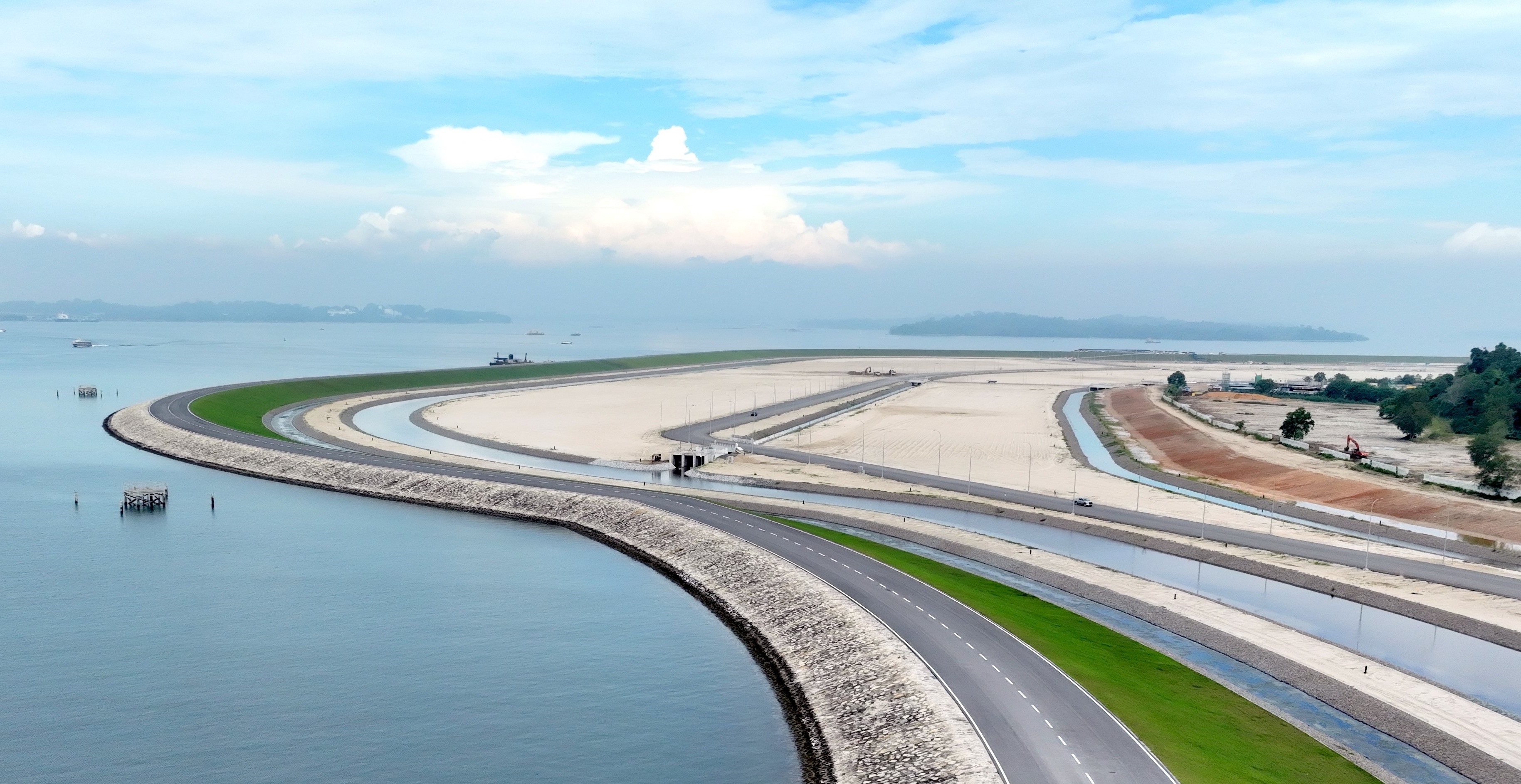 10km-long coastal dike protecting the low-lying polder land from the sea (Photo via HDB)
The 10-kilometre-long coastal dike runs along the perimeter of the polder and protects the low-lying polder land from the sea.
It currently stands at up to six metres above sea level at its highest point, and allows for the polder land to lie about 1.2 metres below mean sea level.
Should sea levels rise in the future, the height of the coastal dike can be adjusted accordingly.
The dike fully encloses the area being reclaimed, helping to manage water levels within the polder.
A road has also been built along its entire crest to facilitate maintenance works.
Comprehensive water management system in place to manage stormwater runoff
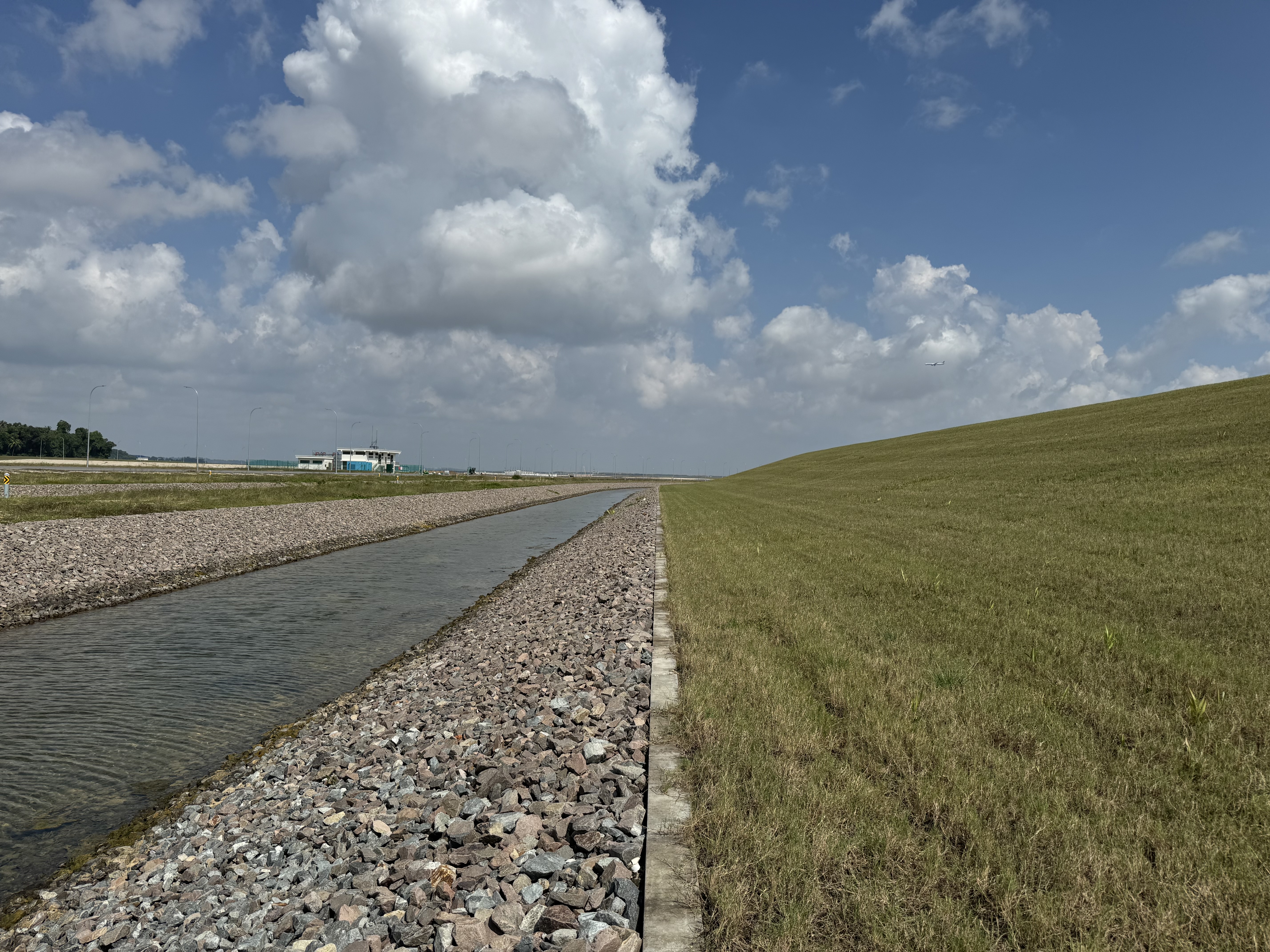 Seepage drain on the landward side of the coastal dike (Photo via HDB)
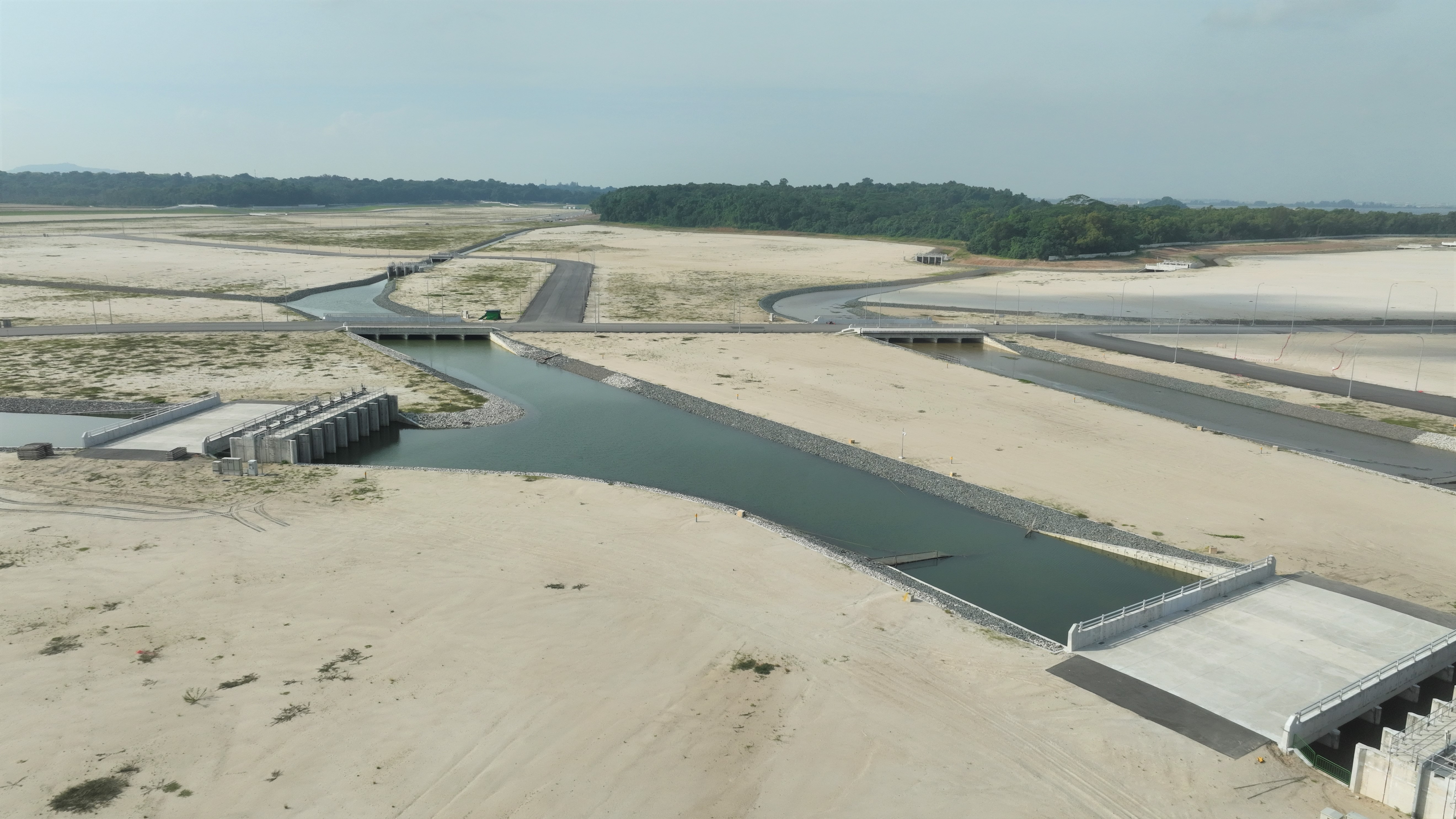 Drainage network on the polder (Photo via HDB)
Given Singapore's high rainfall and the low-lying terrain of the polder, effective stormwater runoff management is essential.
As such, a comprehensive water management system has been built on the polder.
The system comprises a stormwater collection pond, two pumping stations and a drainage network extending 45 kilometres in length.
The drainage network also includes more than 30 water control, inlet and outlet structures with gates to manage rainfall.
To prevent water from being stagnant during periods of dry weather, water is recirculated by pumping water from the stormwater collection pond to the polder drainage network.
Stormwater collection pond
 Stormwater collection pond (Photo via HDB)
The polder's 116-hectare stormwater collection pond can hold up to five million cubic metres of water, which is equivalent to the volume of 2,000 Olympic-sized swimming pools.
When it rains, runoff within the polder and the Pulau Tekong catchment area is directed to the pond to prevent flooding within the polder.
When the water level in the pond reaches a pre-set operating level, excess water is channelled to the Drainage Pumping Station to be pumped out into the sea.
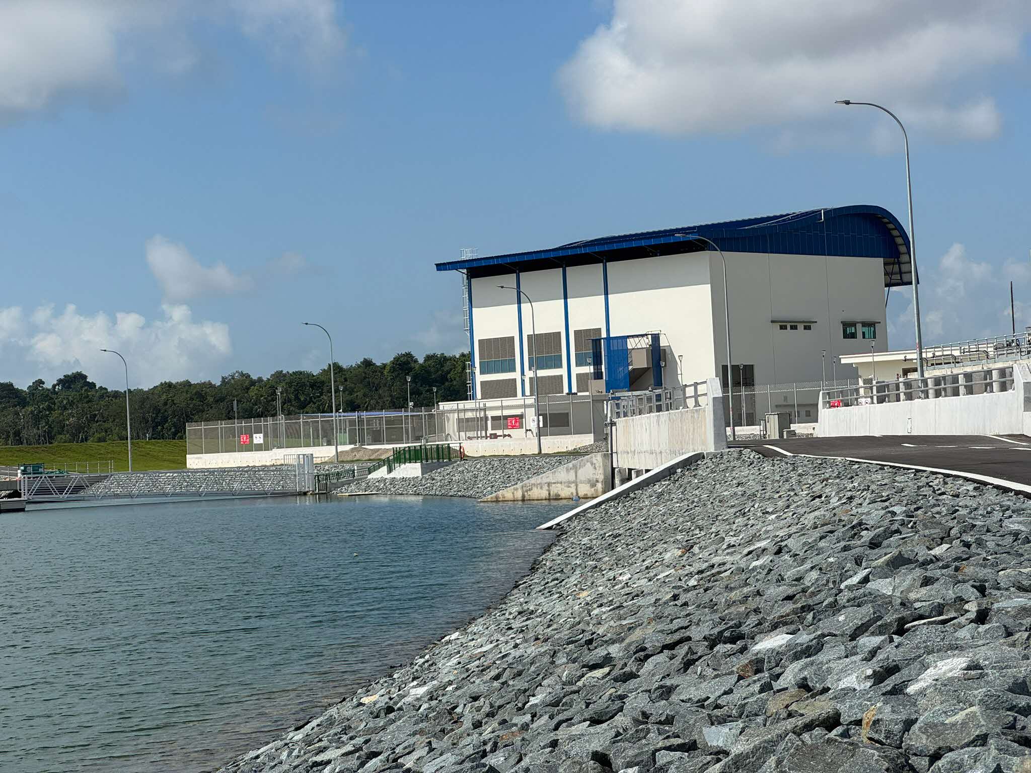
 Drainage Pumping Station (Photo via PUB)
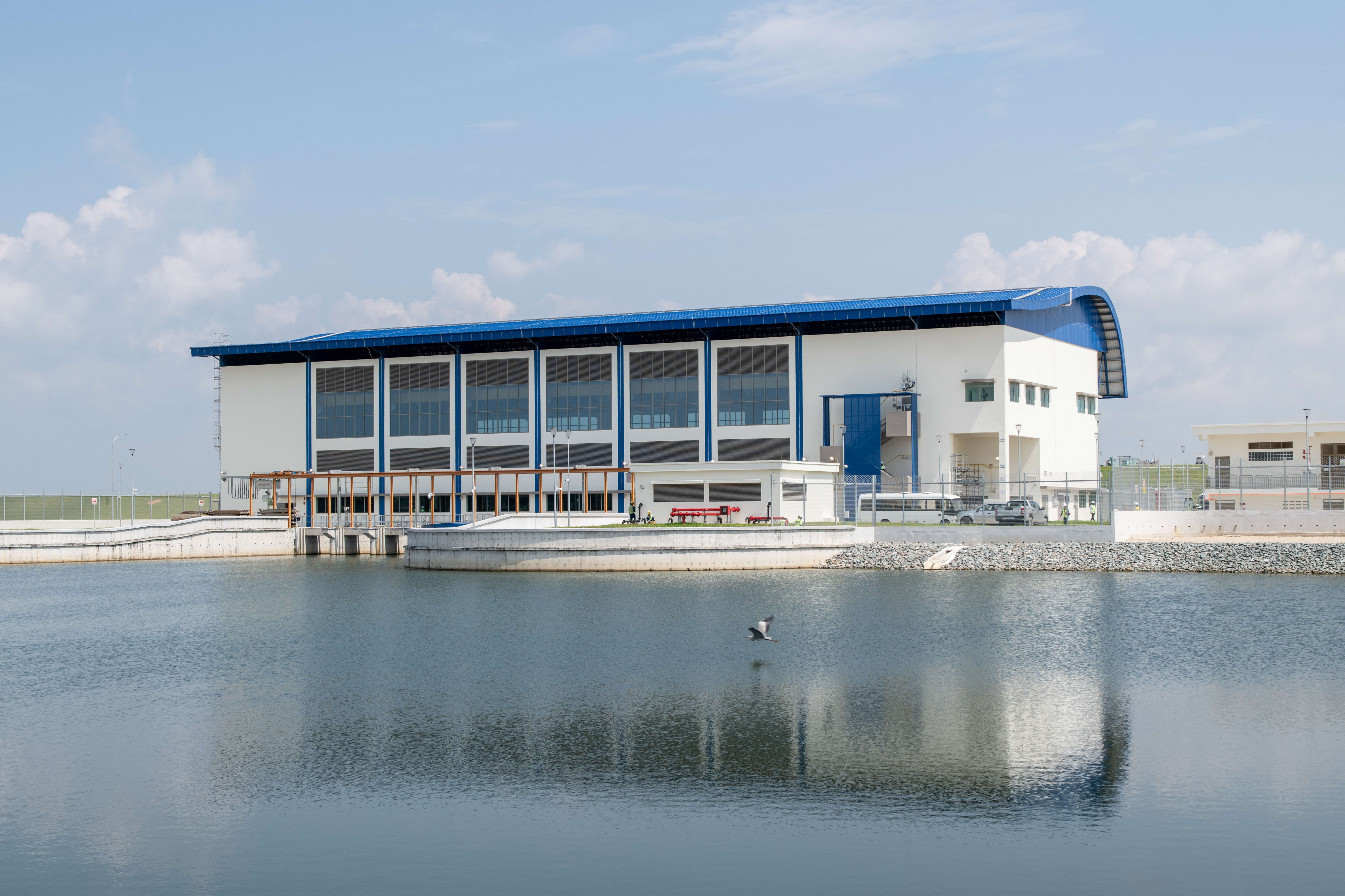
Water pumping stations
 Central Pumping Station (Photo via HDB)
There are two water pumping stations on the polder.
The Central Pumping Station, which is located next to the stormwater collection pond, ensures water quality by circulating water in the drains.
The Drainage Pumping Station, positioned next to the coastal dike, pumps excess rainwater into the sea when the stormwater collection pond reaches its full capacity.
According to HDB and PUB, Singapore will continue to leverage innovation and technology for its reclamation and coastal protection strategies in a responsible and sustainable manner.
Top photos via ST Engineering Geo-Insights, HDB