


News

30 football fields worth of roads to be converted to bus lanes, cycle paths & event spaces along North-South Corridor
The master plan provides proposals for how to use the 30 football fields worth of road space freed up by the NSC.
August 28, 2024, 06:12 PM


On Aug. 27, Singapore's Land Transport Authority (LTA) announced that design firm Henning Larsen would be the Master Plan Consultant for all the surface streets along the North-South Corridor.
Planning masters
Henning Larsen has envisioned the NSC as a linear corridor comprising four distinct character segments.
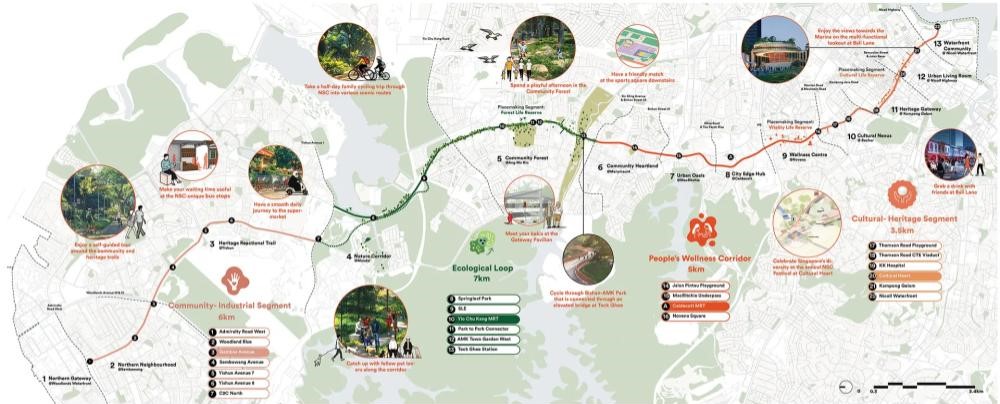 Image via Henning Larsen
In the north between Admiralty Road West and Yishun, it proposed a six km long “Community Industrial Segment"; as well as a seven km long “Ecological Loop” between Springleaf Park and Teck Ghee Station, and a five km long “People's Wellness Corridor” roughly between Jalan Pintau and Novena Square.
Finally, they propose a 3.5 km long "Cultural Heritage Segment" between Thompson Road and the Nicoll Waterfront.
Landscaping and events
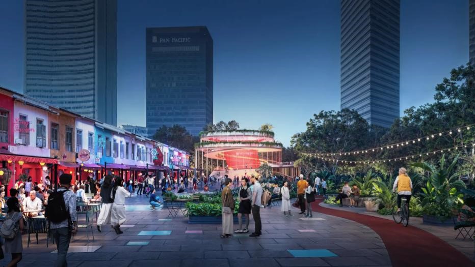
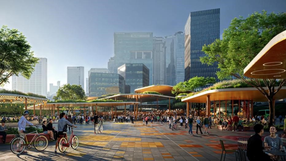
Henning Larsen’s proposals included several preliminary ideas, such as the creation of an "iconic public space" at the intersection between the Rochor Canal Road, Sungei Road, and Jalan Besar.
The space would serve as a focal point connecting Kampong Gelam, Little India, and Waterloo Street, as well as educational institutions such as the LaSalle College of the Arts, the Nanyang Academy of Fine Arts, and the Singapore Management University.
Part of the idea is to also pedestrianise part of Ophir Road, next to Kampong Gelam, which would create public space for "landscaping and events".
 Artist impression of Ophir Road public space. Image via Henning Larsen
It would also improve the walkability and cycling experience, as well as strengthen connections to the surrounding area.
 Artist impression of Image via Henning Larsen
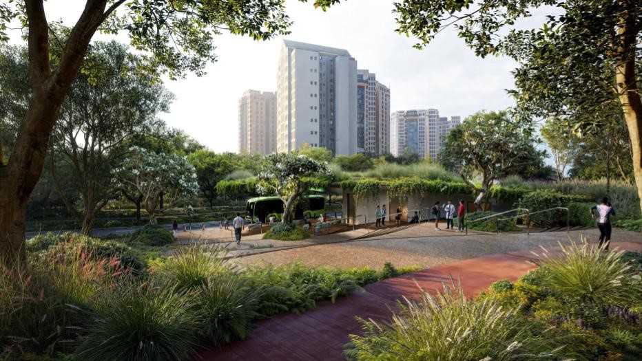
Other similar ideas were part of Henning Larsen's proposal for the other parts of the NSC, such as the creation of a “Life Reserve” in Ang Mo Kio along the proposed ecological loop.
This would feature nature-based public spaces, cycling and foot paths, and play areas.
 Artist impression of Rocher Road Area. Image via Henning Larsen
It will also provide connections for the surrounding neighbourhoods, as well as to locations such as the Bishan-Ang Mo Kio Park.
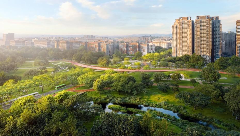 Image via Henning Larsen
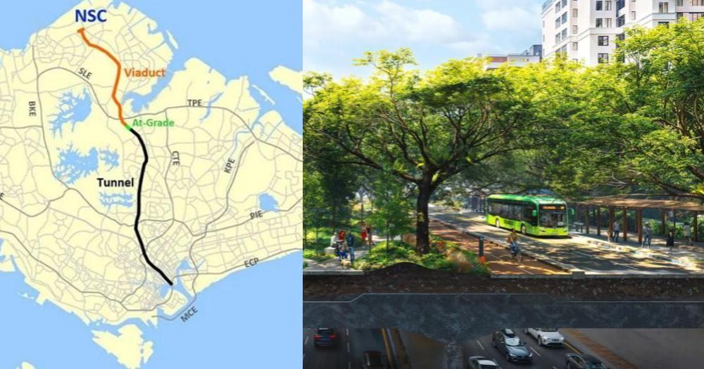
Beneath the viaducts
In the Northern areas of the NSC, where the NSC transitions from an underground tunnel to a viaduct, Henning Larsen proposes to create public spaces underneath the viaduct, such as at Gambas Avenue, for recreation. The space will incorporate playgrounds and art installations.
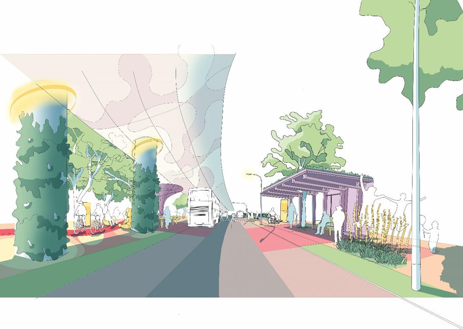 Artist’s Impression of Proposed Concept under the NSC Viaduct . Image via LTA
LTA’s Chief Executive Ng Lang said the NSC provided an opportunity for surface streets in Singapore to be transformed into what he termed a “landmark corridor”.
The Henning Larsen proposals are preliminary concepts and are expected to be developed further in upcoming months, working with the LTA and relevant agencies, as well as seeking further feedback through public engagement sessions.
26 international and local design teams
Other considerations include broader development plans, transport connectivity, as well as site layout.
The appointment of Henning Larsen comes after a Request For Proposal where LTA invited consultancy firms with expertise in fields such as landscape architecture and urban design to submit proposals for the Master Plan.
26 international and local design teams expressed interest, and three were shortlisted to develop a preliminary Concept Master Plan, with Henning Larsen ultimately being selected.
Enhance connectivity
About 30 football fields worth of road surface is expected to be freed up by the NSC project, which builds a 21.5 km corridor across Singapore.
The NSC will be a multimodal transportation corridor that was originally conceived as an expressway.
It will enhance connectivity from the Northern region to Singapore to the city, serving towns such as Sembawang, Yishun and Novena.
A significant portion of the NSC in the south and central parts of Singapore would be in the form of tunnels, allowing the roads above to be converted for other uses to support the Land Transport Authority’s Walk-Cycle-Ride vision, as well as space for events, or locations such as playgrounds.
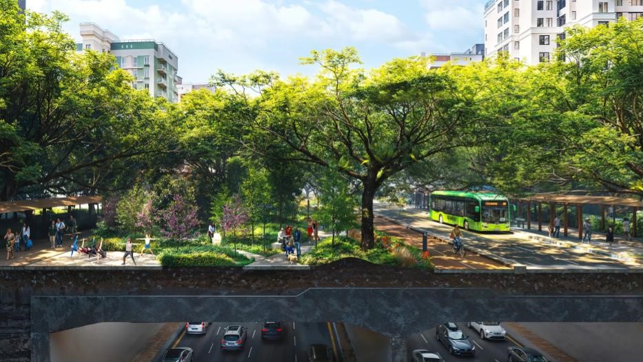 Image via Henning Larsen
The master plan is expected to be completed in 2026, with the repurposing of the surface streets to take place in stages from 2027 onwards.
Image via LTA & Henning Larsen