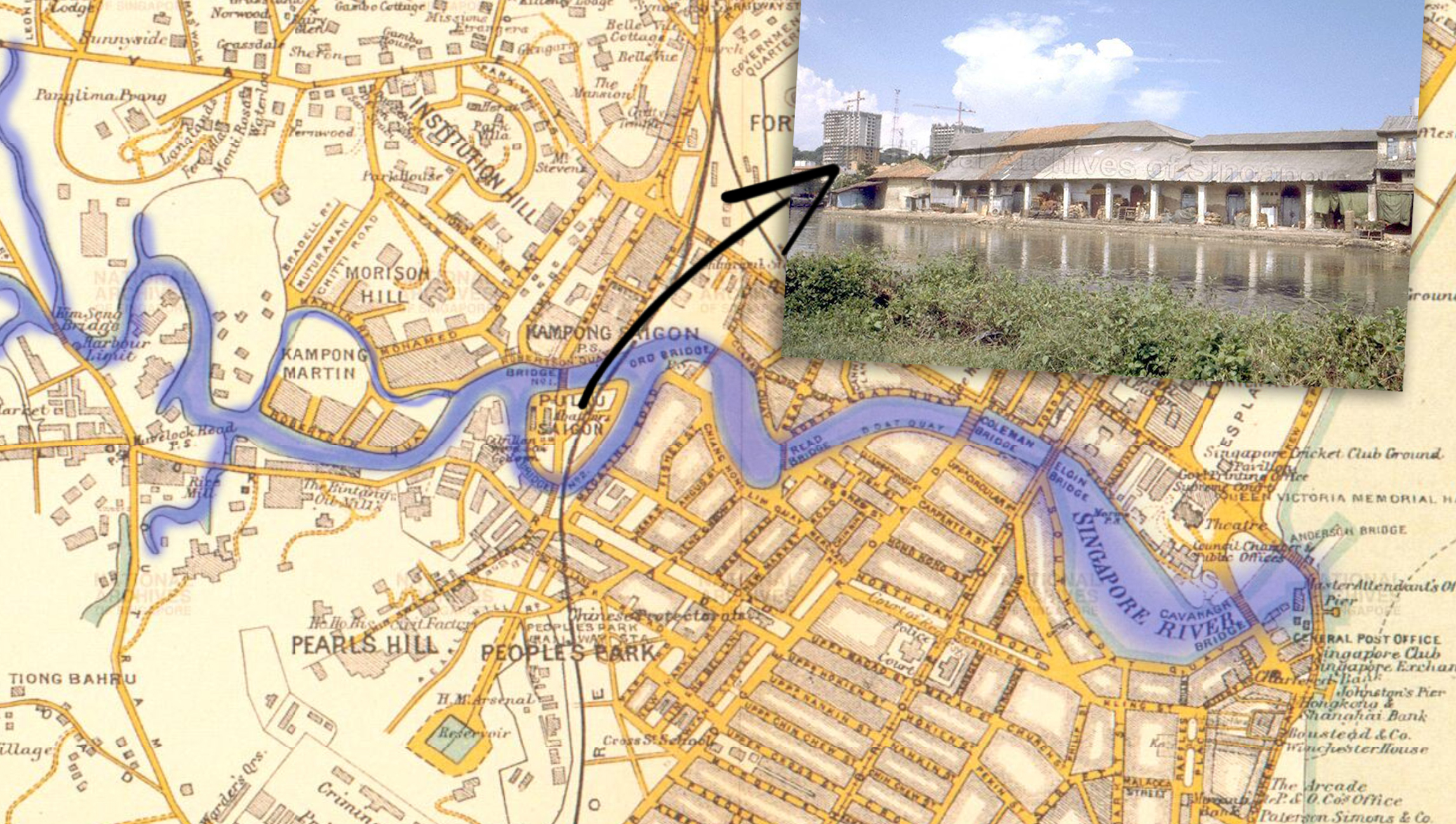
If you were to peruse old maps of Singapore (specifically of the Singapore River), you might come across a strange sight.
Right smack in the middle of the river was a small triangular island with an even stranger name: Pulau Saigon (or Saigon Island).
Take this 1913 map of Singapore. We've highlighted the river in blue so that you can gauge the location. Try spotting the island.
 Map adapted via National Archives.
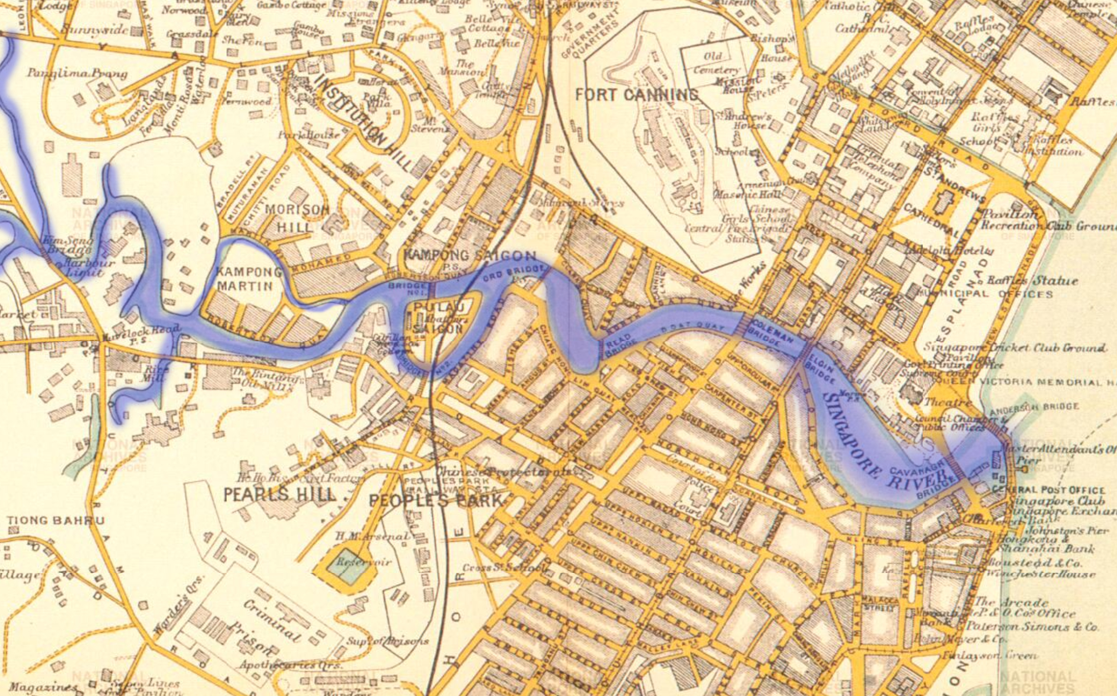
Here in a close-up, you'll be able to see the island clearly, and also note that there is a kampong named after the island (or vice versa, we wouldn't know).
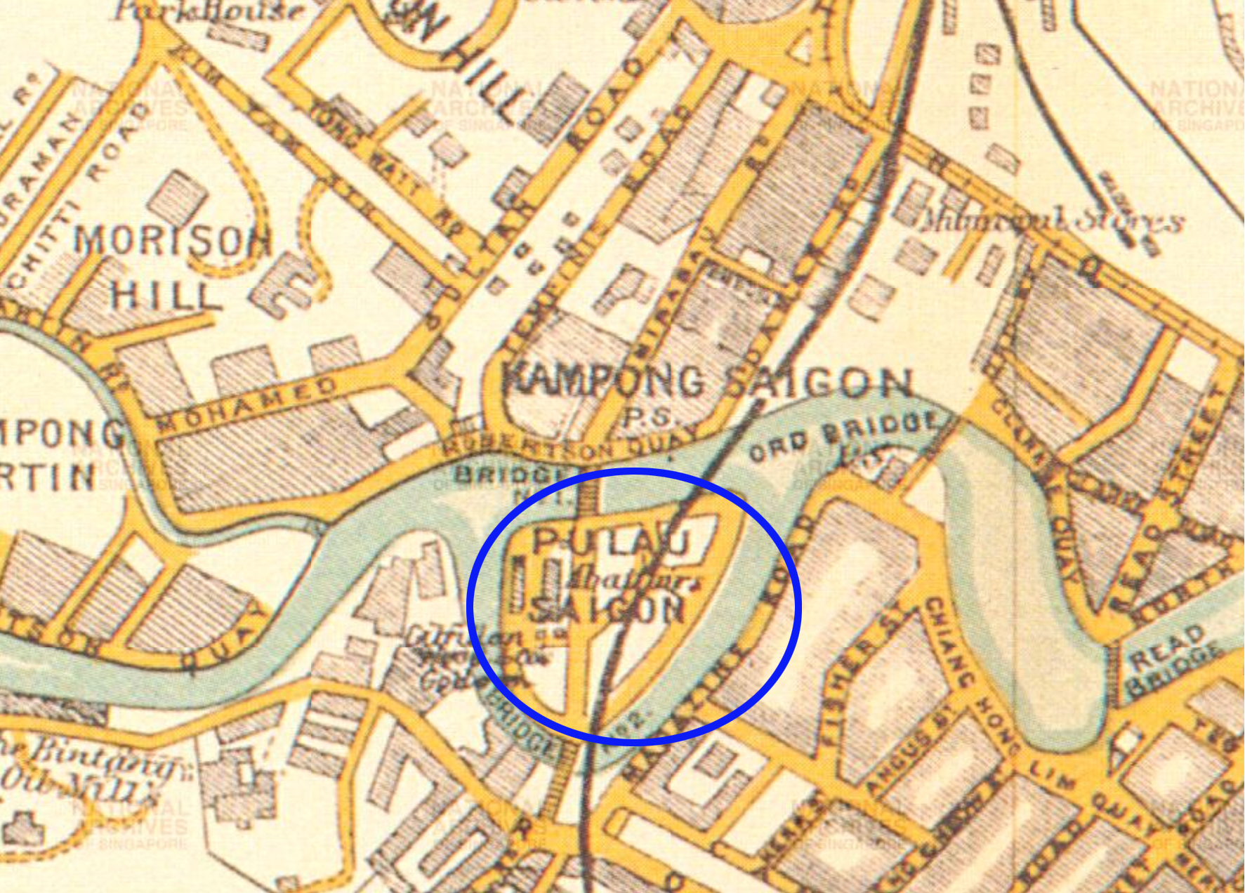 Map adapted via National Archives.
The island was connected to the mainland by a long road, and also bridges over the water. In subsequent maps, we see that the road is named Pulau Saigon Road, as highlighted in this 1966 map of the vicinity.
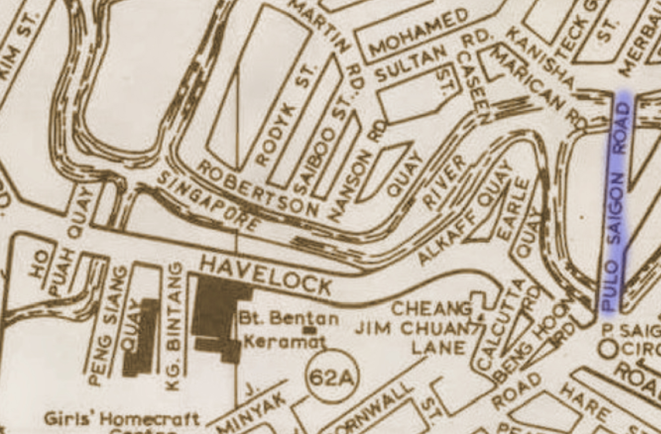 Via One Heritage Map.
A 1985 Straits Times (ST) article on the restoration of the Singapore River gives us more information about the bridge to Pulau Saigon, as well as other prominent bridges along the river, which according to the article, might "well represent the quintessential face of the historic river after restoration".
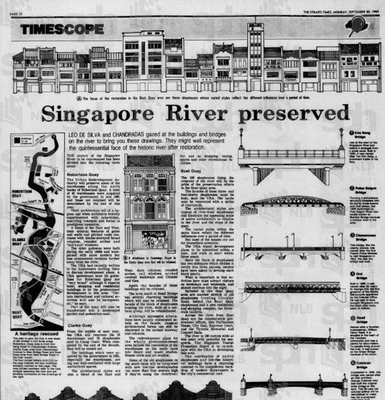 ST article dated 30 Sept 1985. Via NewspaperSG.
In it was a rendered drawing of the Pulau Saigon Bridge. We are also told that the bridge was previously known as Butcher Bridge, named after a butcher who lived in the area.
Unfortunately, in 1991, six years after the ST article was published, the island was merged with the river bank, forming the land on which River Place condominium stands today.
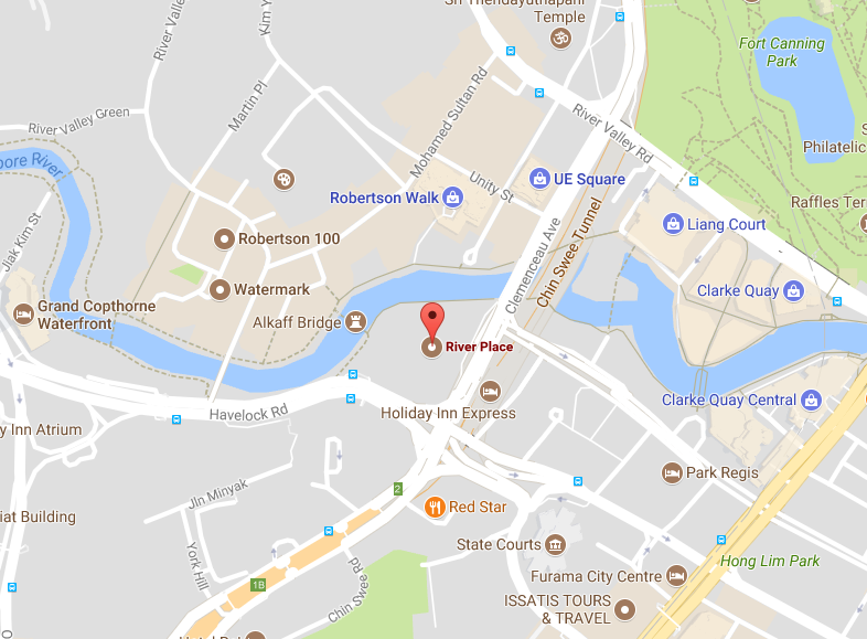 Location of River Place Condo. Screenshot from Google Maps.
[related_story]
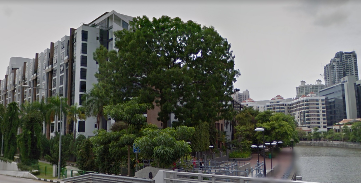 View of River Place Condo from Clemenceau Ave. Screenshot from Google Street View
Here are some images of Pulau Saigon and the bridge in the past:
[caption id="" align="aligncenter" width="768"]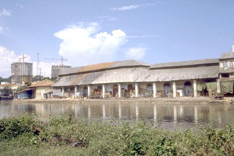 Pulau Saigon. Via National Archives.[/caption]
[caption id="" align="aligncenter" width="768"]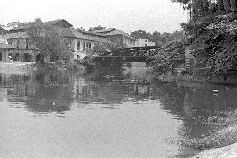 Pulau Saigon with the bridge. Via National Archives[/caption]
[caption id="" align="aligncenter" width="512"]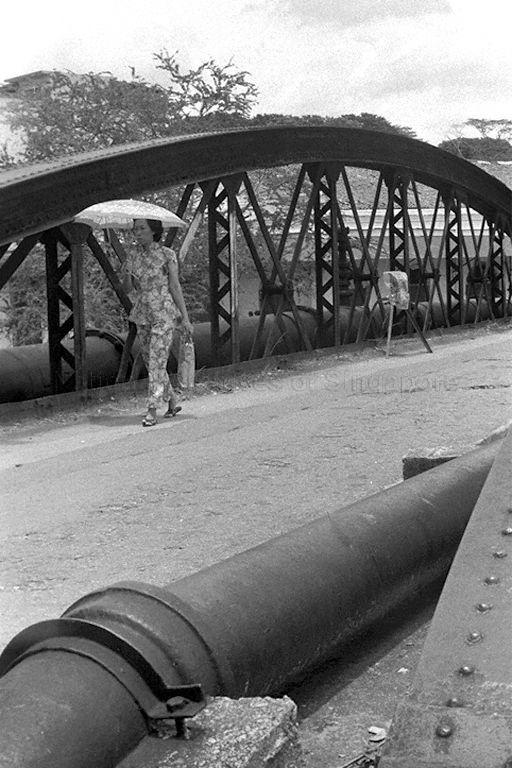 Lady walking along Pulau Saigon bridge. Via National Archives[/caption]
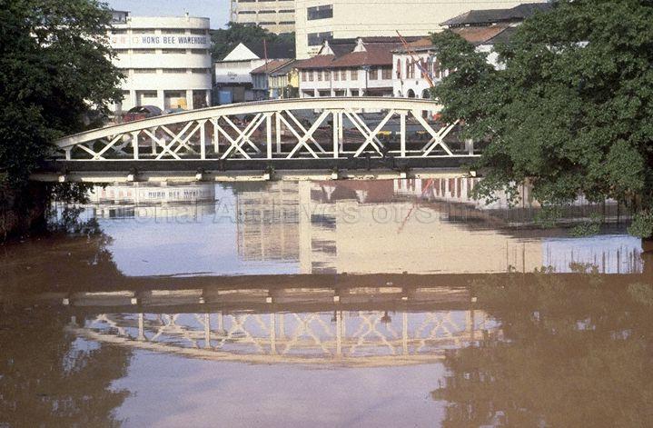 Pulau Saigon bridge. Via National Archives.
Top image via National Archives. H/T to Sunny Side SG.
1819 is a labour of love by Mothership.sg where we tell stories from Singapore’s history, heritage & culture. Follow us on Facebook, Instagram and Twitter!
If you like what you read, follow us on Facebook, Instagram, Twitter and Telegram to get the latest updates.