
The Jubilee Walk was launched in 2015 to commemorate the 50th anniversary of Singapore’s independence.
Spanning a jaw-dropping 24 landmarks, the Jubilee Walk brings you through Singapore’s history from ancient Temasek all the way to independence and beyond - that’s 700 years of history packed into an 8km trail. Talk about being ambitious.
 An overview of the Jubilee Walk trail via Roots.sg. Click on the image to visit the trail’s page.
Admittedly, visiting 24 landmarks on foot can be a little daunting so we tried something more leisurely - cycling!
We picked out 6 spots on the Jubilee Walk located within cycling distance in the Civic District so that we can get a good feel of the trail without getting heatstroke.
Pro tip: Bring your own bike, or find one of those bike sharing hotspots at the nearby Dhoby Ghaut or Bras Basah MRT stations and you’re on your way.
Even better, take on this trail on a Car-Free Sunday - from 8 in the morning to 12 noon - and you’ll find that there are no cars to compete with you for road space in the Civic District. Shiok right? We also say.
Here’s our handy guide to cycling through the Jubilee Walk:
1. National Museum of Singapore
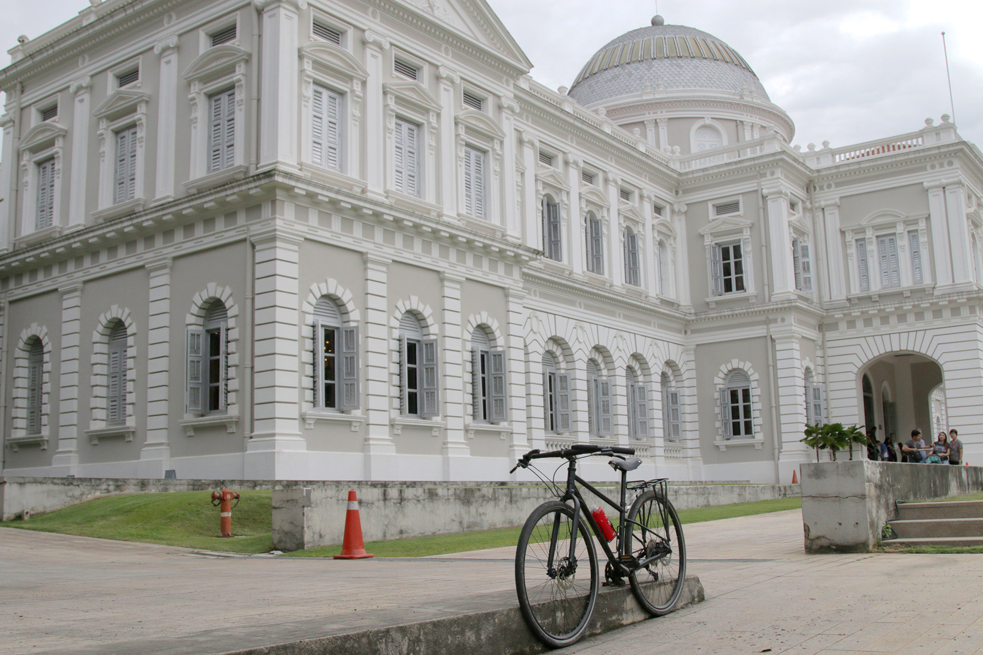 National Museum of Singapore. Image by Joshua Lee.
Start off your cycling trip with a visit to the National Museum of Singapore. This building used to house the Raffles Museum and Library before it became solely devoted to showcasing Singapore’s history and culture after independence.
Fun fact: The famous rotunda that greets you as you enter the National Museum is decorated with 50 stained glass panels - to mark the Golden Jubilee of Queen Victoria’s reign in 1887, the same year the National Museum (then named The Raffles Library and Museum) opened on Stamford Road.
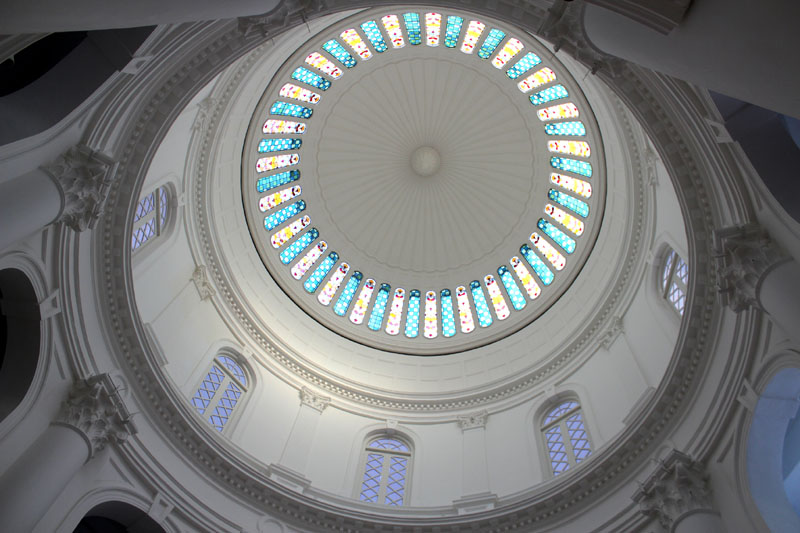 The National Museum's famous rotunda. Image via.
The National Museum’s Singapore History Gallery offers a pretty comprehensive tour of Singapore’s history, from ancient Singapura to today’s modern metropolis.
While you’re at the Singapore History Gallery, check out the 14th century gold jewellery (excavated from Fort Canning Hill) and a lead statue of a headless horseman (found at Empress Place).
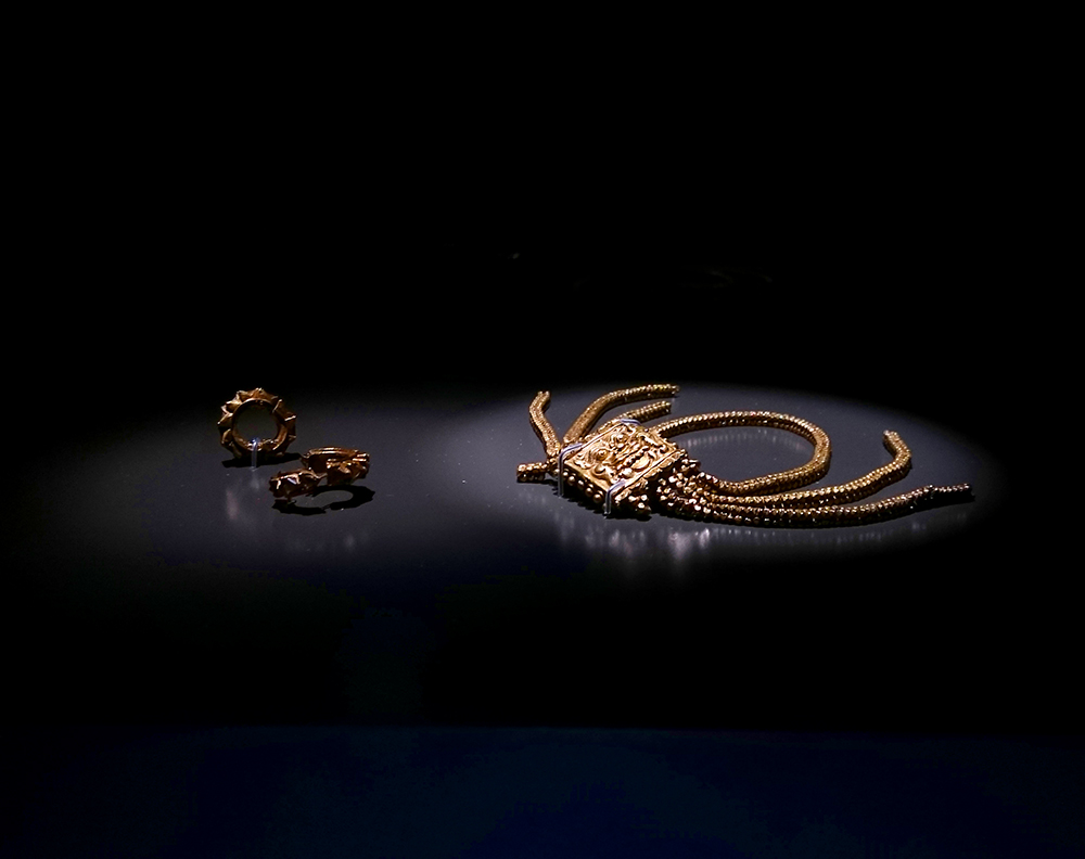 Earrings and gold armlet with the design of Kala, the Hindu god representing time and destruction, believed to be from the 14th century. It was excavated from Fort Canning Hill. Image by Joshua Lee.
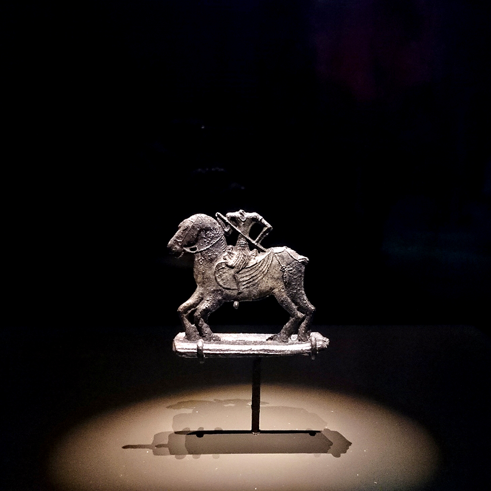 Lead ‘Headless Horseman’ statue excavated from Empress Place. It is believed to be from the Majapahit period (c. 14th Century). Image by Joshua Lee.
After that, hop over to the newly opened Glass Rotunda where a special immersive exhibition inspired by William Farquhar’s natural history drawings is currently on display. There, you’ll find this beautiful Patek Philippe Geneve Dome Clock - created by Patek Philippe to commemorate Singapore’s 50th anniversary in 2015.
 Image by Joshua Lee.
After you’re done with the National Museum, cycle up Fort Canning Road to our next destination - the seat of ancient Singapura royalty.
2. Fort Canning Park
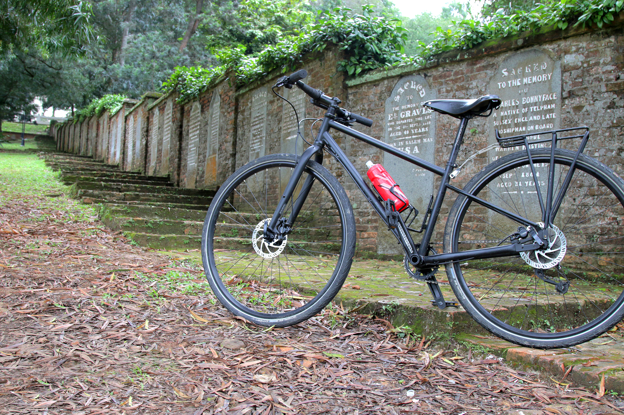 Image by Joshua Lee.
Before Fort Canning Hill got its name, it was known as Bukit Larangan - the Forbidden Hill. The hill was the purported place where the ancient Kings of Singapura lived and were buried, hence many people regarded the hill as sacred/haunted.
In fact, the last king of Singapura, Iskandar Shah, is rumoured to be buried in this keramat (shrine) located on Fort Canning. It is unclear if his body is entombed inside - since no one wants to open it.
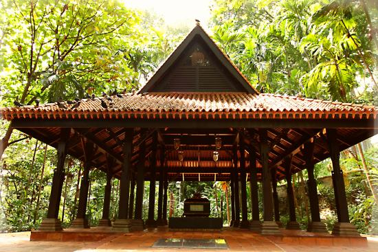 Image via.
According to colonial documents, Bukit Larangan used to be surrounded by a wall. John Crawfurd, Singapore’s second Resident, dubbed it the Old Lines of Singapore in 1822. It was thought that the wall was constructed as a defensive barrier for the inhabitants on the hill.
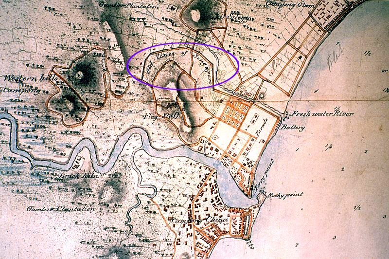
Today this map below located at the foot of Fort Canning Hill shows you where this wall used to run - along Stamford Road.
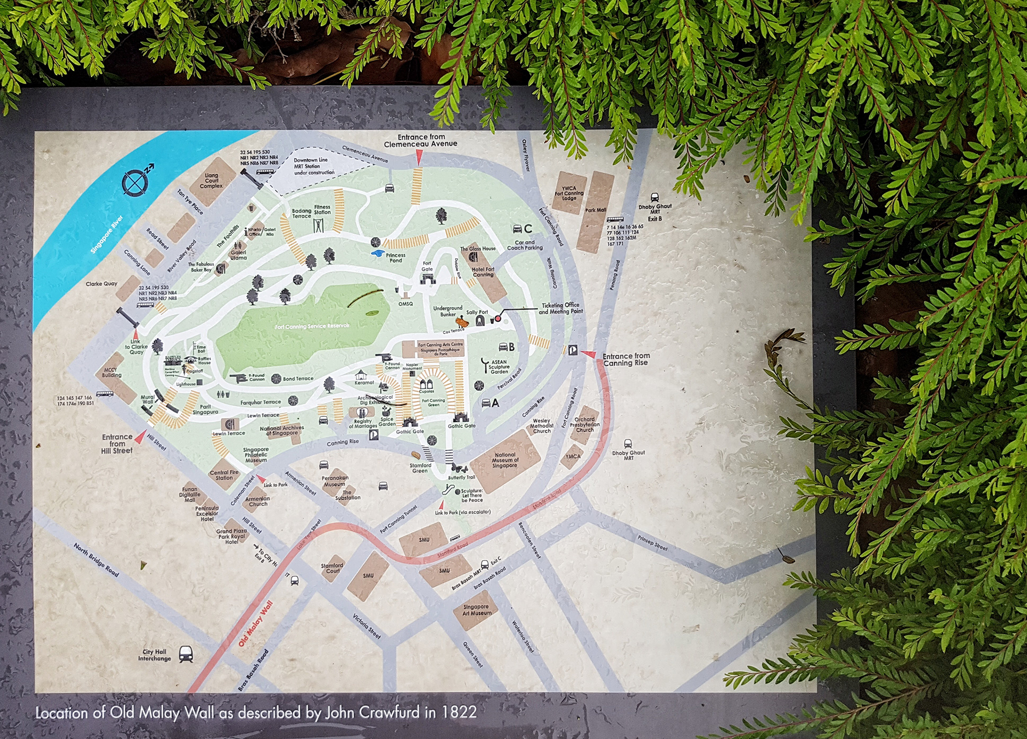 Image by Joshua Lee.
Aside from ancient kings, Fort Canning was home to 2 Christian cemeteries. Only structures from the one on the Fort Canning slope remain today - the brick wall and two Gothic gates which used to enclose the cemetery.
From Fort Canning Hill, cycle down Canning Rise until you reach Hill Street. Continue down onto Coleman Street until you reach the Padang and make a right turn where you’ll find Singapore’s very own Southeast Asian Art Gallery - the National Gallery.
3. National Gallery
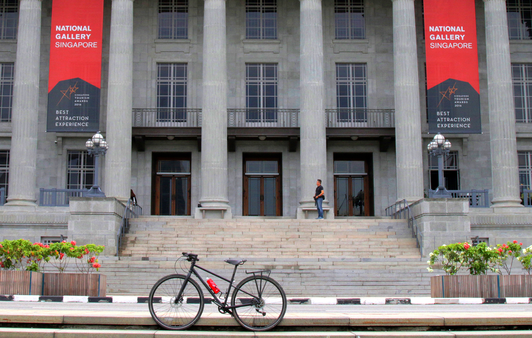 Image by Joshua Lee.
As you take in the National Gallery, take a moment to think about how much drama had occurred on these very steps of the previous City Hall.
These steps had been the stage for many pivotal moments in Singapore’s history. Such as the surrender of the Japanese to the British leading to the end of the Japanese Occupation:
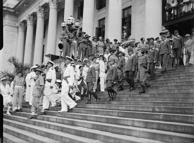 Image via.
The beginning of Merger with Malaysia in 1963:
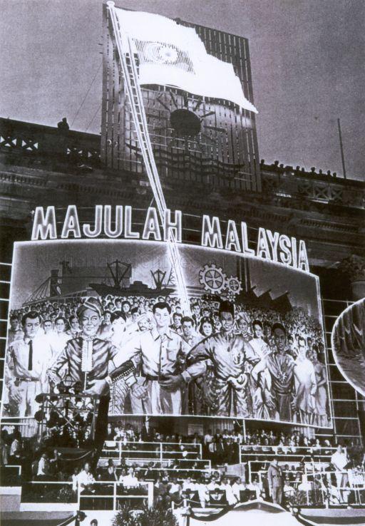 Celebration of Malaysia Day in 1963 at City Hall. Image via National Archives.
And finally, our first National Day parade as an independent country:
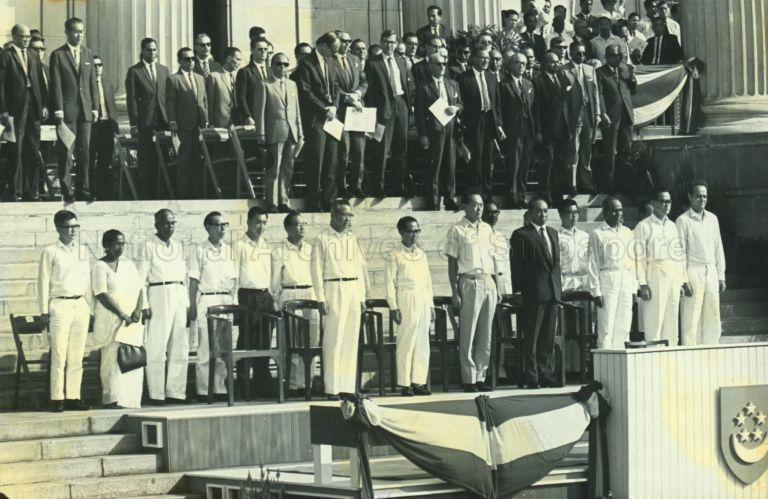 1966 National Day Parade at the City Hall. Image via National Archives.
Today, the National Gallery houses a plethora of Southeast Asian art, including one of our favourite works - the hyperrealistic Forest Fire by Indonesian artist Raden Saleh.
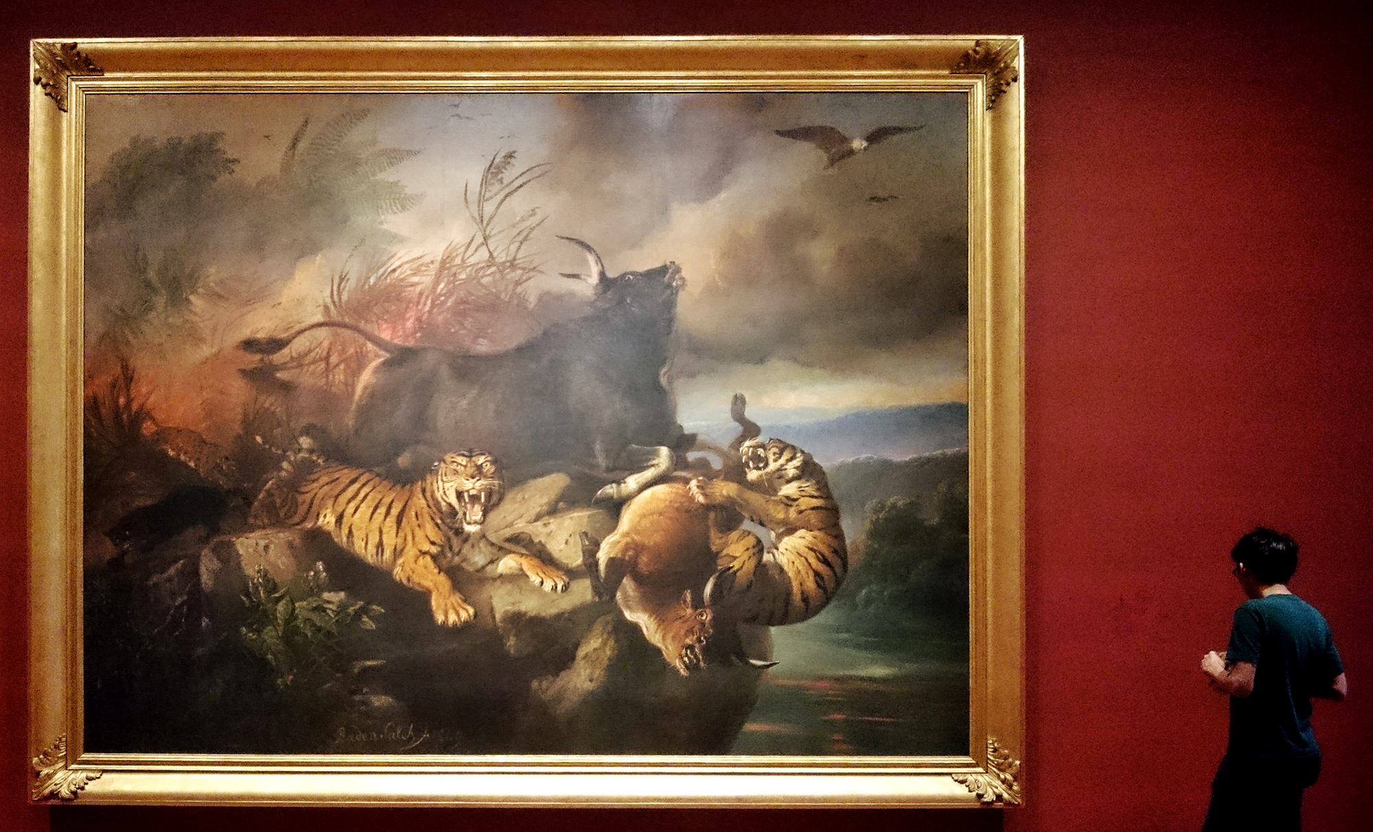 Forest Fire by Raden Saleh. Image by Joshua Lee.
Once you’ve had your fill of art, continue along St Andrew’s Road onto Connaught Drive. Cross Anderson Bridge and you’ll arrive at our next destination - the Fullerton Building.
4. Fullerton Building
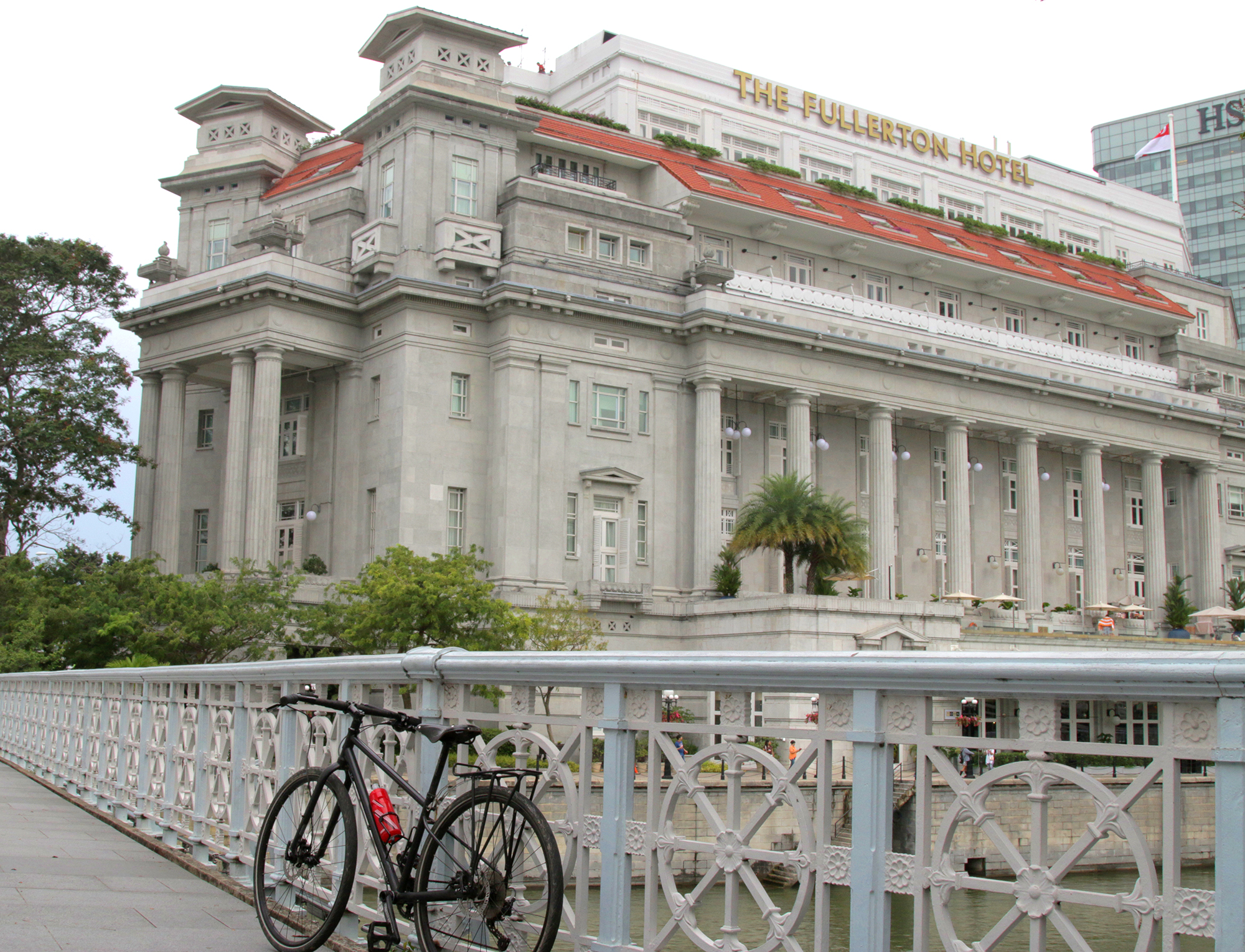 Image by Joshua Lee.
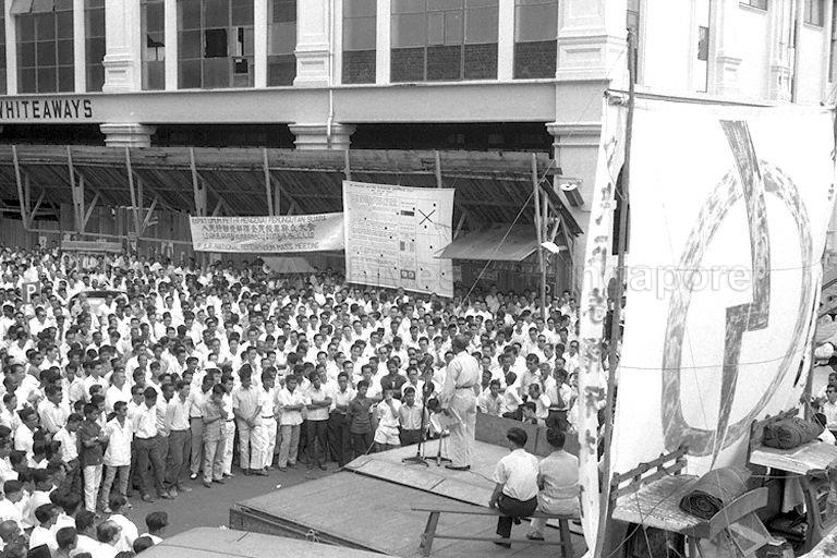
As we embarked on the journey towards self governance, and ultimately, independence, Fullerton Square was a popular spot for political rallies as its central location in the Business District offered political parties access to the working crowd during lunch times.
Since 1959, political parties such as the People’s Action Party (PAP), Singapore’s People’s Alliance (SPA), and the Workers’ Party (WP) have given some of their most stirring speeches to garner votes from the people.
 Then Minister for Culture S Rajaratnam speaking at the Referendum rally at Fullerton Square in 1962. Image via National Archives.
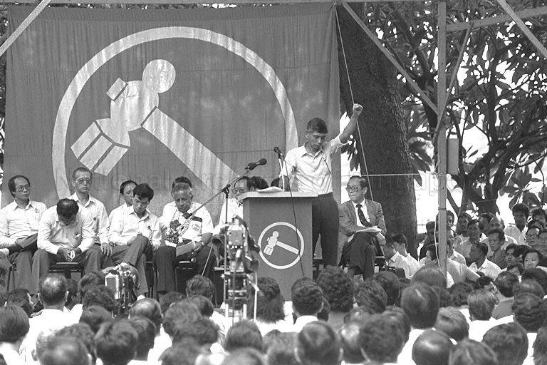 Workers’ Party rally at Fullerton Square during the 1988 General Election. Image via National Archives.
Next on our stop is the Jubilee Bridge, right across from the Fullerton Building. Cross Esplanade Drive and cycle towards the Esplanade along the Esplanade Bridge. About halfway across the bridge, you’ll find a linkway that connects to the Jubilee Bridge.
5. Jubilee Bridge
 Image by Joshua Lee.
No prizes for guessing the inspiration for the naming of the Jubilee Bridge. Opened in 2015, the bridge actually runs more or less parallel to the Esplanade Bridge. Why the need for an extra bridge?
According to then Minister for National Development, Khaw Boon Wan, the bridge was proposed by the late Minister Mentor Lee Kuan Yew in 2004, when he noticed that the Esplanade Bridge’s walkway was too narrow for pedestrians to stop and fully admire the Marina Bay waterfront.
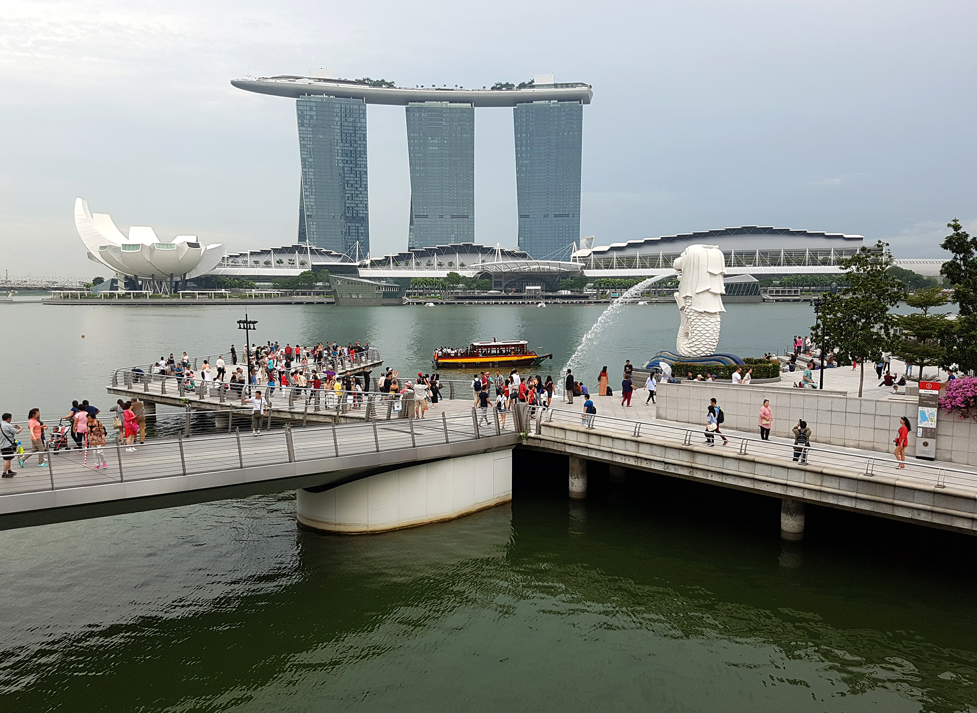 Now you have more space to admire MBS. Image by Joshua Lee.
After the earlier sights along the Jubilee Walk, the modernity of the landscape seen from the Jubilee Bridge is a huge contrast. Here, you’ll find the glittering buildings of the Marina Bay Financial Centre and the Central Business District - a far cry from the landscape of a fledgling nation of 1965.
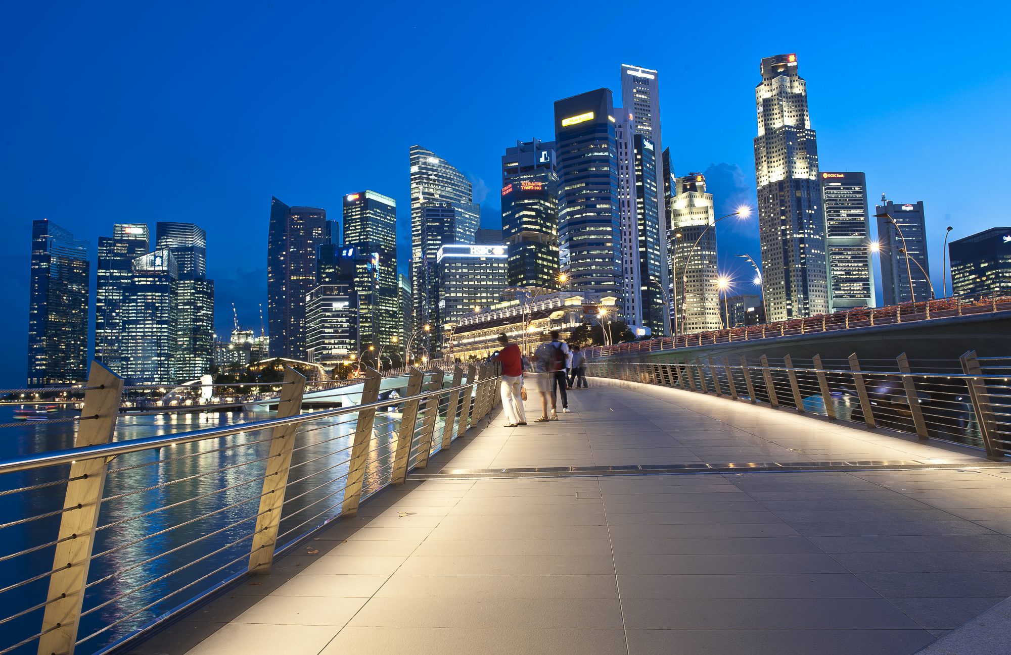 The Jubilee Bridge at night. Image via Planetlighting.com
From the Jubilee Bridge, cycle down past One Fullerton and towards the Promontory. Circle round the Marina Bay waterfront, past Marina Bay Sands, turn into Gardens By The Bay and make your way straight to the Marina Barrage, our last stop on this cycling trail.
6. Marina Barrage
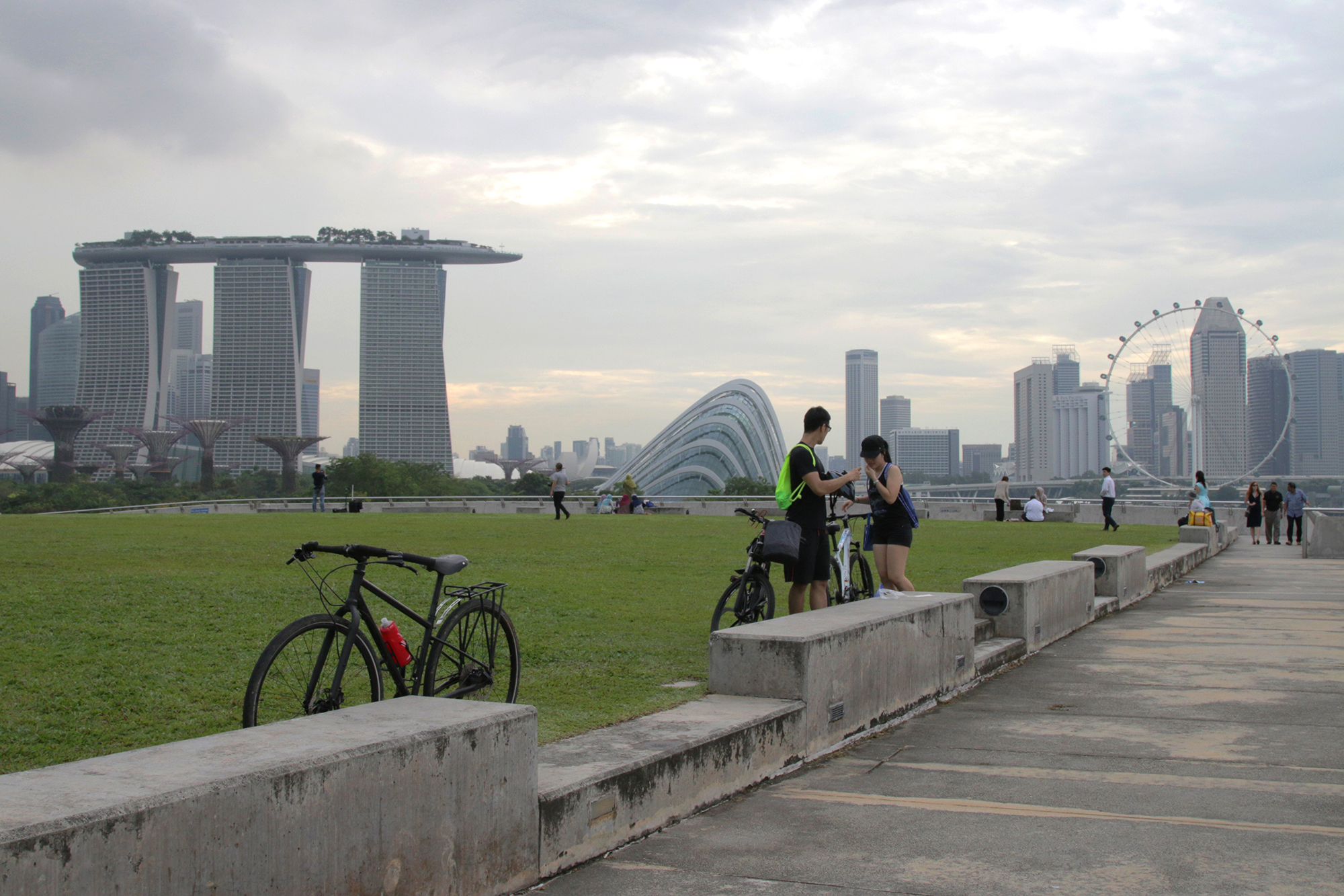 Image by Joshua Lee.
The Marina Barrage is often touted as a technological marvel that illustrates how Singapore continuously strives for water independence.
The Marina Barrage is actually Singapore’s 15th reservoir, constructed to increase our water catchment area and help prevent flooding in low-lying areas in the city such as Chinatown, Geylang, and Jalan Besar.
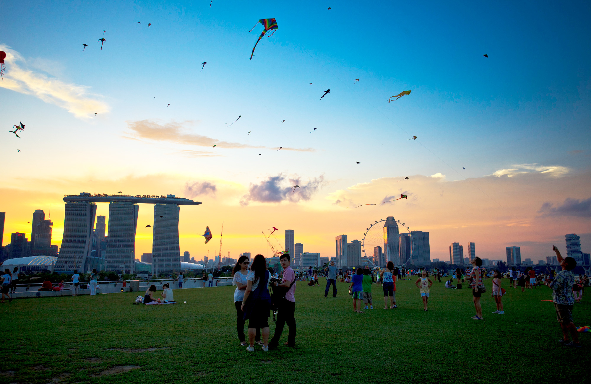 Image via.
That’s not all that the Marina Barrage does though. The ever constantly maintained water level in the barrage allows the bay to be used for water sports. The area on top of the barrage also allows for concerts and kite-flying.
Interested in the Jubilee Walk? Check out the Roots.sg trail here and their video below:
[embed] &feature=youtu.be[/embed]
Top photo by Joshua Lee.
This sponsored post helps our writers buy their own bicycles so they can also zip around town see heritage.
If you like what you read, follow us on Facebook and Twitter to get the latest updates.
If you like what you read, follow us on Facebook, Instagram, Twitter and Telegram to get the latest updates.