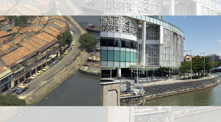
Singapore has been modernising to the point that many places in the present bear absolutely no resemblance to their past. Photos comparing then and now side-by-side might as well be comparing two countries.
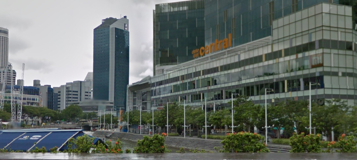
Take the area where Clarke Quay MRT station stands today: You’ll find The Central, a shopping mall. Its present day swanky facade would have been unimaginable in the past.
In fact, right up till the mid-1990s the area was known as Ellenborough and was occupied by shophouses. It was well-known for the old Ellenborough Market and Teochew community. The market no longer exists today.
Some of the shophouses that once occupied the area had witnessed about a century of Singapore's history, including the colonial period under the British, two World Wars, the Communist Emergency, the struggle for independence, and the post-independence development till the mid-1990s.
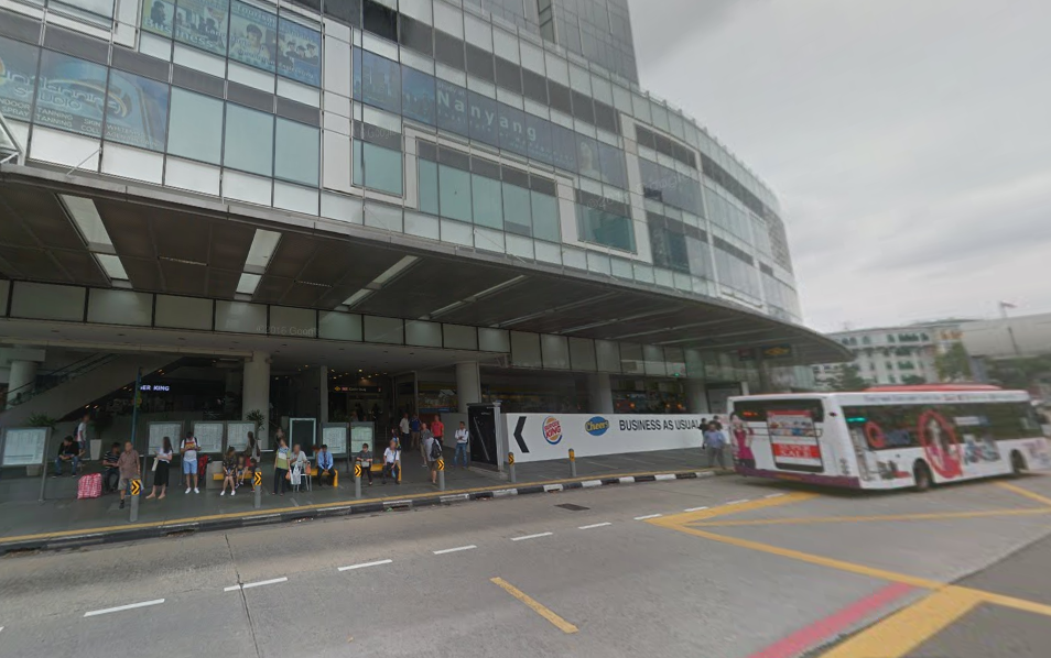
This is the area in the present day (pay attention to the left bank of the river in the picture).
 Source: Google Street View
And here's the same area in 1985.
[caption id="" align="aligncenter" width="722"]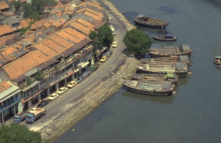 Source: NAS[/caption]
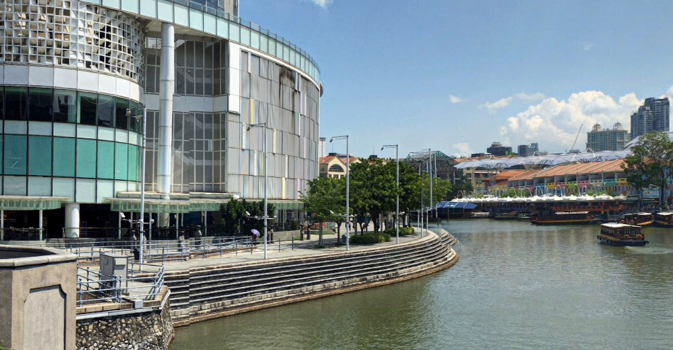
Here's another view of the area in the present day.
 Source: Google Street View
And the same area in 1984, shortly after the Singapore River was cleaned up.
[caption id="" align="aligncenter" width="720"]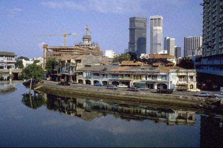 Source: NAS[/caption]
Along New Bridge Road, the area looks like this today.
 Source: Google Street View
In 1990, the same place looked like this. Notice also that the old Hill Street Police Station building to the right of the picture didn't have colourful windows yet.
[caption id="" align="aligncenter" width="768"]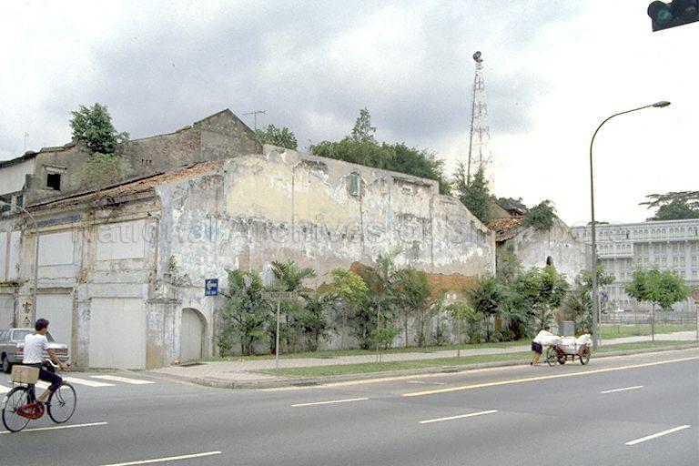 Source: NAS[/caption]
Streets that no longer exist
Here is a map of the area in 1979. Ellenborough Street and Fish Street no longer exist today because The Central mall has taken over where they once were.
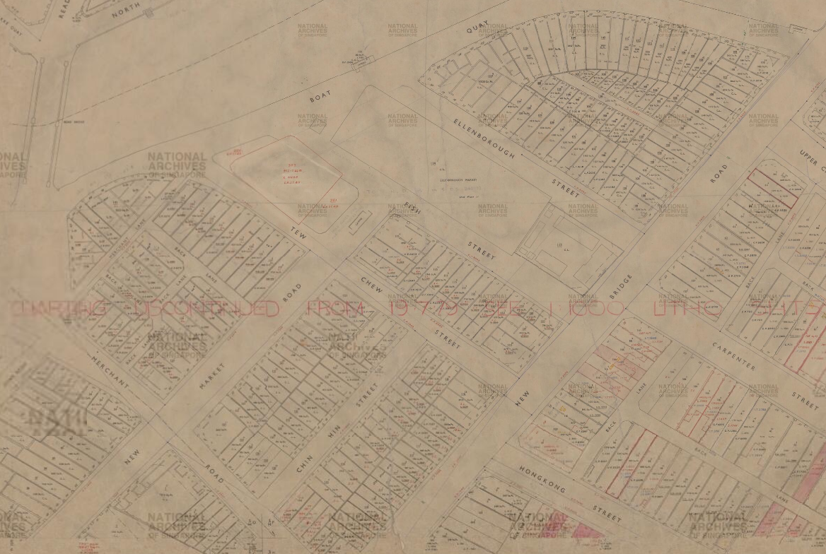 Source: NAS
This was what Ellenborough Street looked like in 1985.
[caption id="" align="aligncenter" width="725"]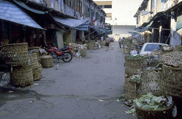 Source: NAS[/caption]
And this was Fish Street when a fire broke out at a few of its shophouses 1958.
[caption id="" align="aligncenter" width="756"]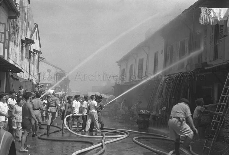 Source: NAS[/caption]
Tew Chew Street is today the road that will take you into The Central's drop-off point and car park entrance.
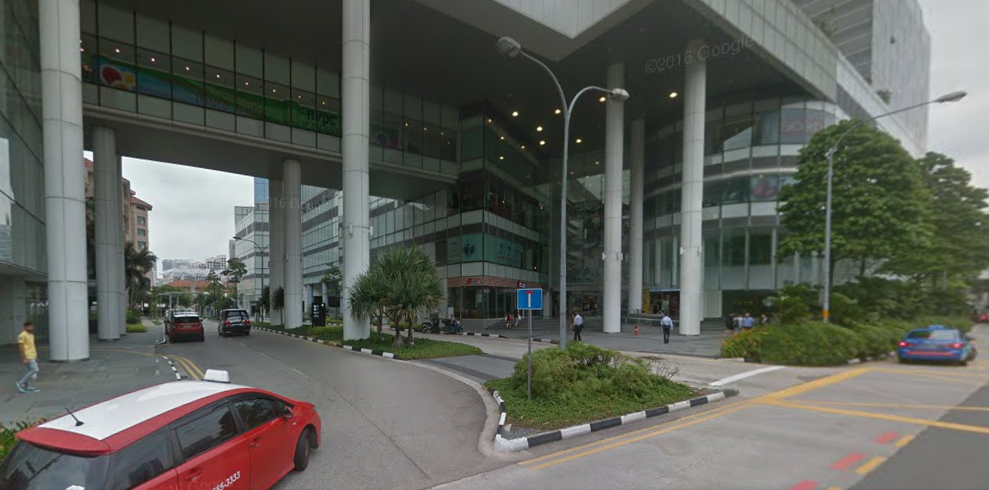 Entrance to Tew Chew Street today. Source: Google Street View
In 1978, Tew Chew Street looked like this.
[caption id="" align="aligncenter" width="723"]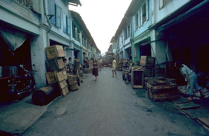 Source: NAS[/caption]
The next time you go to Clarke Quay, remember how it used to look.
Top image from Google Street View and NAS
If you like what you read, follow us on Facebook and Twitter to get the latest updates.
If you like what you read, follow us on Facebook, Instagram, Twitter and Telegram to get the latest updates.