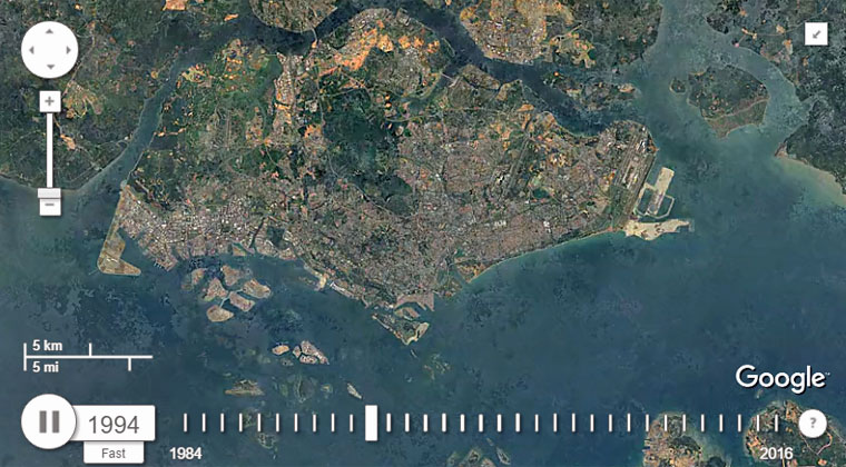
Lo and behold, here is the new Google Earth timelapse map showing how Singapore has shape-shifted since 1984 until today:
[Do note that the Google Earth timelapse map is only available for viewing on desktop versions of Chrome, Safari, Firefox and Internet Explorer 9+ browsers.]
So, how much has Singapore evolved in the past 32 years? Plenty.
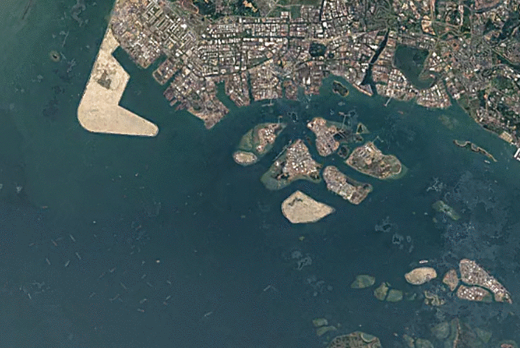
As a fine example, when zoomed in, Jurong and Tuas can be seen to have undergone an epic land reclamation process:
Rapid urban development is not restricted to any one part of the island at any given time, as it is evident that green spaces have been reduced by quite a significant amount over the years.
Other areas you should check out, besides your own house area, are in the east, where the coastlines have shifted significantly due to massive land reclamation works over the years as well.
Google Earth’s new timelapse update is the result of compiling some five million satellite images taken from 1984 to 2016.
"Using Google Earth Engine, we sifted through about 3 quadrillion pixels -- that's 3 followed by 15 zeroes -- from more than 5,000,000 satellite images," Chris Herwig, program manager for the Google Earth Engine, writes in a blog post.
"For this latest update, we had access to more images from the past, thanks to the Landsat Global Archive Consolidation Program, and fresh images from two new satellites, Landsat 8 and Sentinel-2."
If you like what you read, follow us on Facebook and Twitter to get the latest updates.
If you like what you read, follow us on Facebook, Instagram, Twitter and Telegram to get the latest updates.